This was yet another of the many School for Advanced Research field trips Jeri and I have taken.
Although not terribly “archaeological” the first day was spent at the semiannual Hubble Trading Post Indian art action. There were a lot of exceptional deals on Navajo rugs and assorted pottery. As a result we spent way too much money. There’s some nice stuff to be had there.
After blowing our discretionary cash at the auction, Jeri and I headed back to Canyon de Chelly to do the White House ruins hike. Except for the trail to these ruins, you can’t go into the canyon without a guide. The trail is about 3 miles round trip and a 600′ descent then climb back out on the return. I can’t imagine it would be a fun thing in Summer when hot and full of touristas, but it was great for us. The ruins weren’t any great whoop, but it was a good excuse to be hiking in the canyon. It’s a real interesting trail with two tunnels on the route.
Canyon de Chelly is an odd duck in terms of its status. It’s a national monument, run by the park service. They are responsible for preserving its antiquities. But the canyon is part of the Navajo reservation and the land is owned by the Navajos. A certain number of Navajos live in and around the canyon, driving in and out. There are Navajo roadside vendors selling assorted native jewelry and trinkets, as well as inside the canyon to tourists. Compared to other national parks/monuments, there’s a lot of litter and general crap around. A very weird vibe to the place. It struck me as sort of a “Mad Max” version of a national park.
The SAR group dispersed into a number of vehicles with guides and we headed up the lesser visited Canyon del Muerto. We traveled fully to the end of the dirt road, at Mummy Cave ruin. Along with our group was the park archaeologist, Keith Lyons who provided commentary. In all instances the ruins were fenced off and we weren’t able to get close. This was sort of unusual for a SAR trip, as they usually have really special access to sites. However on the way back out we stopped at a series of petroglyphs known as the Standing Cow petroglyphs. Turns out that particular parcel of land was owned by one of our Navajo guides, Sylvia Watchman. She invited us through the fence and up to the family’s ancestral hogan. Sherds and lithics were everywhere, and we spent some time just staring at the ground looking at all the “stuff”.
Following a couple of the vehicles getting stuck in the stream bed (lots of water crossings), we made it back out after a very loooong day.
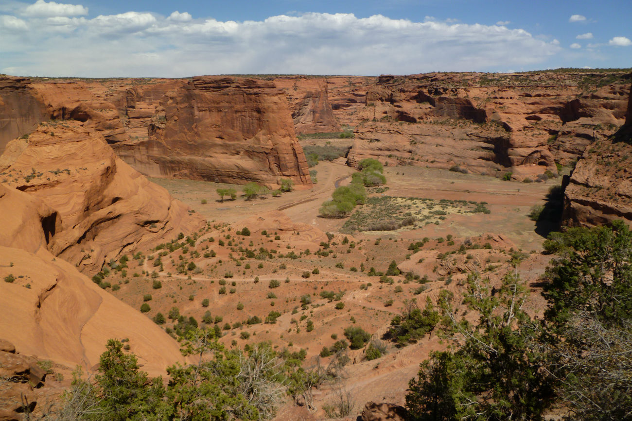
The view from the trail down into the White House ruins.
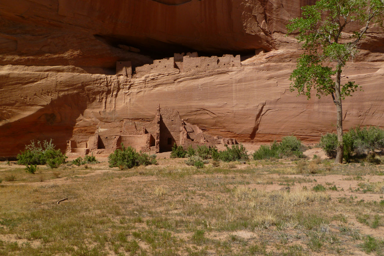
The White House ruins at the canyon bottom. These are the only ruins the public can visit without a guide. Not too shabby and a nice 600′ drop/gain to get there.
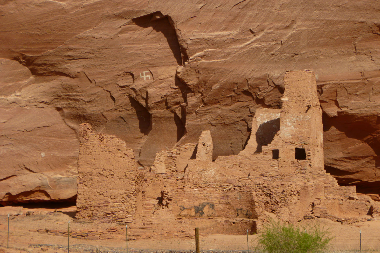
More ruins, the Lodge ruin, I think. Note the neat swastika petroglyph above the ruins.
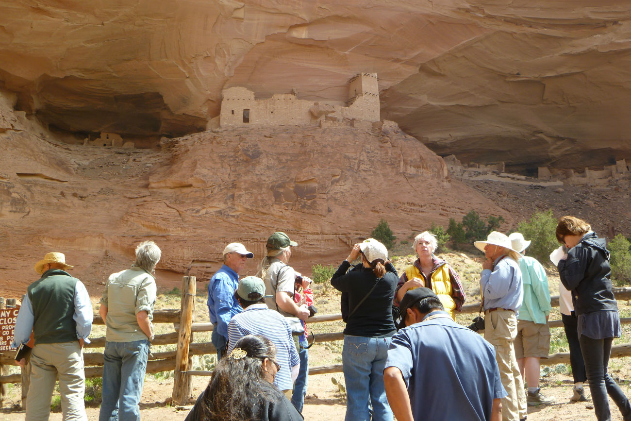
The park archaeologist, Keith Lyons, points out features of the Mummy Cave ruins to our SAR group.
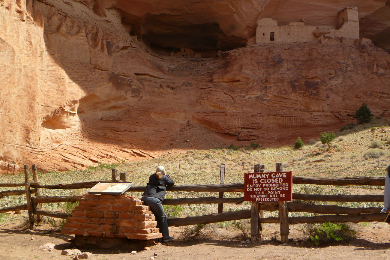
Jeri pondering the warm welcome of the park service. Don’t even think of doing anything interesting.

A hogan at the Standing Cow petroglyphs. This property belonged to one of our guides, who was raised there. She invited on to the land for a close look.

More at Standing Cow and some of the many petroglyphs.