In my wayward youth, I was a big reader of anything involving lost mines and obscure, weird shit. This included being a fanboy of John W. Robinson’s writings, especially on the San Gabriel Mountains. I spent innumerable days in that mountain range on semi-wild goose chases, often inspired by Robinson’s writings. I found some crazy-wonderful stuff, and some things, not at all.
For a number of years I was hunting things specifically in the East Fork of the San Gabriel Canyon, and I of course read whatever Robinson had written on that area. One story that caught my eye concerned a miner who invested in constructing a lengthy flume to bring water to his claim, even constructing a 700′ long tunnel. The engineer who designed the system mistakenly built it uphill and everyone went broke and headed outta town (Or so the story goes, the actual situation is here, which I presume you’ve already read).
Robinson didn’t say exactly where this was, if he even knew. But he did say where the mining claim was located, and as an engineer I knew how flumes worked (Ya know, water flows downhill and all that), where it supposedly originated and how long the tunnel was. After a few hours playing around with a topo map I had a good idea of the general area the tunnel should be, if it still existed. Robinson had described the tunnel as “partly caved” and its “portals hidden in brush”. But it looked to be near a paved road, so how hard could it be? Yeah, THAT question again. It will end up on my tombstone.
So way back in 1979 I found myself wandering the brush-choked slopes above the North Fork of the San Gabriel a couple of miles before it joins the East Fork. If there was a tunnel, this was where it should be. Or so the voices in my head told me. But after a morning of crashing through the dense brush I wasn’t seeing anything non- natural.
Oh…. well, there were the hunters. That was something I wasn’t used to seeing, three deer hunters. We were all surprised to run into each other in the middle of nowhere. Since they had been doing scrambling around like me, I asked them if they had happened to run into any “old mines”? (I wasn’t about to try and explain what the hell a flume tunnel was). “A mine? Sure, a couple hundred yards over that way, below a saddle”. Wait…what?
Seeing as how this was the best (i.e. only) clue I had yet come across, I thanked them and headed off to the saddle they described. Reaching it, I started descending the steep slope back down to the North Fork Canyon below. Suddenly, I came upon a non-natural, level bench, running away from me in either direction. This had to be the flume bed! I followed it only a short ways to the south, and there was a partly filled in tunnel entrance! Looks like I had found it.
The entrance had been mostly blocked with sand and rocks falling down from the slope above, but wasn’t completely filled. Unfortunately due to a lack of foresight on my part, I neglected to bring a flashlight (’cause I was used to never finding anything). Still, I was able to slide in the entrance a body length and let my eyes adjust to the light. I wasn’t about to press in any further, but from what I could see the ground appeared solid with no evidence of ceiling fall. But I couldn’t see any light at the other end and figured that entrance was either blocked or a cave in had occurred, like Robinson described. It didn’t seem like it was worth a return trip, so I just let it go.
A few months later I mentioned my find to some coworker, engineer-types who also loved lost mine stories. Add to that we were all junior Civil Engineers just beginning our careers, and the idea of some numbskull young engineer building a tunnel uphill felt just too….familiar. So the idea of a return trip to the tunnel site was hatched.
So in late 1979 four of us, I believe, returned up Highway 39 to where I had found the tunnel. Access appeared deceptively easy, as it was possible to see the site across the North Fork canyon from the road. The problem was crashing through the dense brush to get to the tunnel which took a large amount of time. But we were young and fueled primarily by Dr. Pepper, Hostess Cupcakes and Slim Jims, and eventually arrived at the site.
This time, with flashlights, we entered the tunnel. Once away from the entrance we found very little breakdown on the tunnel floor. It was in really good condition, but then, as the story went, it clearly had never been used.
About 300 feet in, it appeared to reach an end. However upon arriving at the “end”, we found it just jogged a bit to the left and continued on its original bearing. And there, in the distance, was light!
Wriggling out a much tighter squeeze at its downstream end we found ourselves looking down into the East Fork. The tunnel, in fact, was not caved in and went clear through the ridge, as advertised. A casual observer couldn’t see through it due to the offset in the middle. This offset, we believed, was caused by driving a tunnel in from both sides of the ridge at once, but not quite meeting. There appeared to be an offset of maybe 10 – 15 feet between them.
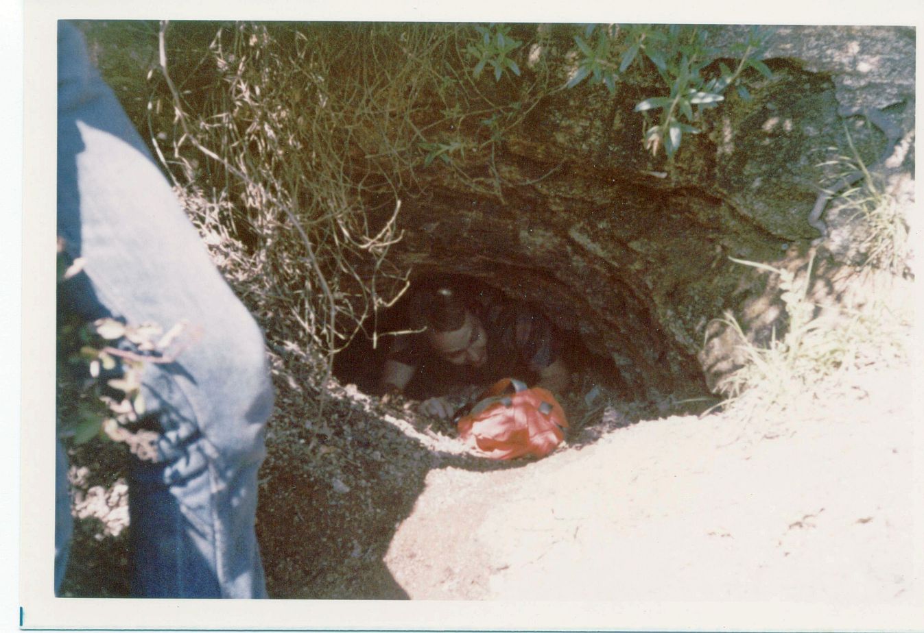
The tunnel exit in 1979 with one of our party slithering out.
We were pretty happy with our find and proving Robinson wrong about it being caved in. Heading back to the entrance I took compass bearings of the tunnel then made a few notes as to where the tunnel was on my USGS topo map. And there I left it for 37 years, never returning. Oh I thought about it occasionally, and still knew where it was as it’s in a real distinctive spot. But I couldn’t see any reason to go back. There wasn’t any more to be found out about it.
Forward in time to 2016. I got an email from someone interested in using a few of my website pictures for a website of her own . I told her that would be fine, and when I got a chance I had a look at her site to see what was there. I was surprised to see a writeup on Buel’s tunnel (Although Missy had not yet found it at that time), but the wording seemed strangely familiar. I pulled out my old Robinson text and it appeared to me much was quoted without crediting Robinson.
I’m embarrassed to admit I gave her a bit of undeserved crap over that. She responded she wasn’t stealing from Robinson, but relating something she found in an old newspaper from 1937. Waaaat? She even included a pdf copy of the October 20, 1937 issue of the Azusa Herald. Looking it over, I saw that’s where Robinson got all HIS stuff! Waaaat?^2
Well, this all got me thinking. Surely someone has been to this damn tunnel and written it up, right? I could Google every other obscure, remote place I’ve ever been to in the San Gabriels and I’d find one or more trip reports, with pics. I’m pretty good at searching the innerwebz but couldn’t find a thing on Buel’s tunnel beyond the original story (true when I started this project, but not so now). I mean, if it’s not on the Internet it doesn’t exist.
Things have, um…changed just a bit in 37 years and I got to considering this could make for a quick (hah!), fun project. I assumed the two tunnel entrances probably had filled in by now, but it might be an interesting exercise to walk the flume line with a GPS and map it. And by working on a few other projects in the San Gabriels I had developed access to an amazing array of historical sources that might allow me to flesh out the full story of the tunnel and put it in historical context. A quick and relatively easy project, I was sure.
Since I apparently never throw anything away (especially maps), I was able to find the original notes from my 1979 visit. I took the tunnel’s location off the paper map and transferred it into Google Earth as best I could. From there I obtained the Lat/Lon coordinates, loaded them into my GPS and headed into the field. We live in magic times.
As I started off for the tunnel’s location on September 7, 2016, I was reminded why I left exploring in the San Gabriels for other, more open areas. That dense brush really sucks! I was truly a stupid kid. The next thing that occurred to me is that I’m old. Damn old. I know how hard this was when I first did it, but it’s MUCH harder now. Yeah, yeah, I know 37 years is a long time and it’s to be expected. Still, no one wants their face rubbed in it, and that’s what was happening to me, both literally (fortunately I was wearing goggles) and figuratively. I guess it’s still better than the alternative. I chose to delude myself that now I am soooo much smarter, being able to use GPS to head right to the site. We’ll see….
Pushing up the slope, I came to what I immediately recognized as the flume line. Once there I was able to make my way along it to the tunnel opening, which turned out to still exist! In fact, it appeared little changed from when I last saw it 37 years prior. Checking my GPS, I found I was only 95′ off from where I eyeballed my location on my USGS topo map so many years prior. I’m either lucky or good, and I’ll take whichever works.
I could feel a good breeze coming out of the tunnel which told me the other end must still be open. While I did have a flashlight along I didn’t choose to enter the damn tunnel, since being there by my lonesome sorta creeped me out. My concern as a now older and somewhat wiser person was that critters (like alligators or rattlesnakes) could have taken up residence inside in such nice surroundings and might not be revealed by my light. Well, maybe alligators would. I wasn’t going to head into the tunnel until I had proper gear along, which included a helmet and serious, serious light to daylight the hell outta the place.

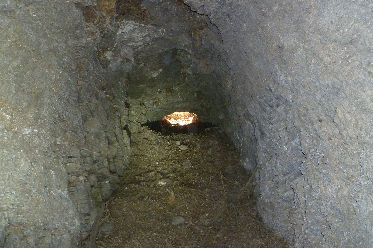
The Buel flume tunnel’s entrance.
Knowing that the tunnel still existed changed the situation a bit and got me thinking, usually not a good sign. With today’s technology I could do things I had no way of accomplishing in 1979. Hell, I could map the entire flume route with GPS! Oooh, oooh…Lasers! I could use a laser level to measure the slope of the tunnel to see if it would work for water flow. Yeah, lasers in an 1874 tunnel. I like it. And I’ve acquired enough compact surveying gear to allow me to map the tunnel, then draw it up on a computer. 1979 sucks SO much!
But before we crawl back through the brush, we should probably talk a bit about flumes, a topic I’m sure you’re dying to know more about.
Flume design “standards” of the era
Flumes conveying water to mining operations were very common in California by the 1870s. Their purpose was to bring water to a hydraulic mining area at some elevation well above the main workings. This elevation, or “head”, provided water pressure with which to wash gold bearing gravels out of a hillside though the use of iron nozzles. Think of a gold rush era fire hose and that sort of sums it up. Water pressure was really a valuable thing to have, so the more head (i.e., pressure) the better. So the idea was to bring water from far upstream, using just enough of a downgrade to keep it flowing, and have it arrive high above the mining site where it could be used to blow the snot out of the hillsides, gold nuggets wash out and everyone gets rich.
To save costs in smaller operations flumes were dug into hillsides rather than using boxes made of wood or iron pipe. Those more costly materials were usually reserved for crossings of canyons (by bridge or siphon) or hanging along vertical rock faces.
How much would a typical mining flume drop per mile? According to “Water Conveyance Systems in California” by JRP Historical Consulting Services and Caltrans, 2000, a drop of 10 feet per mile gave the best balance between amount of flow and limiting erosion. If the drop was much greater than this the water flow would be fast enough to cause rapid wear of the flume sides and increase the risk of failure. Some of this could be mitigated by lining the sides of the flume with stone, but still, you didn’t want your flume too steep.
There were a couple of other flumes in San Gabriel Canyon, serving other claims, and their drops had been published. According to the December 8, 1871 Los Angeles Star newspaper, the 5 mile flume serving the nearby Roberts (Graham & Cecil) claim had a grade of 1/2 inch per Rod (13.3 ft/mile) and the 4 mile flume providing the Ferguson claim had a rather flat grade of 1/4 inch per Rod (6.7 ft/mile).
So the Buel flume could be expected to have a gradient in the neighborhood of 10 ft/mile. This is, by most standards, fairly flat. In a four mile run, this gradient would only drop about one 40 foot contour line on a USGS topographical map. To put it another way, this is only a 0.2% grade.
Having an idea what sort of grade to expect for the flume meant that knowing the tunnel elevation I could easily predict where the upstream and downstream portions would be. Or so I thought.
The flume segment upstream from the tunnel (the “upper” flume)
I wish everything was this easy. I could drive up Highway 39 and see the damn flume on the canyon wall across from me. The 2015 Cabin Fire had stripped away most of the vegetation and the 144 year old scar of the flume line was readily apparent. However closer to the tunnel and away from the burn area the bench of the flume was badly overgrown and um…walking was difficult. Note to self: Crawling shouldn’t be considered hiking.
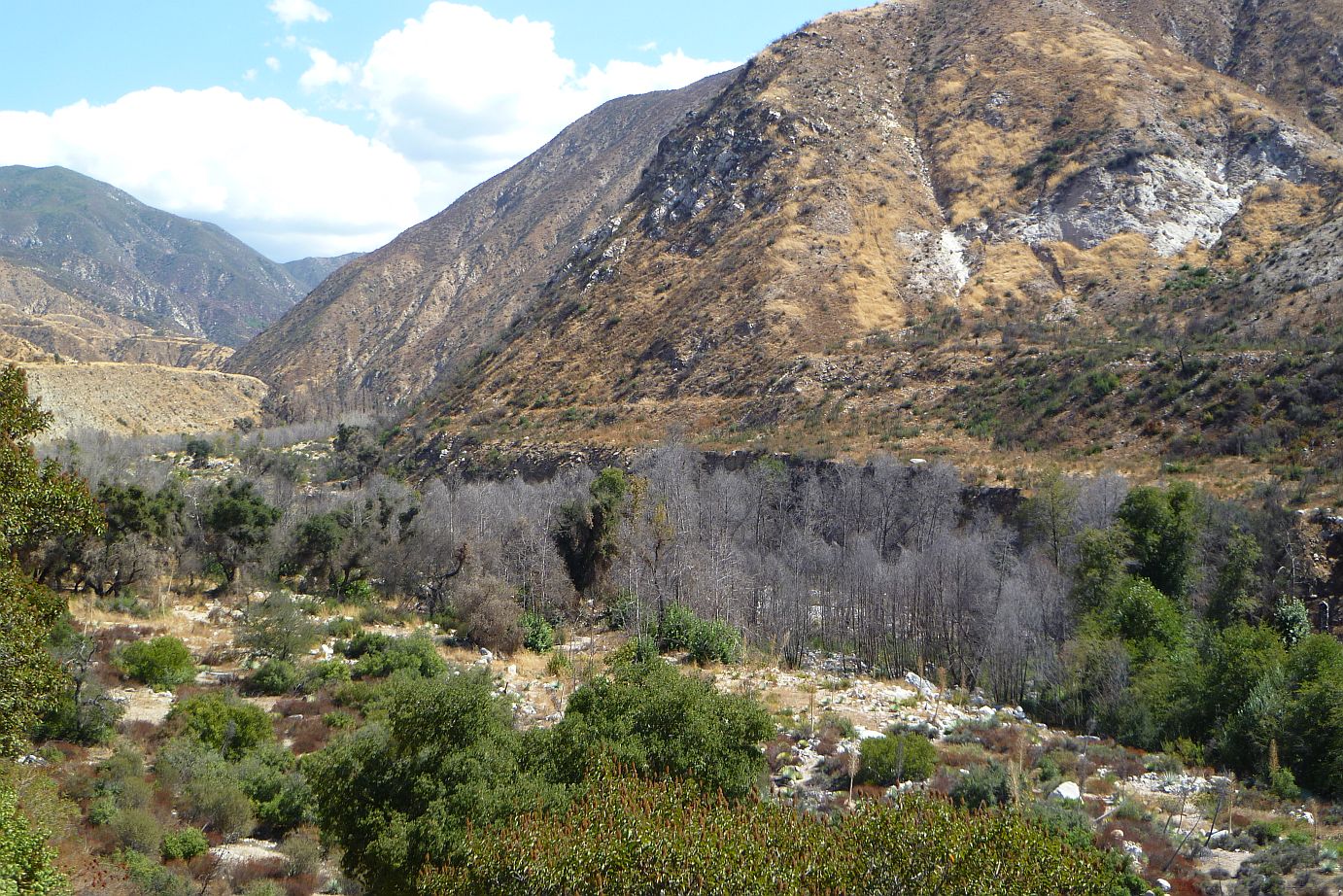
The route of the upper flume is easily visible in the Cabin Fire burn area above the stream. Although it appears to be running uphill, it is in fact descending. The stream is just descending more rapidly.

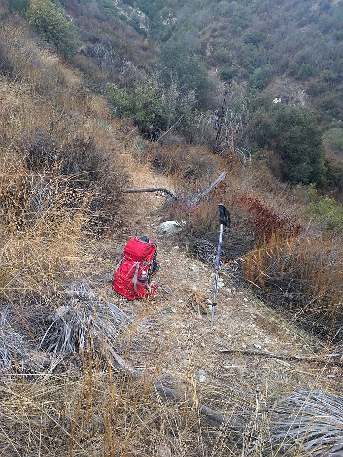
A typical section of the upper flume (upstream of the tunnel)
I also became very aware of the use of bridges in flumes. This would happen when a steep canyon needed to be crossed and a bridge made more sense than staying along a contour for a much greater length. Practically, for me, this meant that at some points when the flume route crossed an exceptionally deep ravine I was unable to continue following it, unless I could find a way down and then back up to its continuation. And in some cases I couldn’t (or at least a route I didn’t consider treacherous as a solo effort….I ain’t as stupid as I seem.)
But after a number of trips and despite the complete shredding of two long sleeve shirts, I was able to map the majority of the upstream segment. However the downstream segment was going to be a big surprise.
Weirdness of the downstream segment (Or, what the hell were they thinking??)
The first time I popped out the downstream end of the tunnel I started looking around for where the flume continued and was a bit surprised not to see anything obvious. The terrain at the tunnel’s exit is extremely brushy and rugged, so I just assumed most of the flume ledge had eroded away and I couldn’t find what was left. But knowing that the tunnel’s exit elevation was about 2,045′ I should be able to find it between the tunnel and the terrain near Buel’s claim.
My first stab was climbing up an extremely nasty spine just westerly of Burro Canyon and Buel’s claim. There was a flatish area on the spine, just barely over 2,000′ which I suspected could be an area used to accumulate the flume water that then could have been piped across Burro Canyon to the Buel claims. But once I got there I found no sign of anything non-natural clear up to 2,100′, nor any evidence of a flume on the slopes further west at the expected elevation. Well,….that was certainly odd.
So for my next effort I decided to split the difference and headed up much further west, roughly midway between the tunnel exit and Buel’s claim. To my surprise, I came across a horizontal trace at only around 1,645′ that sorta looked like a flume. Well, no, it didn’t just look like one, it clearly was one. But it was almost 400′ too low thus it had to be something else. So on up I continued. To 2,100′ again. And found nothing. WTF?
Dropping back down to the lower segment I followed it in each direction until it had been taken out by a slide at one end and the other end was an impassible bridge crossing. Yep, this was my flume, but what the hell was it doing this low???
A non-typical section of the lower flume. Most of it is extremely brush-choked and hard to pass over.
A few more trips revealed the water exited the flume tunnel and cascaded down a ravine almost 400′ before being picked up by the lower flume and carried on. This was just nuts.
Initially I was at a complete loss to explain what reasoning lay behind the flume builder’s decision to construct the flume segment downstream of the tunnel at such a low elevation. In hydraulic mining water pressure is like money, it’s hard to get enough of it and one doesn’t freely give it up. For a designer to give away almost 400 feet of head….is far stranger than building a flume uphill. The former is deliberate, the latter accidental.
Furthermore, the terrain is much easier for flume construction high up on the canyon slopes than down low where the flume appeared to be. The lower side slopes are much steeper and would have required more bridges to cross ravines.
It wasn’t until I located the very ends of the flume’s run that I began to see some engineering reasoning that MAY have made sense. Since Buel’s workings lay to the east of Burro Canyon, he would have needed to have somehow brought the water across that canyon, a formidable barrier. Many flume builders would have carried the water across in a siphon made of iron pipe, carrying it down almost 400 feet, then back up, and flowing again into an open flume. Or they could have simply dumped the water into an iron pipe at the edge of Burro Canyon and piped it to the workings from there. The problem with either of these options is a lot of iron piping would be required and in that era it was very expensive.
Once I discovered that the flume’s route turned and went into Burro Canyon almost 2,000 feet, then crossed in and came back out another 2,000 feet I began to see what they were up to. At some point they determined what the largest bridge crossing they could build in Burro Canyon was, and once they knew that it set the highest elevation possible above Burro Canyon, and hence the elevation of the lower flume line. So the elevation of the lower flume line was dictated by the maximum crossing height they could pull off in Burro Canyon.
Tracing the flume’s route once it came back out of Burro Canyon was a challenge. It paralleled East Fork Road and was close enough that some of the road cuts necessary for East Fork Road took out the flume. But segments could still be found in the ravines away from the road. In fact, upon reaching Buel’s claims the flume route actually crosses today’s roadway before apparently terminating near the dividing line between the Buel and Ford claims. There is literally a segment next to a parking turnout about 5 feet above the road.
The ground near the flume’s end has been heavily modified due to the construction of East Fork Road so it’s difficult to imagine how it may have been in 1872. There are several turnouts created by filling in ravines, and it does feel like this area could have served as a water accumulation pond.
Equipment used for mapping
All tunnel bearings were taken with a Dietzgen pocket transit (Brunton style) with the magnetic declination adjusted for the local value. Horizontal measurements were made with a Lietz-Eslon 100 foot fiberglass tape. Vertical tunnel profiles were obtained using a Kobart laser level (from Home Depot, as no expense was spared!) to establish a level line from which the distance to the tunnel floor was measured.
The flume line was mapped horizontally using a Garmin GPSMAP 64s consumer-grade GPS unit. For elevations along the flume, including the tunnel entry, measurements were made using a mapping grade Trimble Geo XT 2005 GPS for much higher accuracy than the Garmin could provide. In addition, each Trimble measurement was the average of between 60 and 110 individual samples.
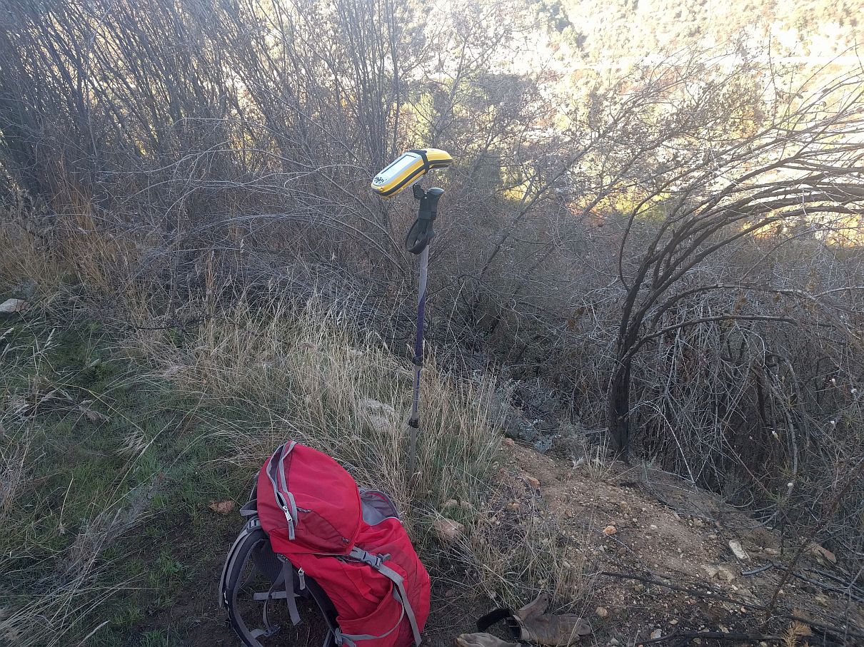
Letting the Trimble GeoXT GPS unit average its readings on flume route for about 10 minutes to increase accuracy.
Overall flume route
Below is a map I created of Buel’s flume line from start to end. The portions in red were those I actually walked (or crawled). The blue solid lines are portions of the flume I didn’t (or couldn’t) walk, but could clearly see them from another vantage point or on aerial photos so I’m satisfied their location is accurate. The dotted blue lines are where the flume should be but has either been washed away or I was unable to see it and was too lazy to crawl through a brushy hell to find out. The four claim locations shown are those that appeared to be either owned by Buel or in partners with his flume effort, based upon contemporary newspaper accounts. Operation of a flume usually requires some sort of diversion dam structure, but I was unable to find any remains of such a structure (The massive flooding of the San Gabriel River in 1938 would likely have washed away any diversion dam).

Tunnel plan view and cross section
Below is a detailed diagram of the flume tunnel both in plan view and cross section, based upon my mapping measurements. As is customary, I have exaggerated the vertical scale by a factor of 10 to make differences more visible. Because there is considerable sediment laid upon the floor and drifted in the mouths over the years, I estimated actual ground level. The elevations of the entry and exit portals were derived from a mixture of the internal laser level data and absolute external measurements taken via the Trimble Geo XT GPS unit.


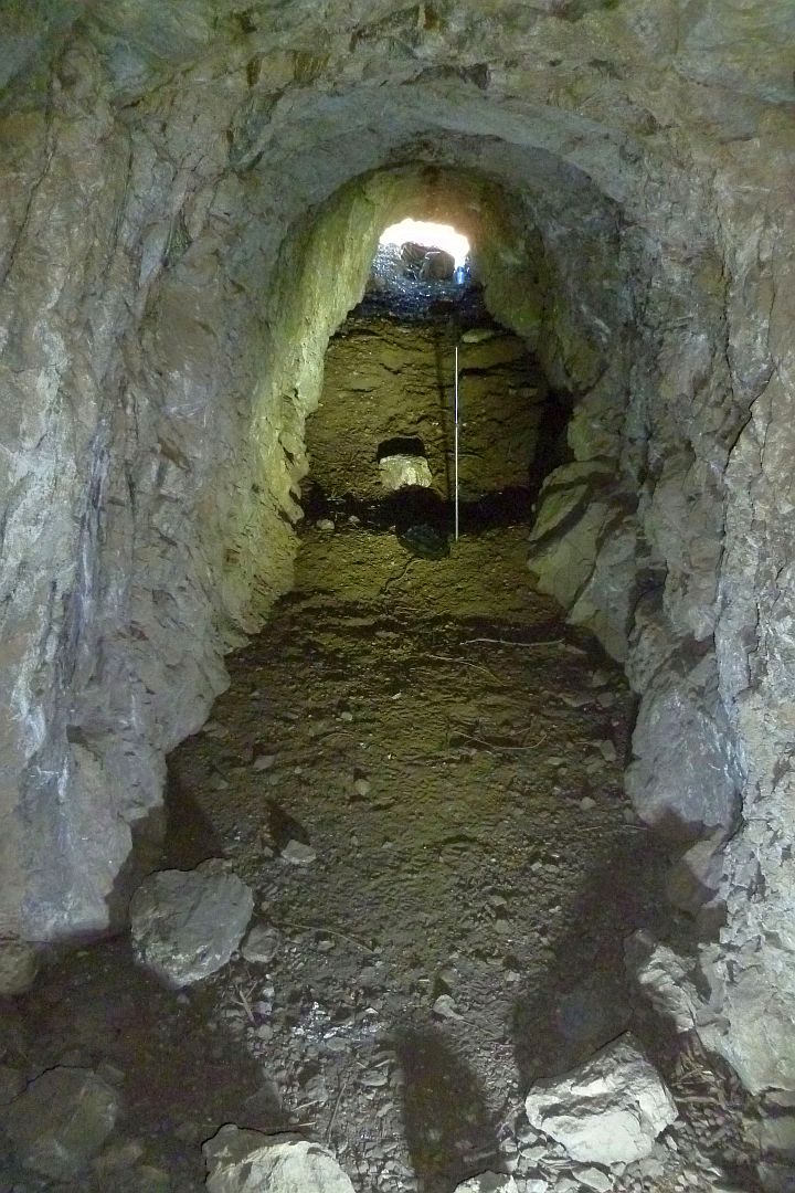
View from inside the tunnel looking back at the entrance showing the amount of material that’s drifted in.
The tunnel interior looking downstream. In the distance the tunnel makes its slight jog to the left.
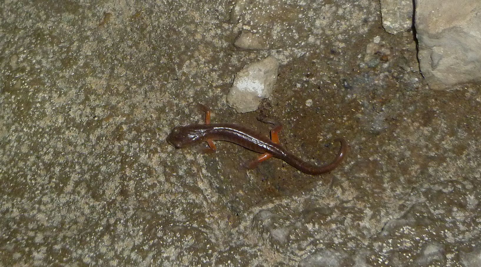
Random tunnel life.
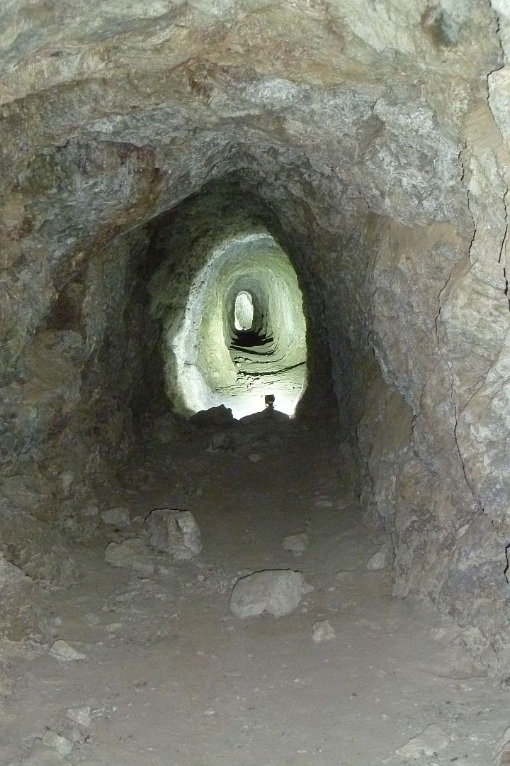
The tunnel exit as viewed from inside. There’s considerably more drifted material than the entrance. The exit isn’t for claustrophobes.

The tunnel exit
If all those pics still aren’t enough for you, here’s a semi-crappy video walkthrough I did of the tunnel, complete with dumb-ass narration:
Engineering analysis of findings
There were a number of surprises in this project, the first being the grade of the upper flume segment. I found upper segment to have a grade in the vicinity of 15 feet of drop per mile, which was a bit….steep. This would have created a fairly fast water flow resulting in excessive erosion of the flume’s soil lined sides. Keeping it running may have been a pain in the butt. As support I offer this excerpt from “Statistics of Mines and Mining in the States and Territories West of the Rocky Mountains“, by Rossiter V. Raymond, United States Commissioner of Mining Statistics, 1873:
The best constructed ditch will cause a great deal of trouble for the first year or two, but an indifferently constructed ditch will cause not only as much repairing as the first costs amount to, but be forever after only a second-hand affair.
Seeing as how the entire Buel operation only lasted for a year or two, a steeply constructed flume may have added to its demise. But it certainly wasn’t built uphill. If anything, it was built with too much of a grade.
In walking most of the length of the upper flume segment I found no evidence of any reconstruction of the alignment, as would be expected if they initially lost the grade.
The use of a tunnel made very good sense and was an obvious alternative route to continuing it along and around the ridge. Doing so would have required building an additional 6,100 feet of flume line. Adding to that the route has a large rocky cliff face blocking the way which would have been very difficult and expensive to cross with a flume. Replacing this route with a 550′ long tunnel was an excellent choice.
The tunnel alignment displayed a high level of accuracy. To the level of precision I could get out of my pocket transit, the bearings of the two tunnel segments were identical. The only “error” was an offset of around 10 feet where they were to meet. Nice work Mr. Tunnel Builder, whoever you were.
I measured the drop through the 550′ tunnel to be just under a foot. This is a little flat, but would still be sufficient to maintain a flow though the tunnel. I thus conclude the tunnel as built could provide adequate water flow.
When measured on a map, I found the upper flume length to be 1.87 miles and the lower flume length to be 2.63 miles. Adding in the 550 foot tunnel length, that brings the total map-measured length to be 4.60 miles. However this value was obtained by measuring a fairly smooth line on a topo map. When comparing the segments I actually walked, with lots on ins and outs along the contour, I found my walked segments were actually longer than map-measured. So I’d estimate the actual total length of the flume system to be just over 5 miles (if one was stupid enough to attempt to walk the whole thing with a GPS).
The flume appears to arrive at the midpoint of the Buel and Ford claims at around 1,618 feet. The mining claims’ terrain ranges in elevation from a high of around 1,800 feet, to a low in the stream bed of East Fork of the San Gabriel River of about 1,450 feet. This means the provided water would be useless for working the upper portions of the claim (no pressure), but could provide a head of about 170 feet (or about 73 psi) for the lower portions. That’s not very much by most hydraulic mining standards but could be useful for washing materials along the lower banks of the river. Perhaps this inability to hydraulically work the upper claim areas contributed to the decision to walk away from the claim.
Overall, for 1872 this was a pretty damn impressive engineering effort. The tunnel work appeared first rate (it’s still usable after 144 years!) and there’s no evidence it didn’t function as designed, despite myths to the contrary. The decision to construct the portion of flume downstream of the tunnel at such a low elevation is perplexing, but was likely due to the flume’s need to cross Burro Canyon.
This was a real fascinating project to do, as I was really surprised to find what little conventional wisdom there was on this facility was so wrong. I can see why it was wrong, but these days just a little digging will turn up much more info than research in years past. I, for one, am damned glad it’s over so I can cease my crawling around in the brushy hell that is the lower slopes of the San Gabriels. I’m headed back out to the deserts where you can easily head in any direction, unhindered by bushes, and you don’t need no stinkin’ snake chaps…..