One of the rationalizations (excuses) I used for getting into drones was that they’d be excellent at imaging archaeological sites. Sounds pretty legit, doesn’t it? Makes spending the money feel not as bad.
However the more I got into the damn things the more I realized how easy it is for crap to go wrong, turning your wonderful flying machine into a $1,500+ pile of rubble. And I also discovered there’s a big difference in just having a fun time, flying casually around “testing”, over actually putting them to field use. The latter usually occurs in remote locations with little capability for repair, and you often have to fly with the weather you get, not the weather you want. But still, I was long overdue to put my menagerie to real use, so time for a trip to New Mexico in May of 2015.
Because this was my first real field use I decided on a number of fairly non-challenging targets of opportunity in western New Mexico, spread out between Gallup and Farmington. I had made prior ground visits to them all, so was familiar with access constraints. I ended up visiting eight sites, six of which I’m going to cover with this post. The seventh site is very involved, something I’ve been exploring for a few years, and may be done in a separate, longer post. The eighth site…..well, there are some places I just won’t write about. Too many yahoos out there.
Circumstances dictated most of my imaging was to be merely “beauty shots”. Those are aerial images looking forward and down about 15 to 20 degrees. However there was one site I did substantial aerial mapping with my fixed wing, which is part of what I may cover in a later post.
One thing I should touch on is the legality of this. Three of the sites I visited and imaged are outliers of the Chaco Culture National Historical Park. The land beneath these three sites is under the control of the National Park Service. And as some of you may know, the NPS generally prohibits the operation of “drones” or radio controlled aircraft within their boundaries.
But here’s the thing…..The NPS has the right to regulate activities on “their” ground, but they have no jurisdiction over Federal airspace above their parks. That’s the purview of the FAA. And as long as I’m flying below 400′ the FAA is generally cool with what I’m doing. So, just to be clear, the imaging flights I made over the NPS sites all originated and terminated outside NPS property (i.e., I took off from outside park property and then landed outside park property). Furthermore, all control of the flights was performed while I was physically outside the NPS boundaries. So there. The remaining sites were all on BLM land and they are cool with most any use activity unless you’re being stupid.
A note on equipment. All the still images posted here were shot with a Canon SX230 HS camera (12.1 megapixels), carried by my Tri^3 tricopter. The camera was running a CHDK script which took an image every two seconds. I positioned the tricopter using both line of sight and also the onboard FPV cam.
In addition to the tricopter I brought along a heavily modified Tarot 650 quad copter with a brushless gimbal for video. And my final flying goodie was a Storm Chaser fixed wing aircraft for taking mapping images. But these other two craft aren’t very relevant to this post.
For each of these sites I’ll include a link to any earlier ground visits I may have made to the sites.
Kin Ya’a
First up was Kin Ya’a, near Crownpoint. I wanted to do this one first since access, while rough and somewhat 4WD, is relatively easy. It was early morning with a slight, milky overcast, so the lighting could have been better.
Curiously, after my visit I pulled up the online NPS info for Kin Ya’a and found a notation that it was closed to all public access. During my visit the access gate was unlocked and there was no signage posted indicating any closure. So, I dunno. In any case, during my visit I didn’t set foot on any NPS property so I guess I’m good.
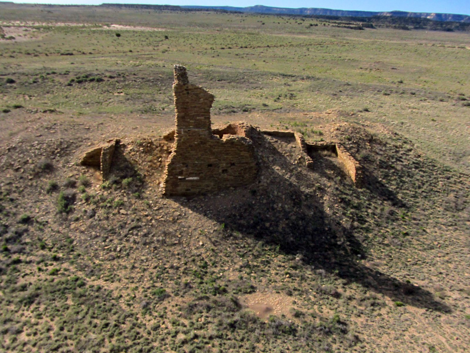
Kin Ya’a, looking southerly. The rubble pile is all excavated ruin.

Kin Ya’a, looking sorta northerly. The circular tower structure is the remains of a very unusual Tower Kiva.
Kin Bineola
I love Kin Bineola due to its remoteness and its dark beauty. I don’t mean dark as in sinister. The stone used to build the Great House is of a very dark color and the result is striking. And I’ve never seen anyone there. You can’t say that about Downtown Chaco.
Beyond its general remoteness, I think part of what keeps people out is the hinky, unsigned access road. As soon as you turn off towards Kin Bineola, the road runs across the rather narrow top of an earthen dam on part of the Navajo Reservation. There is JUST enough room for one vehicle with steep drop offs on both sides. Even in a 4WD I usually found it a bit….puckery.
Well, turns out that’s a problem. Unbeknownst to me, sometime in the past two years, THIS happened.
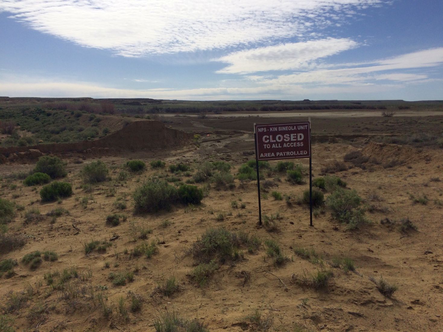
OK, well I guess we’re not doing this.
Yep, that’s the access road behind the sign, on top of what’s left of the earthen dam. It’s hanging about 15′ in the air. As this is on Navajo land and not NPS property, I don’t see this getting fixed anytime soon. So skunked on this one.
Halfway House
I continued on to Halfway House, located on BLM land. I will concede this is a boring and totally unremarkable site, which is why I included it. When most people think of Indian ruins in New Mexico they imagine the impressive towering structures of Chaco Canyon. The thing is these sort of ruins have been partially excavated and usually restored and/or stabilized. In reality, what one sees when coming across a ruin in the “wild” is more like a dirt pile with some suspicious rocks sticking out of it. Which is exactly what Halfway House looks like. So be bored.

No, this isn’t some random dirt pile in the desert. It’s Halfway House. But I did have to circle it.
Twin Angels
Another real interesting smallish site on BLM land. The coolest thing about it is that it overlooks the (alleged, purported, maybe, perhaps) Kutz canyon segment of Chaco’s Great North Road. This is fairly easy to get to, IF one knows the way. Otherwise you’re doomed to wander forever in the maze of oilfield service roads in the area.

Looking out over the spine Twin Angels rests on, with Kutz Canyon Wash in the background.

Out over Kutz Canyon Wash, looking back at the Twin Angels spine.
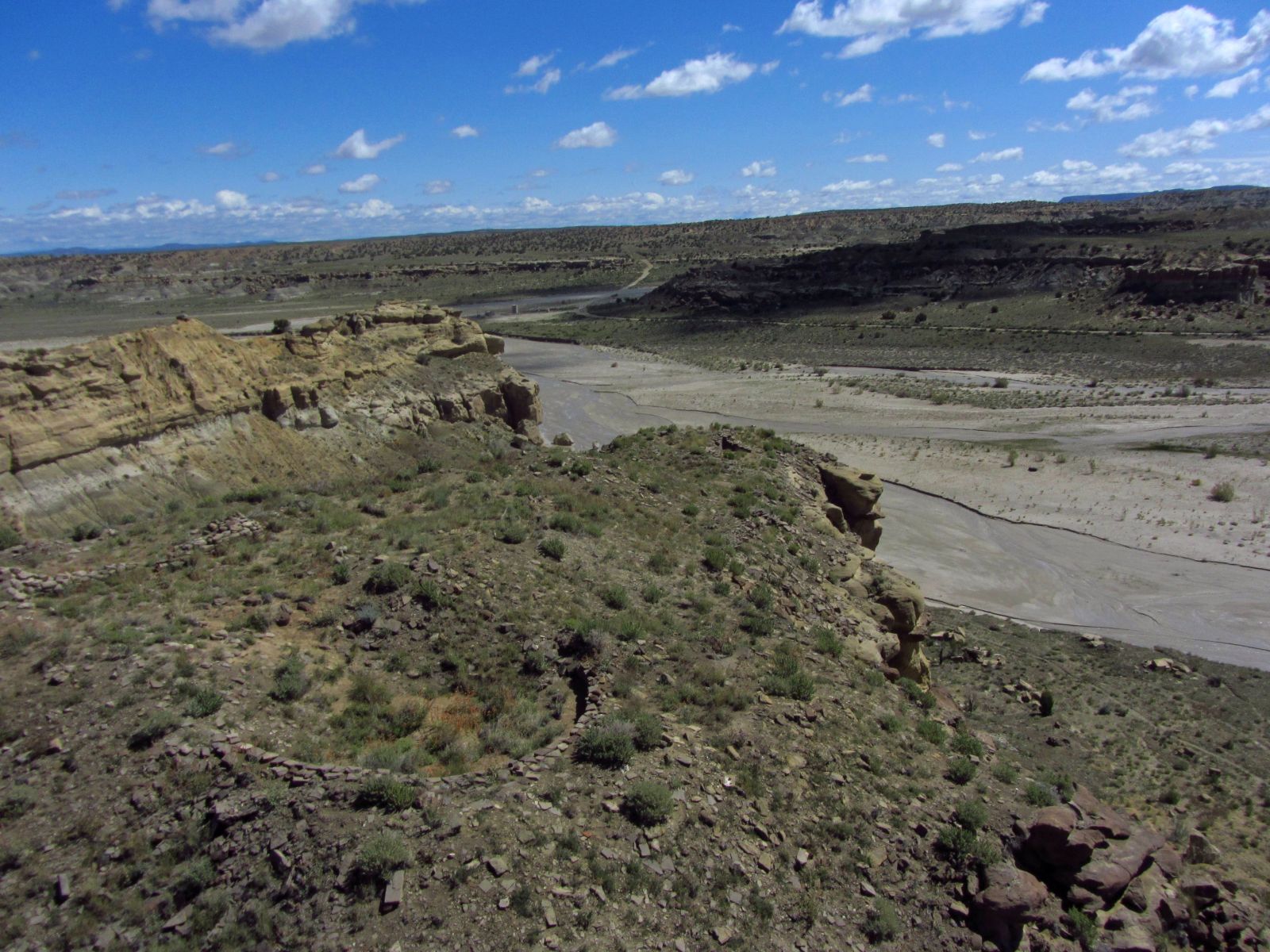
Looking downstream in Kutz Canyon Wash with Twin Angels in the left foreground.

Another angle of Twin Angels. Yeah that’s water in the wash. It made for interesting access.
Bis sa’ani
I really like Bis sa’ani. It’s BLM, obscure, very remote, and it requires a hike (or flight) in. Its setting, on the crest of a narrow, rocky ridge is very dramatic. I was able to image the site while staying quite some distance away at my vehicle. Let’s just say it was far enough out that I triggered a radio failsafe during the flight and I’m using long range UHF control equipment. I REALLY didn’t want to have to hike in to get the tricopter if it went down. But it didn’t!
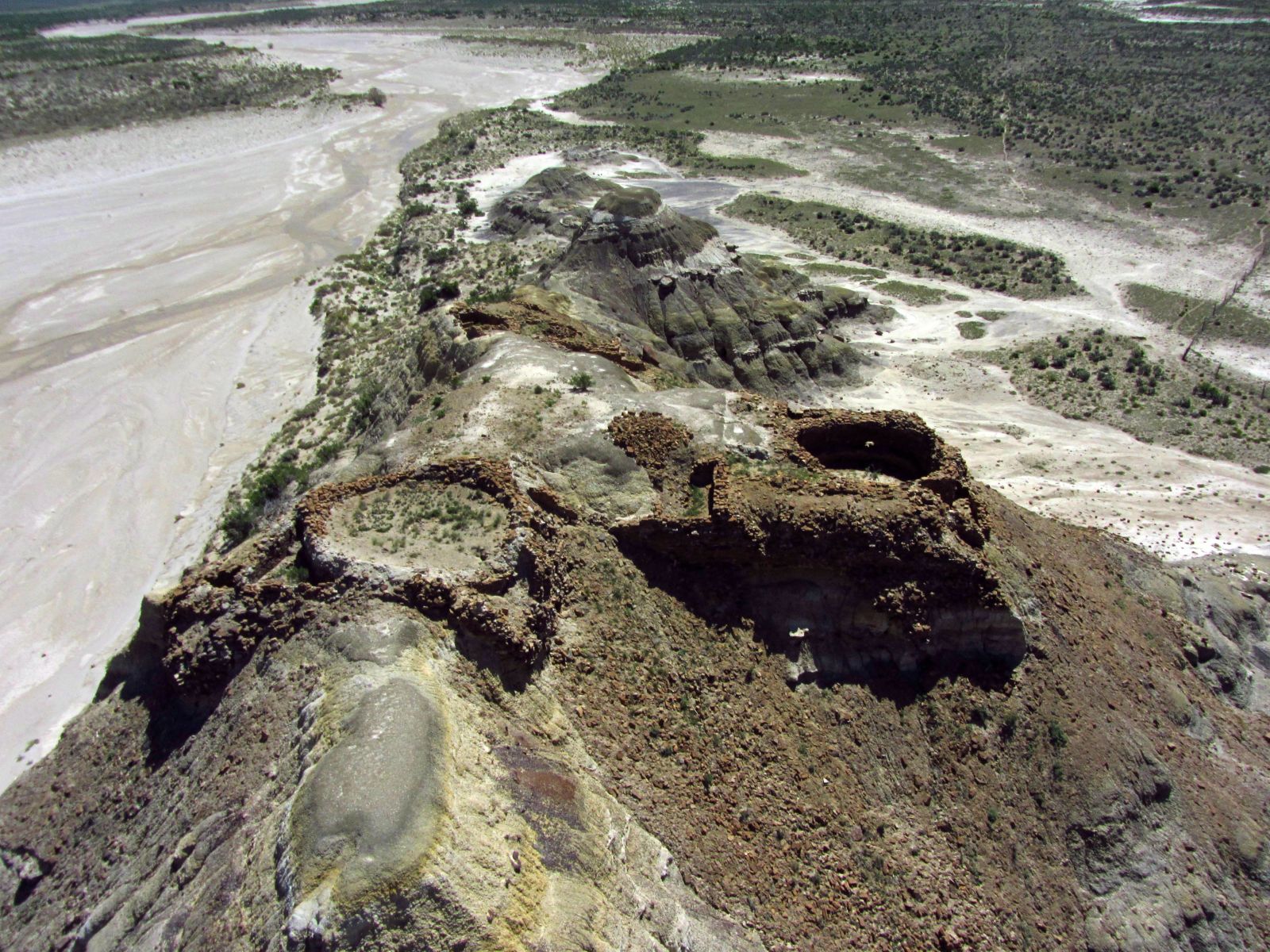
Some of the Bis sa’ani kivas perched on top of the spine. It’s not easy to climb up to those things. These are the East ruins.

Another view of the Bis sa’ani East ruins, looking down into one of the kivas.
Pueblo Pintado
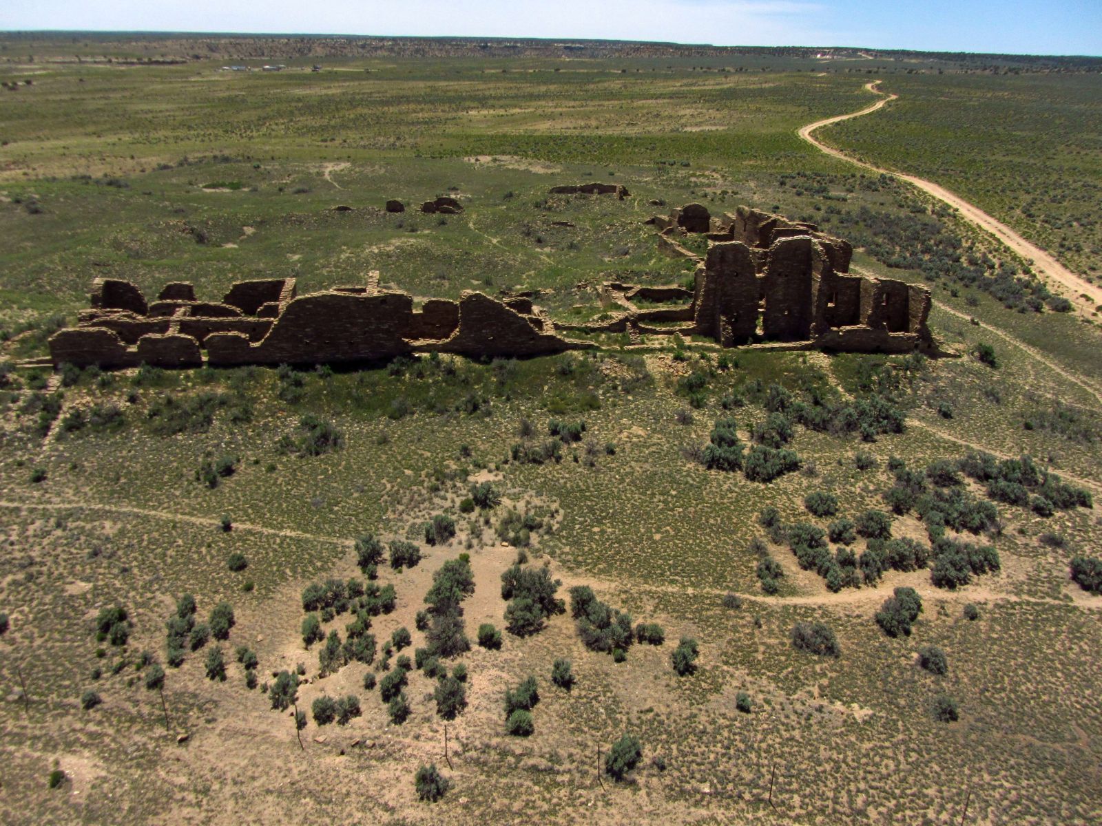
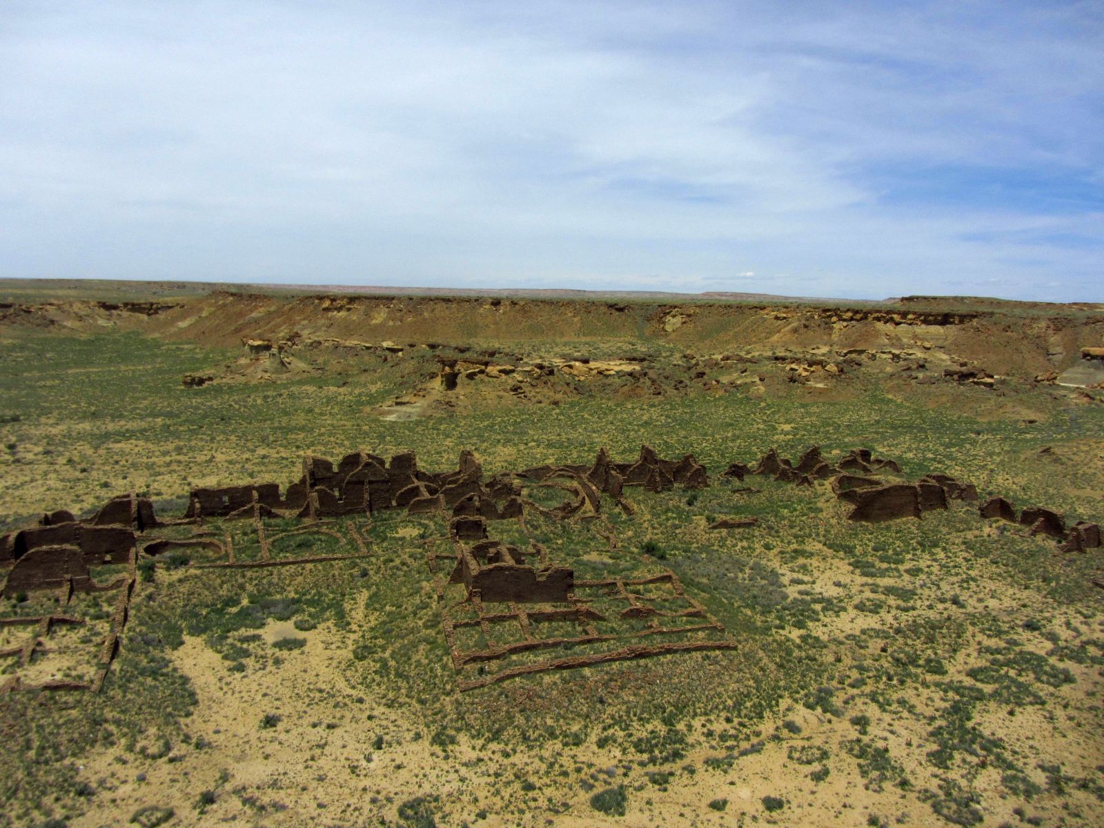
Real easy to visit, on NPS property not far off a paved road. Despite that, I’ve never seen many people stopping there. Its size makes for interesting images, and the walls are quite tall. I made sure I kept my distance from this NPS property while flying the tricopter.

A very elevated view of Pueblo Pintado showing the entire site. The change in ground color marks the fence line up to which the Navajo animals graze.
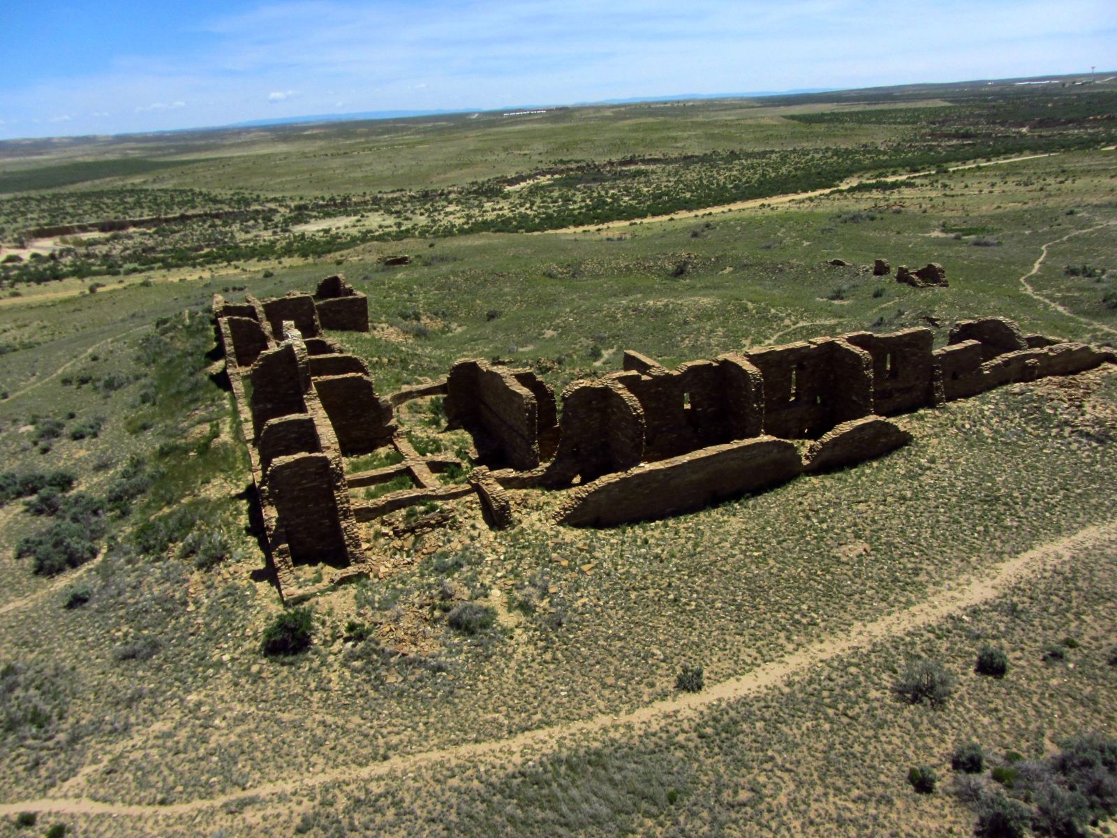
Looking southerly at Pueblo Pintado.
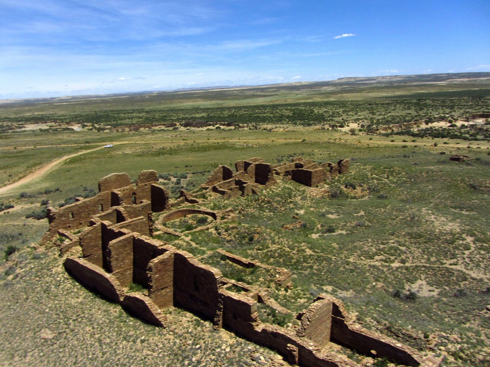
Looking easterly across Pueblo Pintado.
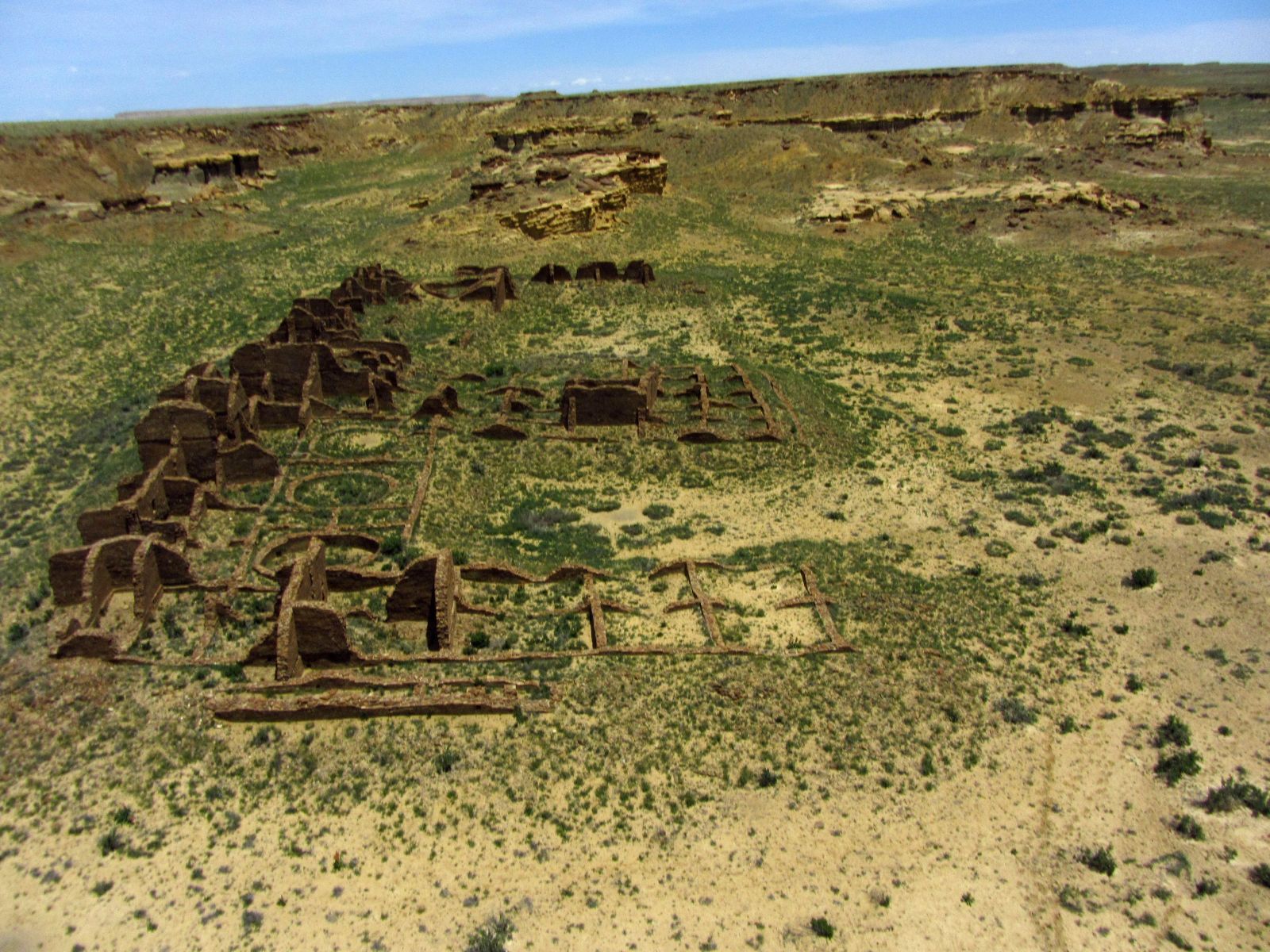
Looking northwesterly.
Kin Bineola Revisited
So I sulked a few days about getting skunked at Kin Bineola. Before I left the location I checked with binoculars and found I could see the damn thing off in the distance. Later, checking a map, I discovered it was only 0.8 miles away, line of sight. Hah! that was nothing.
So back I went. The flight went pretty well, other than the dreaded New Mexico wind had come up, and I was now facing a headwind return. So I erred on the side of conservatism and made my aerial visit quite short. Which is my excuse for the less than stellar pictures.
Looking easterly across Kin Bineola
Facing the main part of Kin Bineola

Aerial view of the dam and the washed out access road.
By the time I had wrapped up my trip I was exhausted. I had covered a great many miles, both dirt and paved. But somewhat to my amazement my three aircraft came through it unscathed, returning literally thousands of images. To be fair, 99% of them are totally crap, but I work on a volume basis.