Jeri and I made our first trip to Kutz Canyon in August of 2012. We planned it as an overnight trip to Farmington, with a stop at another ruin I wanted to see, Twin Angels. One would think August would have been a good time to go, but it turned out to be between a few summer storms. It had rained the previous day and as bad luck had it, there was another storm close behind us. So we didn’t have much time to linger.
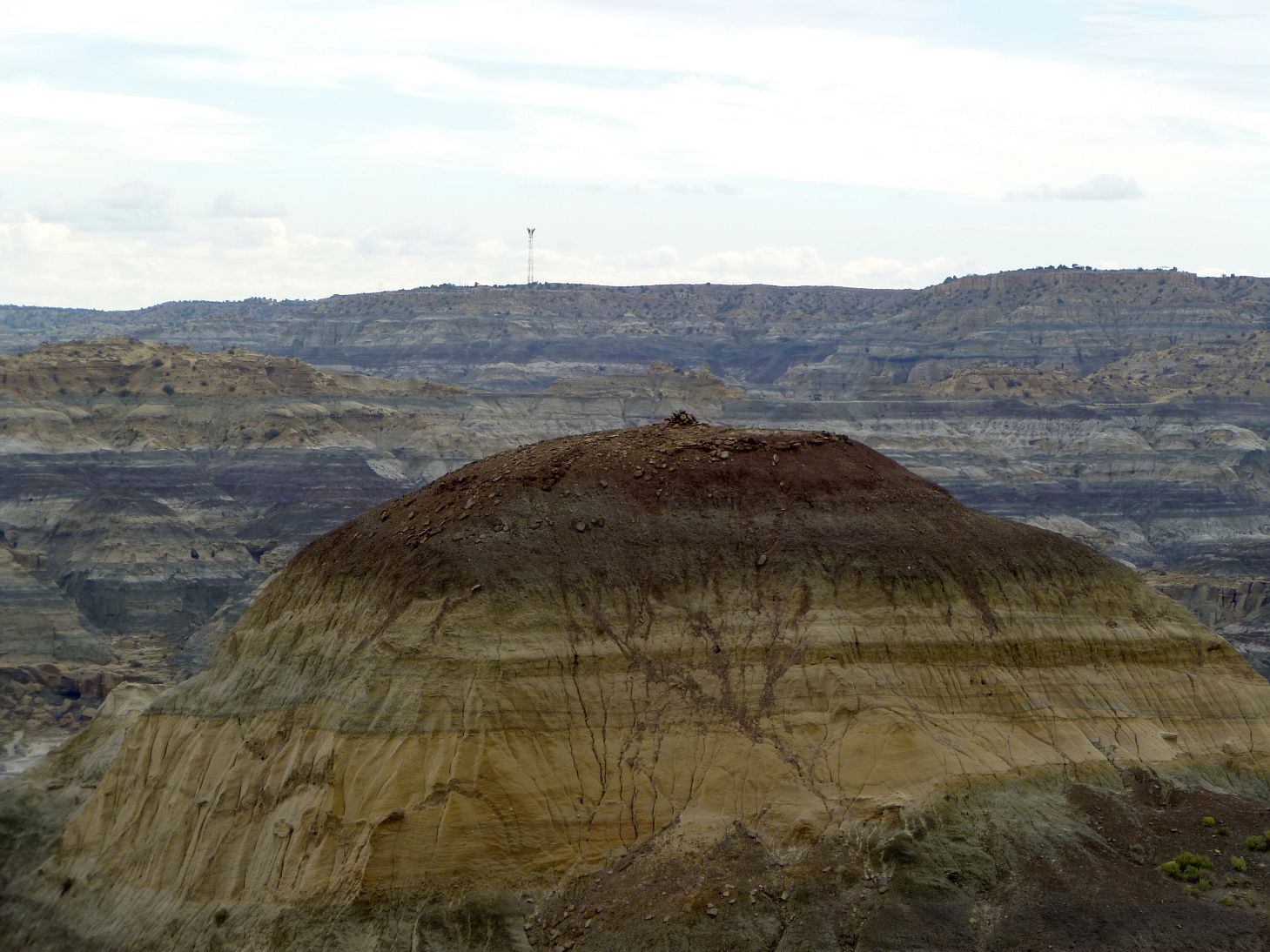
It certainly wasn’t hard finding the overlook as it was just a mile off Highway 550. And despite the overcast it was knock-your-socks-off breathtaking. The drop off from the flat grassy plateau we had been travelling on to the bottom of Kutz Canyon was just amazing. The eroded formations below looked like the mud hill badlands I had seen before in Anza-Borrego and Death Valley, but these encompassed a far greater elevation change. They were badass badlands.
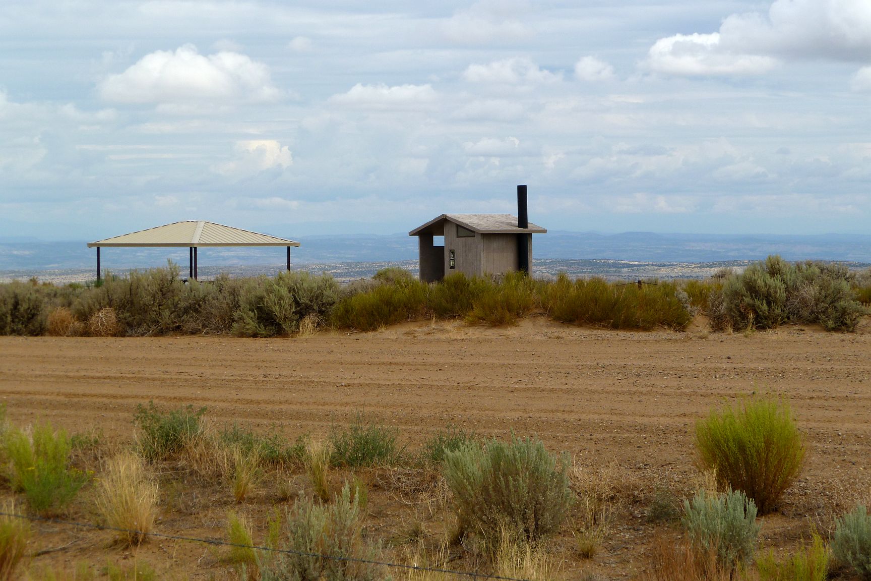
The Bathroom At The End Of The Universe which serves as an amusing marker for the last traces of Chaco’s Great North Road.
I’m using the term “badlands” but I’m not sure that’s proper terminology. The material exposed between the plateau’s rim and the Kutz Wash 500′ below is a clay-silty material loosely held together. It looked very erosive. As the surface eroded away small stones (less than a couple inches diameter) were exposed that once had been part of an overall conglomerate. Drainage water created deep, narrow ravines making….well, badlands.

Looking down into Kutz Canyon from the overlook area. This gives a sense of how rugged the terrain is.
The ground was still wet from the earlier storm and the clay surface of the mud hills was slick and treacherous. It was clear I wouldn’t be able to go far off the rim without considerable risk.
I spotted the “shrine” pictured in Sofaer’s paper quickly (“shrine” in this context is essentially a pile of rocks, not any sort of fancy structure). I wandered over to its base to see if it was climbable. Not a chance in hell. Even if the ground wasn’t slick as snot the side slopes were steep with serious amounts of exposure. I did note that quite a bit of whatever structure had been at the top had crumbled down the east slopes and left small piles of clearly out of place stones at the bottom of the slope.
The “shrine” near the Kutz Canyon Overlook. It’s really just a pile of rocks and because of the steep drop offs, access is very dangerous.
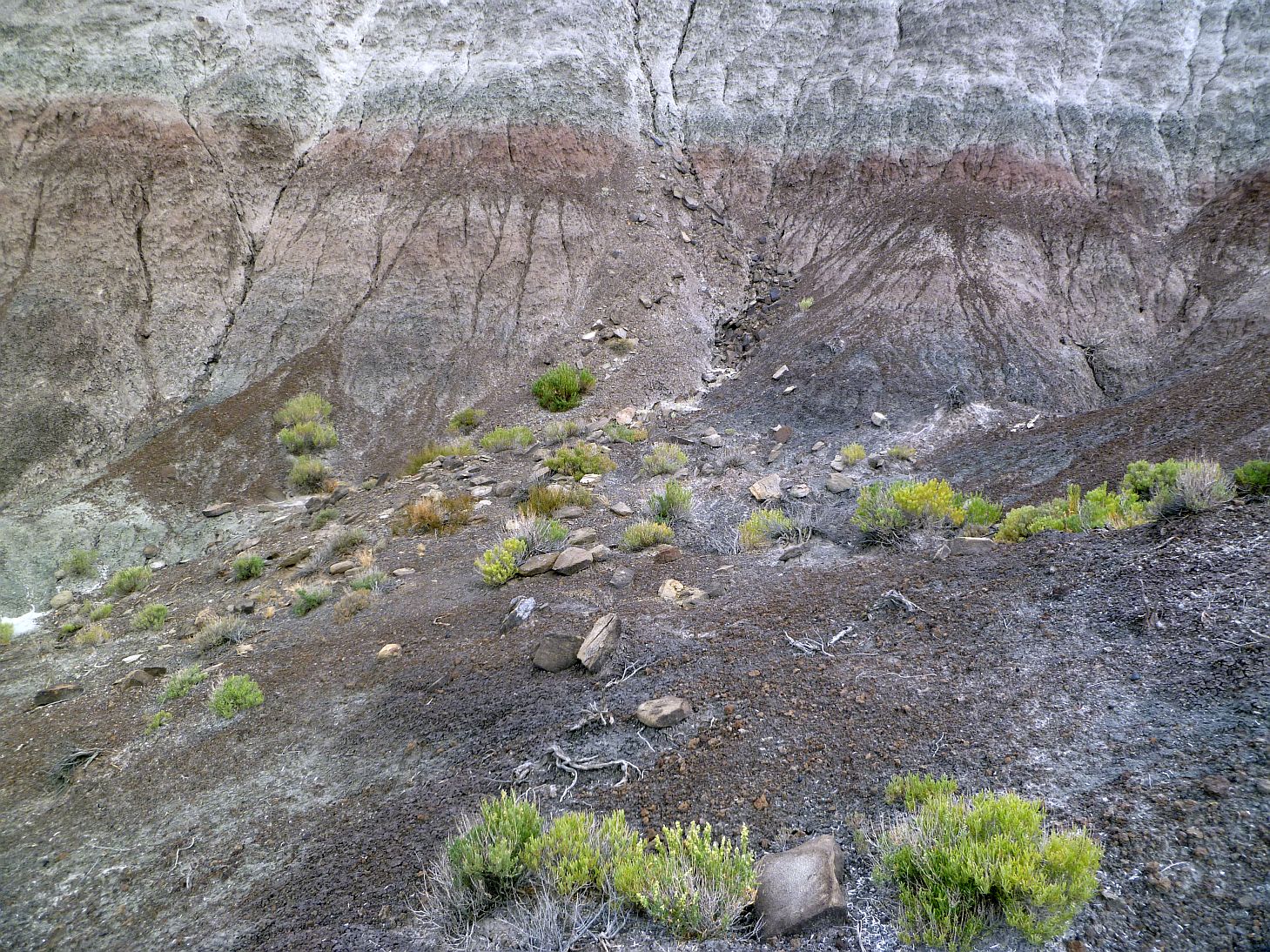
Rocks that have tumbled down the easterly side of the shrine’s mound the shrine due to erosion.
The obvious route down toward the wash below looked to be the ridge spine running north from the overlook area. I headed down to see if it were passable to the wash below. It wasn’t. After descending perhaps a hundred feet the slope became so steep that it was wildly unsafe to go further. However just before things went all to hell slope-wise, I did come across some sherd scatter, including a nice corrugated pot bottom.

This was about as far as I could safely descend the spine. The ground really went vertical at this point. Below is an oil well and storage tanks. While its access road provided good access to the bottom, the pump engine was pretty noisy and sort of ruined the otherwise tranquil atmosphere of the area.

A nice corrugated pot bottom found about 1/3 of the way down the spine. There were other sherds along this route but this was the most interesting.
I was able to lean over and see a bit of the spine area further below me. I suspected it might be possible to climb up from the bottom, but I was going to have to wait until it dried out a bit, and also had to figure out how to actually get to the bottom.
Next: Kutz From the Bottom Up (Sorta), August 31, 2012
or, Back to the main Kutz Canyon Stairway page