For some time I’ve been working towards developing a multicopter capable of being fielded into a backcountry environment for imaging and mapping of archaeological and other interesting sites. With the Tri^3 I think I finally achieved full utility so it was time to head for the field and really put it all at risk.
My first test was a neat ruin called Casamero, in New Mexico, just northerly of I-40 between Gallup and Grants. It has easy access, is on BLM land and in my experience has little visitation. Here’s the BLM’s web page on the site.
I wasn’t sure how well the tricopter would do, as it was carrying a heavy battery load (dual 4,000 mAh 4S LiPo batteries) operating at around 7,000′ above sea level, and it was a breezy morning. Despite its overall weight of 2,360 grams it did quite well!
There were several flights that morning. The primary flight was a preprogrammed grid flight about 30 meters above the Casamero ruins while taking vertical images every two seconds. That’s the kind of flying I like, where the tricopter flies itself and I just monitor the data via a video link. It flies much better than I do.
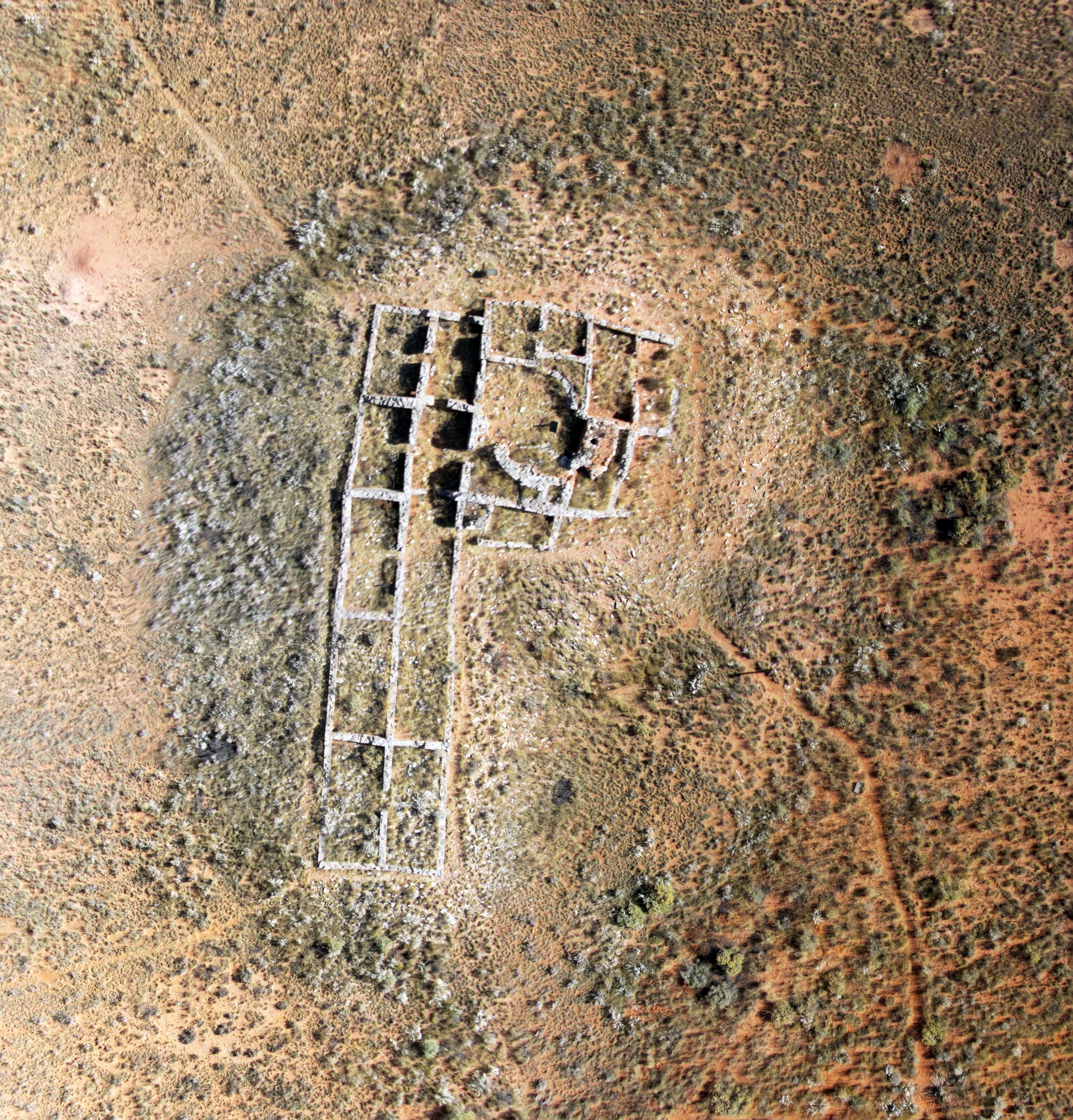
The result of an autonomous mapping mission above Casamero utilizing a tricopter carrying a Canon SX230 camera, flying a preprogrammed grid pattern at an altitude of 30 meters. This is a stitched composite from 80 smaller images and a greatly reduced file size. Imaged on 10/2/2014.
After successfully completing the mapping flight I launched the tricopter again, this time under my full control, such as it is. I had swapped out the vertical camera mount for one facing forward for oblique shots. With the FPV camera lined up to match my imaging camera I was able to use my video goggles to position the tricopter for a series of shots with Casamero and its very scenic background. And that, like the mapping, was a great success.

Looking northerly across Casamero from an altitude of approximately 10 meters. Imaged on 10/2/2014.
Looking southerly over Casamero from an altitude of approximately 10 meters. Imaged on 10/2/2014.

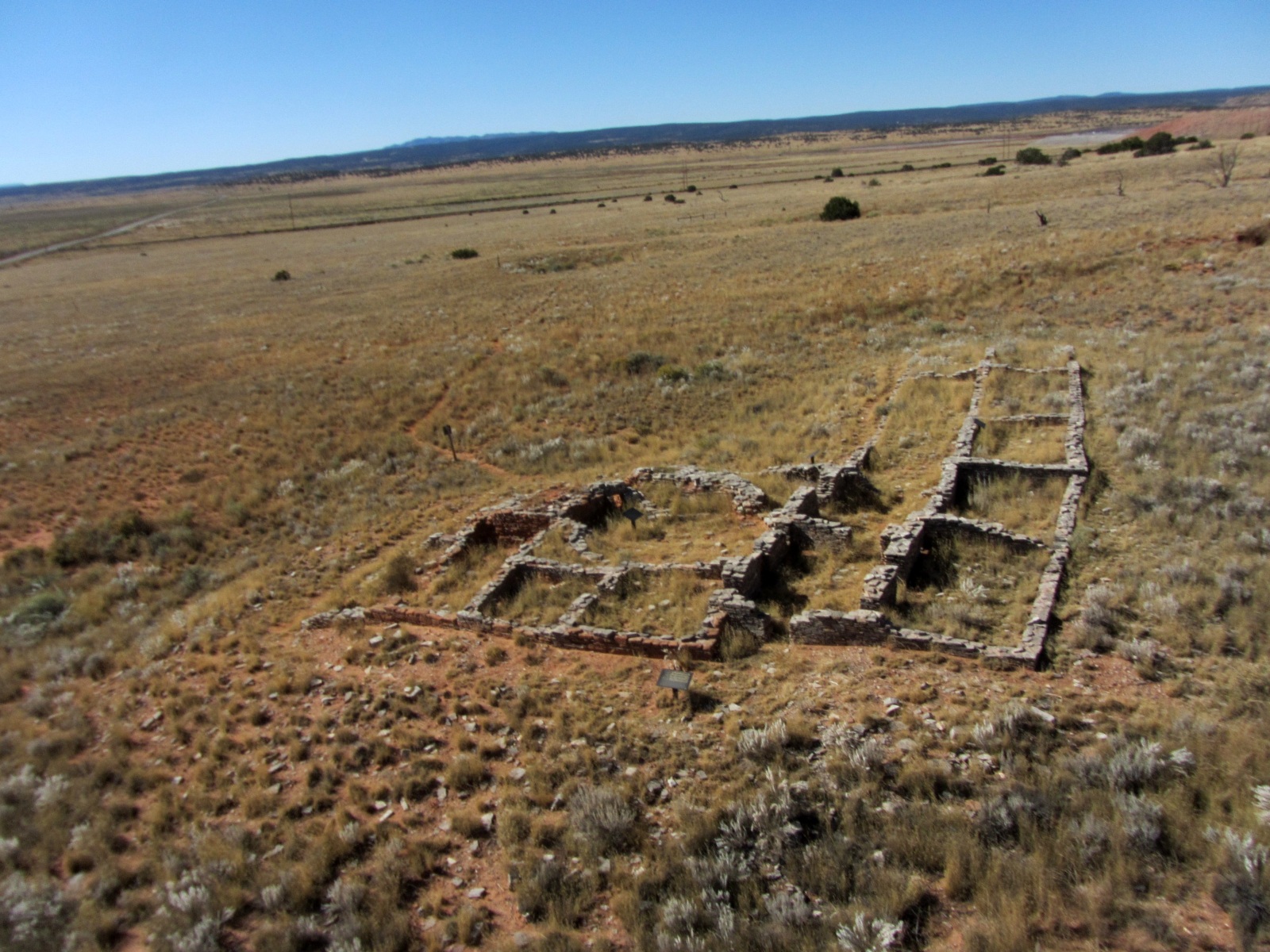
A view of Casamero, looking southerly, from about 50 meters. The shrub-filled depression about 100 meters directly beyond Casamero is believed to be an unexcavated Great Kiva. To provide a sense of scale, note the parked white vehicle on the road at the left. Imaged on 10/2/2014.
Emboldened by my good luck, the next day I picked a much more challenging goal, imaging the sites of Astialakwa and Patokwa near Jemez Springs, New Mexico.
The first flight was simply oblique shots but was my most ambitious. The primary target was the ruin of Astialakwa, located on a mesa top 1,100′ above my launch point and just under a mile away. Jeri and I had hiked to the top before and it’s a tough hike on a narrow, 300 year old trail. It’s an extremely dramatic and compelling place due to its somewhat tragic history. Here’s my web page I did when I first visited the site.
My main concern was flying across the mesa top and losing a line of sight from my launch point below and killing my video link. So I set an auto mission with the first waypoint on the southerly nose of the mesa spine, and a few waypoints across the top of the mesa staying toward the easterly edge. I was pretty sure I’d retain my 430 MHz control link even if I lost video. I wasn’t sure how well I’d be able to see the actual ruins so I set my final waypoint to give a decent view of some of them. They are scattered over a large part of the mesa top.
The weather was absolutely perfect with almost no wind, unusual for this area. I launched from a turnout on the side of a paved road and flew the tricopter manually out and up until I was comfortably high, at which time I engaged the Auto mode. The tricopter headed right for the spine and the programmed altitude, hit the first waypoint, turned and began following the spine. Ain’t technology grand!

Looking south while hovering just over the nose of Guadalupe Mesa about 1,100′ above and a mile out from the launch site. Imaged on 10/3/2014.
As it reached the actual mesa top I was impressed with the visibility in my new FPV goggles, and I could actually see ruin walls approaching. What I didn’t fully appreciate was that I was only flying at about 20′ AGL instead of the 100′ I had wanted. I don’t know why, it could have been an atmospheric pressure change or just errors in the Google Earth measurements I based my flight programming on. But I was starting to think I was a little low as I passed over the first set of walls and could make out individual rocks. That was, um….interesting.
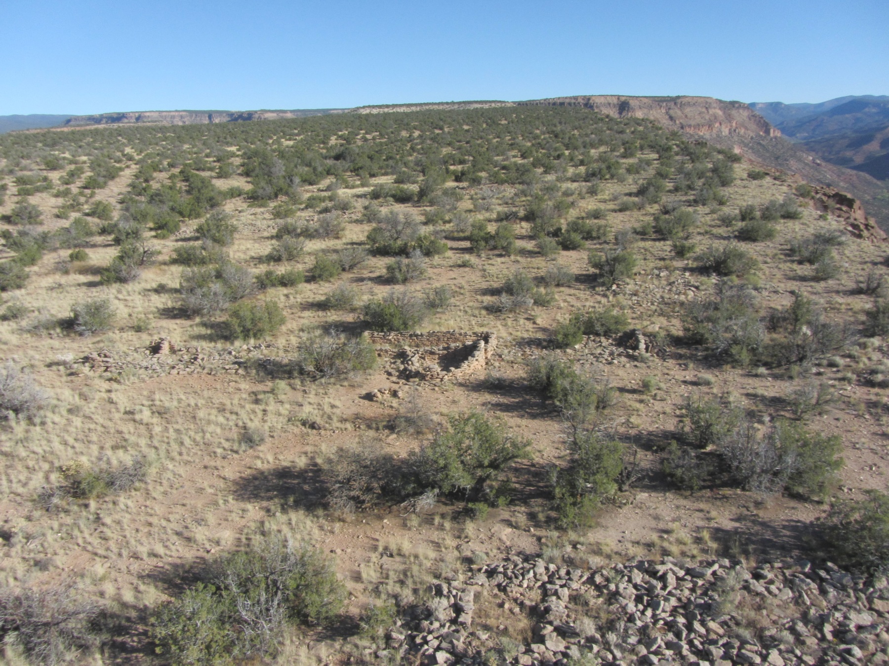
An aerial view looking north of some of the crumbled Astialakwa roomblocks. All the visible rubble piles are former walls knocked down by either the Spanish or the elements over the past 300+ years. Imaged on 10/3/2014
I was about 200′ feet from my final waypoint when I lost the video signal. It then hit me it was because I was so low, and had flown over the edge of the mesa out of the line of sight the video link requires. I popped the tricopter out of Auto and into Position Hold, so I knew it would stop where it was and hold its position even though I couldn’t see anything on the video (Had I lost the control link the tricopter would have quickly returned to the launch site and landed on its own….it’s idiot proof that way). I then added altitude and the picture quickly came back. I probably got to about 120′ AGL. I hung around there a few minutes taking pictures of the mesa top and of the adjacent valleys. I would have liked to have pushed a bit further on to the mesa where there are more ruins but losing the video had spooked me and I was being conservative. It would have been a long hike to do a recovery.
After having my fill of that, I turned south and followed the mesa spine back down toward me and headed for a much lower mesa almost across from the launch site. This is this site of a ruin called Patokwa. There’s not a lot to see there, as the walls have collapsed into mounds. But the footprint is still visible. Between imaging both sites the flight ended up being 17 1/2 minutes in length and I still landed with excess battery remaining.

Looking southerly over the site of Patokwa, visible as the light colored, raised mounds. The Pueblo of Walatowa is in the far left background. Imaged on 10/3/2014

Looking northerly over the site of Patokwa, in the foreground. Astialakwa is on top of the mesa to the rear, about a mile distant. Both sites were imaged on the same flight. Imaged on 10/3/2014
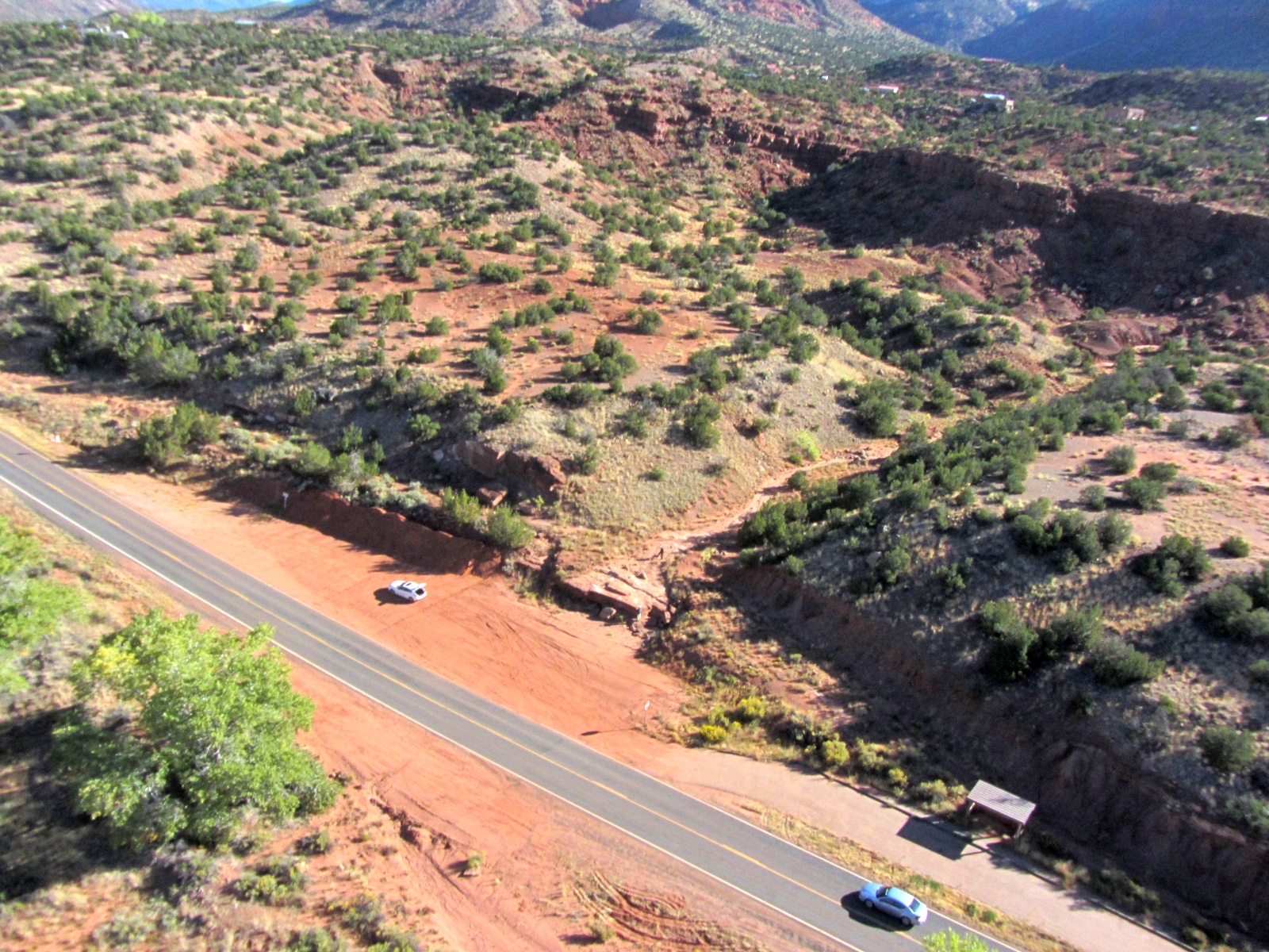
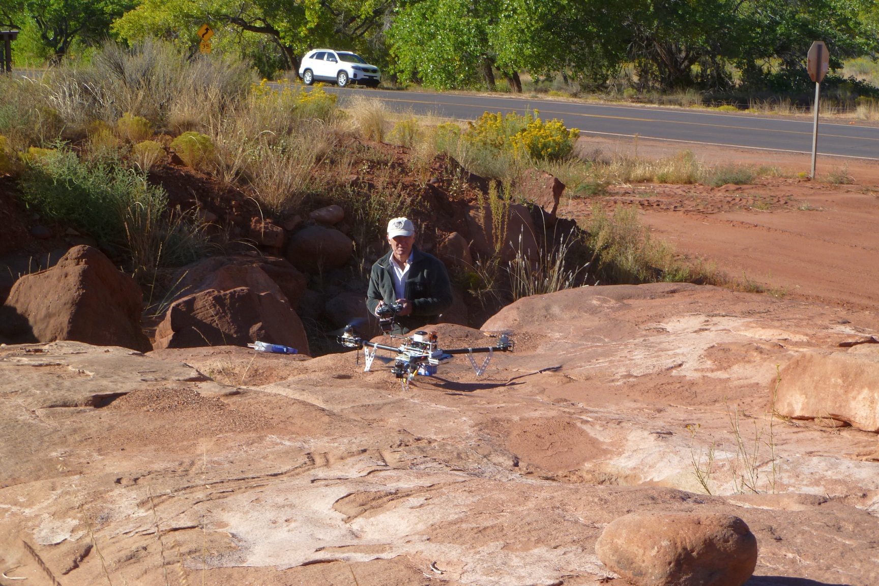
Returning to the launch location by the side of the road. Damn pretty area. Imaged on 10/3/2014.
I then reprogrammed the tricopter for a grid pattern mapping mission of Patokwa. Given it was just across the river from me, it was an easy, but slightly boring mission. After launching I put it on Auto and monitored how it was doing. Strangely, rather than climbing above the low mesa, it was heading right for it. “Right for it” as in heading for the cliff. So I took it out of Auto, raised it up another 100′ and manually flew it over the ruin area. I later found I made an error in the altitude I had entered, so it was doing exactly what I had programmed it to. Unfortunately since I was trying to do a lawnmower pattern by eye, it didn’t turn out well and my stitching efforts didn’t amount to much. Not a great loss since it was just an experiment anyway. I was much more interested in the Astialakwa obliques anyway.
Just about to launch the tricopter set up for a mapping mission of Patokwa. Imaged on 10/3/2014.
Sooooo…..Looks like I’ve finally moved out of the development phase and into implementation. What fun!