Once Jeri and I tasted a bit of staying at Two Harbors on Catalina, we quickly lost interest in that bustling burg at the other end of the island, Avalon. Two Harbors is barely a village, with minimal services. A general store, a cafe that closes at 3, and a rather decent restaurant that doesn’t open until 5, leaving unwary visitors having to forage for food for an incredible two hour interval. For most modern Americans, this two hour lack of access to instant food is a deal killer, and to them I say, “Stay away from Two Harbors”. More room for me!
Seriously, the lack of diversions make it not suitable for just everyone. But if you’re looking for an amazing place to get away from things and enjoy a rural lifestyle in view of the SoCal megalopolis just across the channel, these just might be the droids you are looking for.
We had already done a bit of mountain biking out of Two Harbors, so this trip was to be about hiking. And as before, we planned on staying at the Banning House (your choices are there, camping or live on a boat…so, easy choice) for a couple of nights. As with previous trips, transportation to/from the mainland was via the ferry out of San Pedro.
The Trans-Catalina Trail (TCT) runs from one end of the island to the other, dipping down and passing through Two Harbors. In fact, it passes right by Banning House. We decided (“we” of course, means “me”) to head northwesterly on the TCT because I thought it might be the easier of the two choices. Sometimes the voices in my head win.
The TCT route out the door of Banning House southeasterly towards Avalon is pretty steep, but doesn’t climb as high as the northwesterly direction does. But the topo maps showed that northwesterly route to not have as steep a gradient, as the trail was following a road. And we know that roads can’t be that steep, right?
So after breakfast Jeri and I headed off to the isthmus and located where the TCT started up and to the northwest. Hmmmm…..pretty steep, but it was still cool, it kinda being April and all. That soon changed as we got out of the wunnerful marine layer into the warmer air above. And steepness? That went to shit really fast. The ONLY thing good about this route is that we weren’t trying to bike the sucker. It was nasty steep.
During the climb to the ridge we had a lot of time to think about things and discuss them calmly. We concluded that “Catalina” must be an ancient Indian curse word meaning “the only way you can go is up”. Sure, it got flat by the time we reached the crest of the ridge, but that was at 1,600 feet and by then our legs were too toasted to enjoy it. Also, we wondered, why is it always so damn hot on a place that’s surrounded by thousands of square miles of water? Seems unnatural. Seems even more unnatural that we keep coming back.
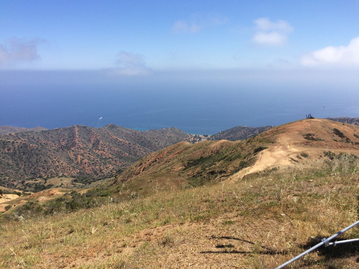
Looking down to one of the summer camps in the cover below. Looking waaaaay down. The mainland is off in the distant clouds.

As good a place as any to turn around. Random weather stations usually mean a high spot.
At about 4 miles in we reached a local high point at about 1,800 feet with an automatic weather station. Great views of both sides of the island simultaneously with dramatic fall offs into the sea. Although we had been at it for several hours, Two Harbors looked annoyingly close. Seeing that the ridge we were running along was going to descend a bit, we decided this was probably a smart place to turn around (though less smart than if we had remained in Two Harbors), so back down we headed with dreams of lunch.
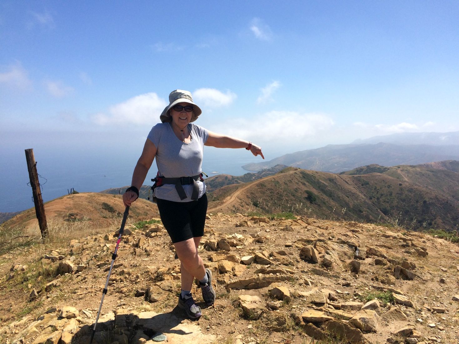
Jeri helpfully pointing out the location of Two Harbors, to where we must return. Doesn’t look that far, does it?
Returning back down the road validated our opinion that this was a steep bastard. Hard to believe we were dumb enough to go up it.
We made it back to the cafe before it closed and indulged in Bison Burgers, some of the best fries we’ve ever had, and unlimited drinks, the last part being the best. Or maybe it was the fries. Hell, it was all good by that point.

After the hike: THIS is why we do what we do. Oh, and a lack of sense.
There’s at least one other trip left for us to do, and that’s the TCT southeasterly out of Two Harbors. From the vantage point of our hike I got a good look at this route and it appeared a much easier route than what we (I) had selected. The climb to the ridge line in that direction was a bit over half of what we had done, so maybe we’ll be smart next time and do that. Or maybe we’ll be truly smart and just lounge around Banning House for the day reading books.
Ummm, not likely.