We are all getting quite sick of Smith Water Canyon in Joshua Tree as part of our ongoing search for Bill Ewasko. In an inspiration of self-preservation, Patrick McCurdy suggested to me that as a break maybe we should do the Stubbe Springs Loop hike, as we had never been there. And oh, by the way there’s a rumor of an old mine in the area. He knows I’m easily distracted by shiny things and had me at “rumor”. And rumor is usually more interesting than fact. (For Patrick’s account of the trip, see here)
In all the times we had been out in that area we never got around to actually doing the loop. Maybe because it was longish, on the order of 13 miles. But I had more than a little curiosity about the place as it had been covered pretty well on the original search for Bill Ewasko. The search notes reported the dogs showed an interest in the vicinity, a foul stench being noted, so a lot of time was spent going over it in detail. It was ultimately determined the likely source of both the dog’s interest and stench was a Big Horn Sheep carcass in the vicinity.
Patrick had heard something of the existence of an old mine near Tandy Point, supposedly known as the Tandy Mine. Internet searching turned up nothing but it was as good an excuse as any to wander around cross country through the desert. We dragged Pete Carlson’s ass along because a 13 mile hike through the desert is the sort of warm up thing he does before breakfast. Besides, we conned him into driving so it would be much more pleasant than our usual trucks.
We left the Juniper Flats trailhead around 9 AM and headed out on the California Riding and Hiking Trail. We quickly noticed there was a lot of charring in the low hills to the south, something new since the last time I had been through the area. It looked to be a pretty substantial brush fire.
Just before reaching the trail junction and turnoff to Juniper Flats, we hung a sharp left and started up cross country toward Tandy Point. Tandy Point was a peak originally listed in the first (1946) Hundred Peaks Section of the Sierra Club. However after the first group went up it, it was removed from the list as it was simply too flat a climb and unworthy of being included on the list. Not climb-worthy. However for me, the flatter the thing the more attractive. Perhaps that’s why I never joined the Sierra Club?
Anyway, the climb was short and pleasant, passing through an unburned area. We kept a lookout for any sort of mine or prospect, but failed to notice anything. That doesn’t mean it doesn’t exist, we simply didn’t see it. We didn’t spend any extra time looking though. So go look for it! If you don’t find it, blame Patrick. I do.
As we approached the high point on the ridge we started looking for the Tandy benchmark. This turned out to be a little difficult as the highest point wasn’t especially pronounced and there were two other unnamed benchmarks in close proximity. But we finally found Pete unknowingly standing on it. Lesson learned: When you’re looking for something, look under Pete.

Patrick on Tandy Point. “I just KNOW there’s a mine out there somewhere….”

The benchmark on Tandy Point. Proof we were there (unless we lifted the image off the Innerwebz)
The view from the top was very nice both towards Palm Desert in the west and east towards the Juniper Flats area. We were surprised to find a small register at the peak with only a couple of names in recent years. Well, maybe not surprised. Who in their right minds would come up here?

A panorama of Juniper Flat from Tandy Point. That’s Quail Mountain and the Quail ridge toward the left side of the image.
We could see Stubbe Spring off in the distance to the west and well below us, so we started on down. We didn’t head exactly for the spring as we wanted to intercept the trail from the Juniper Flat junction and see what it was like. There was a comment by one of the Ewasko search teams that someone on that trail could conceivably get confused were it crosses a wash and inadvertently continue the wrong way on down a wash. So we wanted to see what the trail was like.

Stubbe Spring from Tandy Point. It’s that brushy area in the middle of the picture.
Turned out the trail was very good and the likelihood of taking a wrong turn seemed low. We followed it to the area of Stubbe Spring and noticed the park service had posted trail guide markers guiding you right past the spring without noting it. But there was nothing that said keep out so we continued over to the spring. We quickly found it perhaps would have been wise to post a keep out sign!

Looking back at Tandy Point from Stubbe Spring. It’s that little blip on the saddle in the center of the picture. Yeah, I know, it’s that impressive in real life, too.
The spring appears to be a seepage on the westerly slope of a narrow ravine, continuing down to its bottom, which is fairly lush with vegetation. We saw no evidence of open water. What we did see was Big Horn Sheep skeletons….lots of them. We counted at least four within a hundred foot area in the canyon bottom of various ages. Some still reeked a bit. There could have been more in the brush but we became less eager to explore.

The vegetation on the far side of Stubbe Spring. The ravine of death is below.
Now a Big Horn is a big animal, something not likely to be taken down by a coyote. The only thing we could think of capable of the job was a mountain lion. Hello kitty! It looked like Stubbe Spring was something of a mountain lion kill area, their local minimart. It quickly became apparent this was not a smart place to be if you were a solo hiker. And while this area has been designated as day use only by the park, camping anywhere near here would be about the last thing I’d want to do, since it could be the last thing I’d do.

One of the multiple sets of Big Horn Sheep remains at Stubbe Spring. Ah the desert is such an inviting place…..
We continued up the slope to the west looking for a guzzler listed on the topo map of the area. What we found was a pile of old lumber, some cammo netting and a couple of rusty folding chairs. I’ve never seen a wooden guzzler but perhaps that’s what it used to be. Who am I to question the USGS? I’m guessing the chairs and netting were left over from some sort of Big Horn Sheep census project. But hey it was a place to sit in the middle of nowhere.
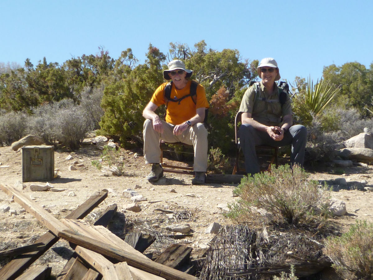
Truly mountain lion bait. Pete and Patrick on the chairs in the middle of nowhere. The remnants of what is supposedly a guzzler are in the foreground.
Time was passing and we weren’t getting any closer to getting out of there, so eventually we left the ravine of death and started back on the loop. Pete wanted to see the Fan Canyon Overlook so we diverted to there for a peek. It was pretty impressive.
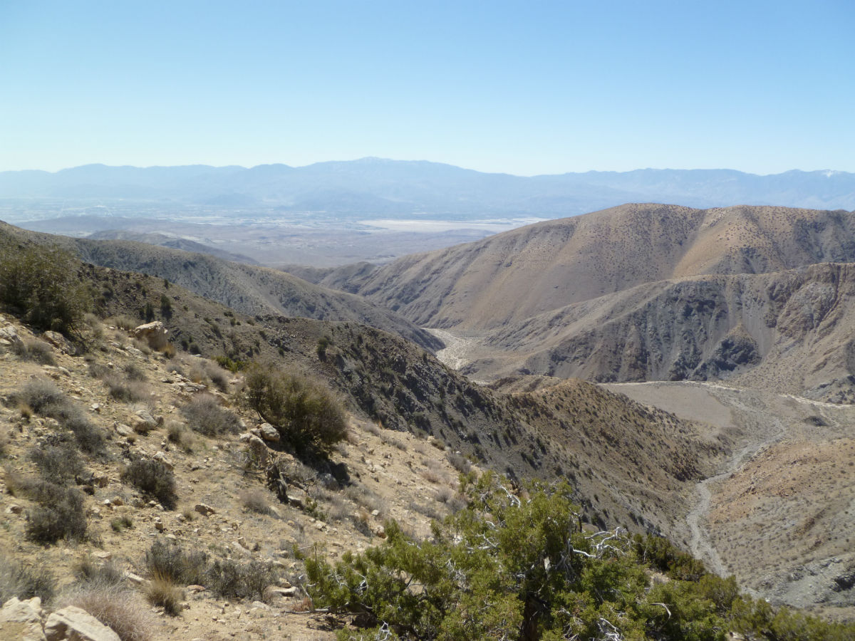
Looking westerly off the Fan Canyon Overlook.
We left the overlook and headed north through the hills to rejoin the California Riding and Hiking Trail. In May of 2012 for JT36 I had checked out this area and it was very nice, covered with junipers. Sadly this same area was really hard hit by the fire and it was scorched and bare. It still smelled burnt.
After hitting the main trail it was the usual long slog back to the trailhead. I’ve done that damn trail enough times to have grown to dislike it as it seems far too long. We made it back to the vehicle around 3 PM, having covered about 13 miles. That was 13 miles in 6 stinkin’ hours, including stopping a few times to not find mines and eat. We all decided this was far too fast a pace for a hike (even Pete!) but none of us wanted to be the one who said, “Uh, guys, could we take a break?” I suspect it was because it’s been a while since we actually used this thing called a “trail” at Joshua Tree and didn’t know how to react to all that smoothy goodness.

Our GPS tracks for the Stubbe Spring Loop hike.