In September of 1924, Michelson began to consider using a much longer baseline than he had for his Mount Wilson-San Antonio measurements. To that end, he inquired of Adams about measurements between Mount Wilson and San Jacinto Mountain, 82 miles away. Adams began looking into the idea and in October of 1924, sent a cost estimate back to Michelson for the work.
Due to the greater distance, Michelson wanted to use larger diameter mirrors, at 40 inches, which would have collected 3.3 times the light of the smaller 22″ mirrors used for the Lookout Mountain effort. With the distance now increased by 3.7 times over the Lookout Mountain link, the larger mirrors should have been adequate for the task.
In terms of cost, it was estimated to cost $4,000 for the two necessary mirrors. Added to that was a “house” at the San Jacinto end of the link, needed to shelter the equipment there. The San Jacinto house was estimated to cost $1,500. For the Mount Wilson end, it was felt the existing house could be modified to allow pointing toward San Jacinto. The total estimate for the Mount Wilson-San Jacinto experiment came to $10,000.
In November of 1924, Pease made an exploratory trip to the San Jacintos to scout locations. He noted four possibilities, ranging from 3 miles to 17 miles northwest of Idyllwild, generally along the road to Banning. Pease also reviewed the roads between Pasadena and both Banning and Hemet, pronouncing them “excellent”. Over the winter of 1924/25, repeated observations were made of San Jacinto from Mount Wilson, and except for the occasional storm, the visibility was described as “astonishingly high”. So with things looking favorable for a Mount Wilson-San Jacinto link, the mirrors were ordered, the first arriving in May of 1925 and the second in June.
In August of 1925, Pease and Jones went to San Jacinto to make a decision for the final site. The one they chose is just westerly of today’s small community of Pine Cove, although Michelson continued to use the name “San Jacinto” when referring to the site.
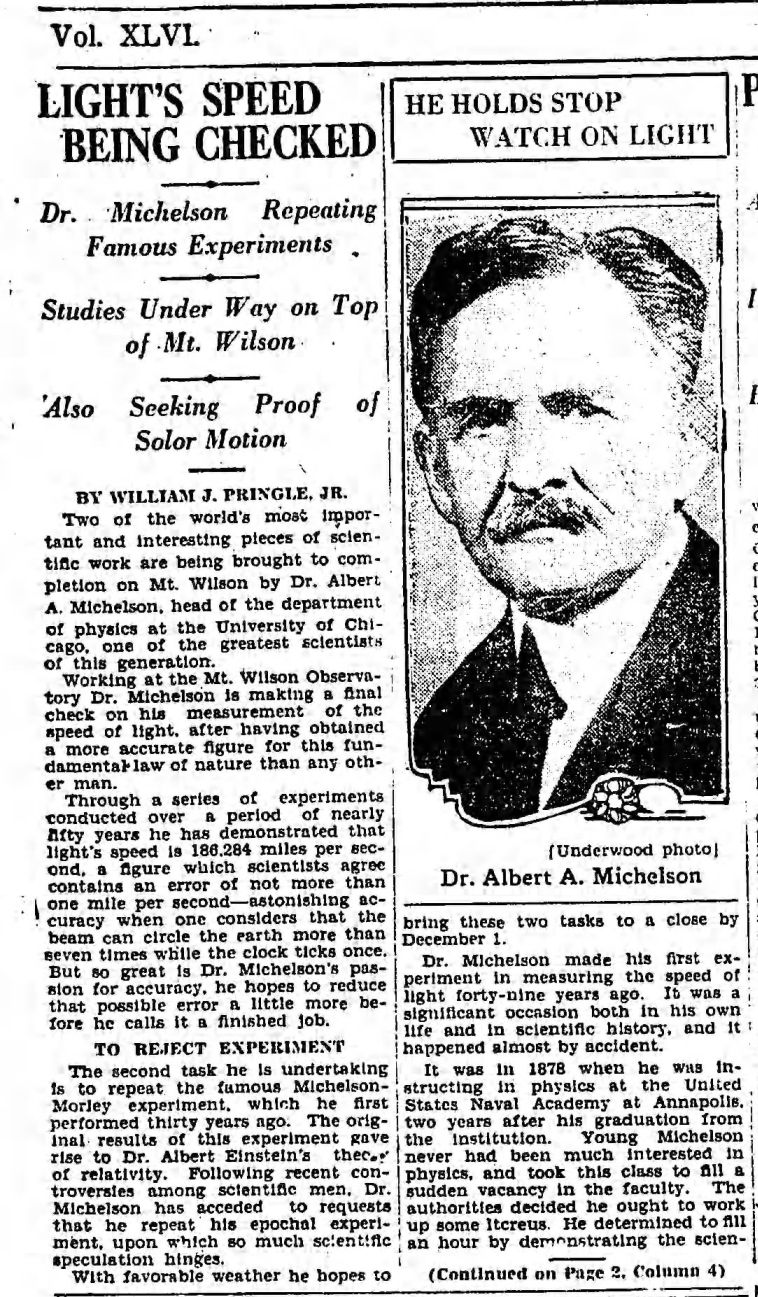
During the Summer of 1926, Michelson performed initial measurements using the new line. He was underwhelmed. In March of 1927, Michelson expressed some concerns to Adams about the San Jacinto site. The distance measurement between Mount Wilson and San Jacinto had been done some years prior, and wasn’t as accurate as the measurement done to the San Antonio site (1 part in 200,000 versus 1 part in 500,000). Michelson also found the returned light to be poor, despite the larger mirrors. This was due to the haze occurring naturally and to what Michelson referred to as “forest fires”. (More likely than forest fires was the then common practice of incinerating trash combined with the natural inversion often occurring in the Riverside and San Jacinto Valleys.) At this point Michelson raised the idea of using a 3 mile long pipe, evacuated or perhaps filled with Hydrogen gas. Adams quickly responded, pushing Michelson for further attempts using San Jacinto saying, “…it would be a pity to dismantle it…”. However sometime during the Summer of 1927, the San Jacinto site was dismantled and abandoned, the mirror and mountings returning to Mount Wilson.
Contemporary press coverage of San Jacinto work from the Los Angeles Times:
Aug 2, 1926 Mirror about to be placed on San Jacinto within the next few days.
Feb 28, 1927 Poor weather causes Michelson to abandon the San Jacinto work for the season.
Aug 25, 1927 Michelson “will continue work next month”.
Sept 25, 1927 Michelson left for California to work again on San Jacinto test.
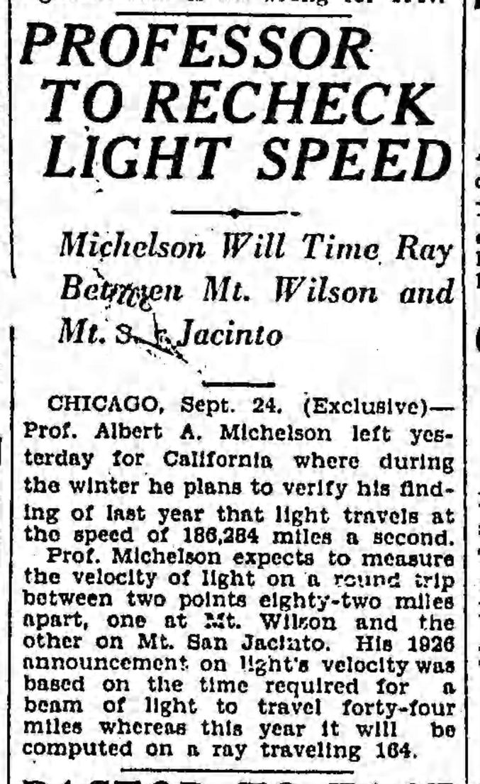
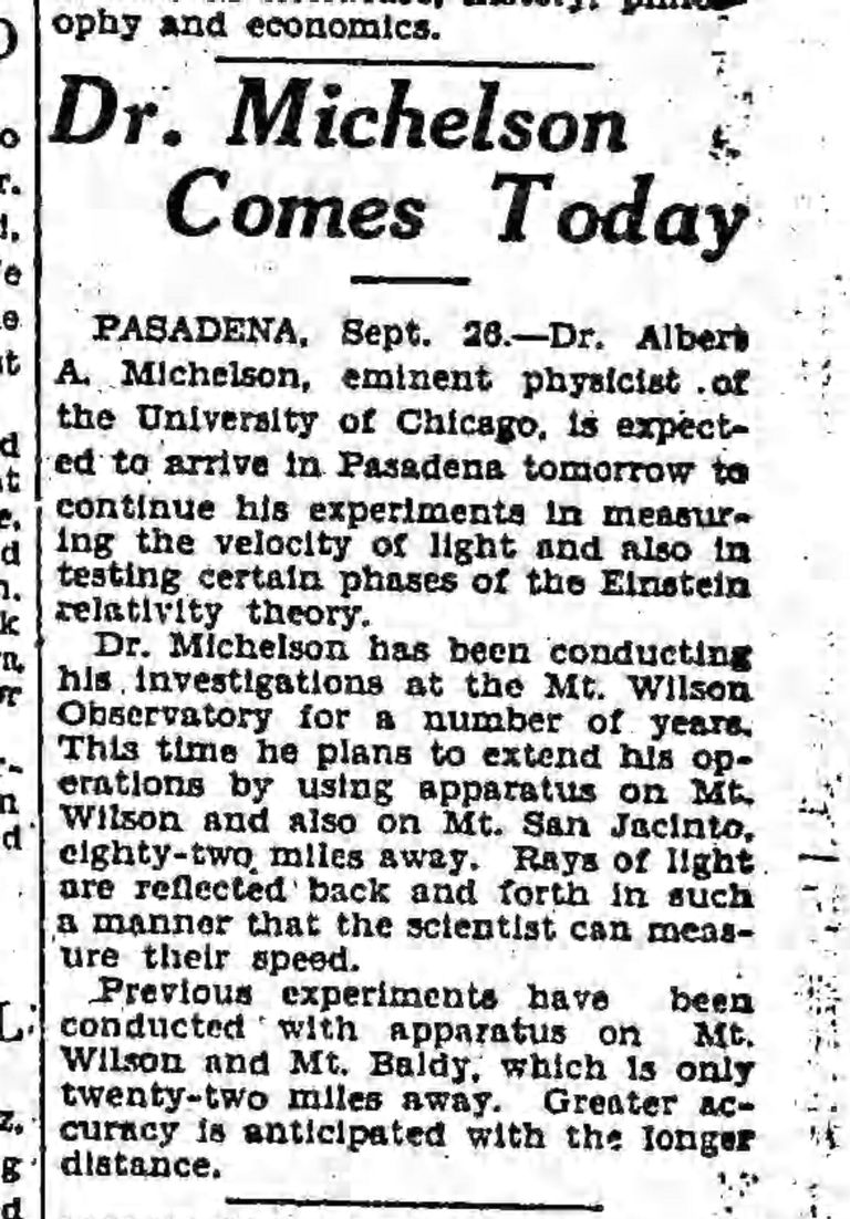
Sept 27, 1927 Michelson arrives in Pasadena to work on San Jacinto test.
Sept 28, 1927 Michelson expects to complete San Jacinto work within the next two months.
Oct 16, 1927 Detailed overview of San Jacinto project suggesting some baseline measuring has already been done, Part 1. Part 2.

Layout of the two mirror houses constructed near Pine Cove to house the return mirrors for Michelson’s measurements.
The site today
This is the easiest of the Michelson sites to visit. It’s 0.4 miles from Highway 243 on Pine Cove Road, at the corner of Chickadee Lane ( 33.759135° N, 116.744793° W). It’s been marked with a plaque since 1969. Note that the rear pier appears to be on private property (i.e., someone’s backyard), but it’s not fenced or posted against trespassing. Just don’t be stupid.

Main pier and plaque at San Jacinto site (T. Mahood)
The Riverside County Historical Commission first placed a plaque here in 1969, and it was replaced by this fancy-dancy version in 1989 by the Clampers.

The plaque at the San Jacinto site (T. Mahood)
There is a rear pier at this site, about 50 feet back from the main pier. It lines up with Mount Wilson and was the base for the 40″ return mirror.

Rear pier at San Jacinto site (T. Mahood)

Looking from rear pier toward main pier in Mt Wilson direction (T. Mahood)
Things look rather different here today versus 1926. The trees have regrown such that Mount Wilson is no longer visible.

Looking toward Mount Wilson from main pier – San Jacinto Site (T. Mahood)
Back to Historic Speed of Light measurements in Southern California