Date: 12/11/2012
Participants: Tom Mahood
General search area: Multiple areas from Park Road southwesterly to the northerly slopes of the freestanding hill northerly of Samuelson’s Rocks.
Rationale for searching this area:
This was something of a continuation of JT42, filling in gaps along the Serin cell tower 10.6 mile radius from Park Road towards the mouth of Smith Water Canyon. I also wanted to do a final check of the free standing hill northerly of Samuelson’s Rocks. I had been around it and on top of it, but never along the middle of its northerly slopes, which receive a strong signal from the Serin Drive cell tower.
Impressions of area and findings:
Travelling cross country between Park Road and the hill/Samuelson Rocks area, I was struck by the number of footprints I came across. Apparently this area gets considerable hiker traffic in the cooler times of year. I also noted that many shrubs, like the Acacias, lose their foliage in Winter, eliminating hiding places. What in Spring and Summer might be a field of shrubs blocking the view to the ground in Winter is bare and clear.
Coverage level:
As I stated in JT42, the area between Park Road and the Quail Spring/Smith Water/Samuelson’s Rocks vicinity has been saturated by not only searchers but by casual cross country hikers.
Comments:
At one point in my travels I reached the northerly summit of the free standing hill northerly of Samuelson’s Rocks. Looking southwest I could see the rugged slopes of Quail Mountain. Looking due west, I could see right into the month of Smith Water Canyon. Toward the north, Quail Wash flowed down toward the homes just beyond the limits of Joshua Tree National Park. I was looking at the entire playing field. I sat for a while, scanned the area with binoculars and thought about things. Knowing where we had been, where the original searchers had been and what we now know the cell phone ping means, I started to develop some new ideas for the next phase in searching. And one way or another, I suspect it will be the final phase. We’ll either find Bill or he’s not findable.

GPS tracks for JT43 in blue. The black lines are searcher’s tracks from the original search and the red lines are our tracks since. The orange radius is the 10.6 mile distance from the Serin Drive cell tower.
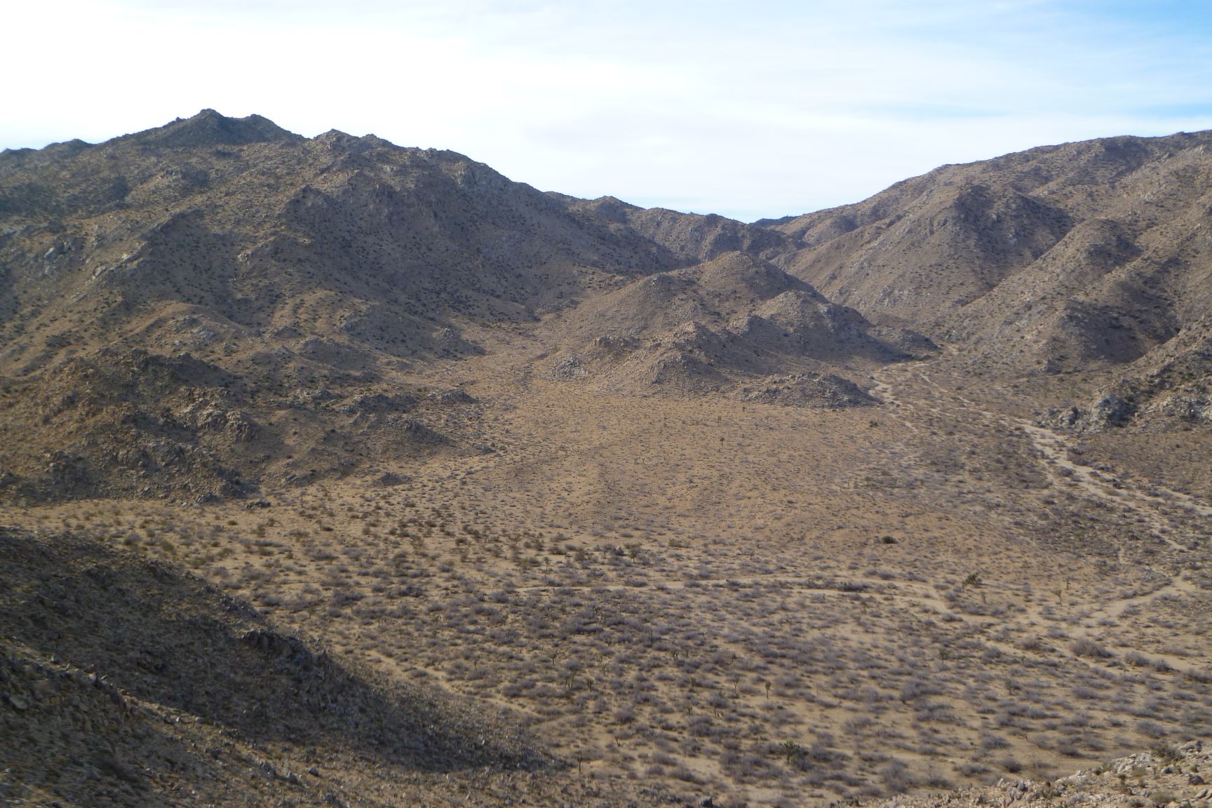
Looking westerly into the mouth of Smith Water canyon. The canyon itself is on the right. The area to the left is the bowl explored in JT42.

A closer look at the bowl on the southerly slopes of the mouth of Smith Water Canyon, explored in JT42. There is an area of Serin tower cell coverage at the rocky peaks on the upper left.
GPS mileage for this trip: 7.0 miles
Cumulative GPS mileage to date: 578.2 miles
GPS tracks for this trip in Google Earth kml format
GPS tracks for this trip in Garmin gdb format