Date: 2/9-10/2013
Participants: We have a couple of easily seduced guest searchers this time, Myth of the Mt. San Jacinto Forum and saint-like spouse (I believe “saint-like” is a euphemism for ever suffering).
General search area: The area between Quail Mountain and the mouth of Smith Water Canyon and also the southerly slopes of the mouth of Smith Water Canyon and the adjacent southerly canyon rim.
Rationale for searching this area:
Explained in way too much detail here: Current Bill Ewasko thoughts, January 2013.
Impressions of area and findings:
See Myth’s full trip report and some photos here for details
Coverage level:
See Myth’s full trip report and some photos here for details
Comments:
It always feels good when I can talk someone else into searching out there so I don’t have to do it! This was a really ambitious route (i.e., pretty crazy) and covered a lot of area sane people wouldn’t and shouldn’t.
Seriously this sort of thing is precisely why I went to the effort of posting all the data and GPS tracks online. The more people looking around out there (who know what they are doing!), the sooner Bill will be found.
My thanks to Myth and spouse for the effort. Hopefully you have learned any lessons from this adventure and can be conned into more pointless efforts..
Note: Although this was an overnight trip I combined the two daily GPS tracks into one single track for ease.
GPS mileage for this trip: 17.5 miles
Cumulative GPS mileage to date: 641.9 miles
GPS tracks for this trip in Google Earth kml format
GPS tracks for this trip in Garmin gdb format
GPS tracks for this trip in gpx format

This is the entire route done over two days. Camping was in a canyon between Quail Mountain and Smith Water Canyon.
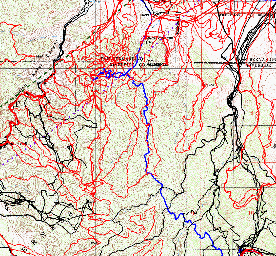
A more detailed view of the JT46 route between Quail Mountain and Smith Water Canyon. JT46 is in blue, the Serin cell tower 10.6 mile radius in a green dash and the Serin 11.1 mile radius in a purplish dot. Yeah, I know, it’s a busy map.
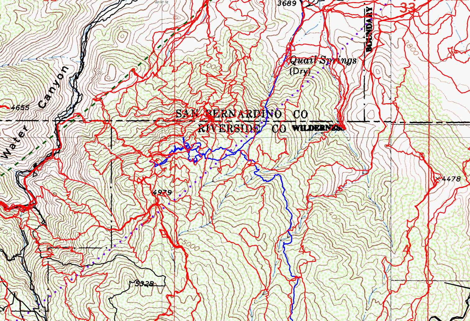
A closeup of the southeast Smith Water area. JT46 is in blue, the Serin cell tower 10.6 mile radius in a green dash and the Serin 11.1 mile radius in a purplish dot.