Date: January 28, 2015
Participant: Tom Mahood
General search area: The mouth of Smith Water Canyon and adjacent Quail Wash area.
Rationale for search:
The ground search coverage of Smith Water Canyon, has over time been rather….thorough. There are very few places left to be searched. The mouth of Smith Water, where it intersects with Quail Wash, still had a few secluded, unsearched spots, and it’s right on the 10.6 mile radius. So the search plan for JT75 passed through all the remaining gaps in coverage regardless of whether they made sense. Just plain ol’ brute force.
Impressions of area and findings:
It was refreshing to search through an area that wasn’t treacherous. It was, dare I say, almost pleasant! I need to do more of this. It was definitely worth the trip as I found there were many hidden areas at the base of the southerly slopes of Smith Water that we never made it through. Despite quite a number of previous trips into that area, this time I found a mining prospect (didn’t know anyone tried that there) and two Big Horn Sheep skeletons. So there remained unsearched spots.
Coverage level:
I think the mouth of Smith Water (and almost all the remaining part of the canyon), have now been searched to a level that’s “beyond a reasonable doubt”, as they say in TV courtroom dramas. For this particular effort I thought my coverage was very good, perhaps better than 80%.
Comments:
During the first part of this hike my route took me along the side slope of the hills on the easterly side of Quail Wash, immediately opposite the mouth of Smith Water Canyon. The reason for such an apparently stupid route is that this area is at the 10.6 mile radius, and there is Serin cell coverage on the upper slopes of these hills. So it made some sense to run a course through there. I’m willing to entertain the idea that Bill may have climbed a slope in an effort to get a cell signal…..maybe. I did note the slopes are fairly open and from my line could see clearly down the slope to its bottom at the edge of Quail Wash. So everything from slightly above my side slope path to all the way down at the toe of the slope has been cleared.
As can be seen from the picture of the cumulative search tracks below, this area has been saturated. What few coverage voids remained in the canyon mouth I cleared on this hike. I don’t think I’m missing anything as I came across two Big Horn Sheep skeletons and was able to easily spot them some distance away. This area of Joshua Tree is very pristine and anything that isn’t a plant or rocks really jumps out at you.
GPS Mileage for this trip: 9.0 miles.
Cumulative GPS mileage to date: 843.4 miles
GPS tracks for this trip in Google Earth kml format
GPS tracks for this trip in Garmin gdb format
GPS tracks for this trip in gpx format
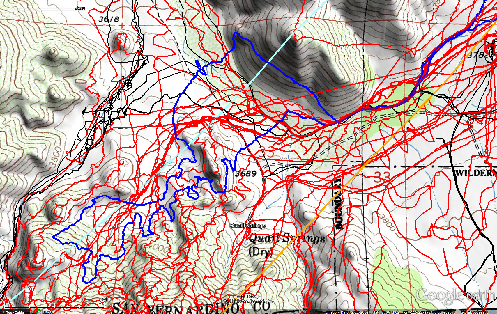
JT75 GPS tracks are shown in dark blue. Tracks from the original search are shown in black and searches since then are shown in red. The light blue line is the 10.6 mile radius from the Serin Drive cell tower and the orange line is the 11.1 mile radius.
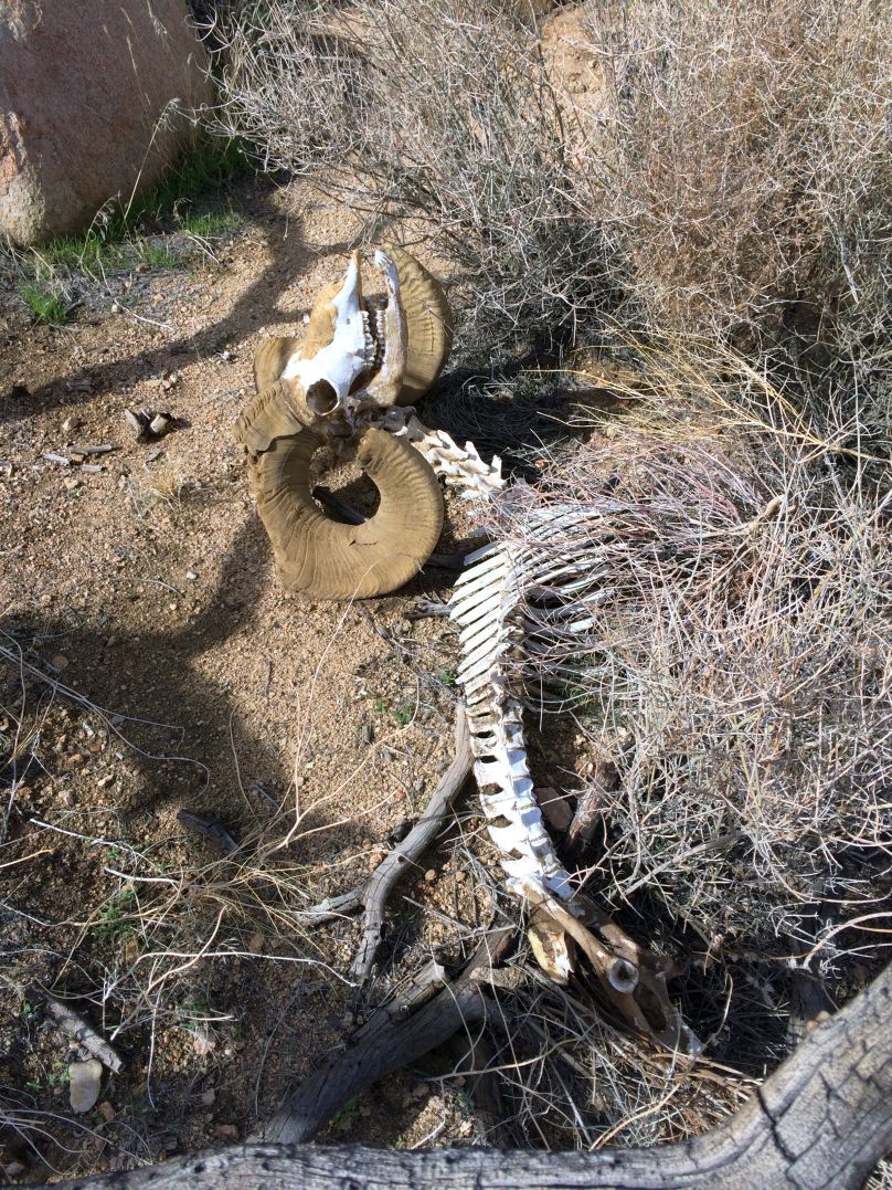
Yet another Big Horn Sheep skeleton. At least I’m finding something.