Writeup and pictures by Adam Marsland
Date: February 4, 2016
Participant: Adam Marsland
General Search Area: Traversing the highlands on the north side of Smith Water Canyon.
Rationale for Search:
Assessing the terrain on the north side of Smith Water Canyon, which is the largest unsearched area within, and proximate to, the 10.6 mile radius.
Impressions of Area and Findings:
A semi-level, fairly easily traversed high ground surrounded by and interspersed with rougher, boulder strewn terrain that falls away towards the canyons below, ranging from mild to precipitous.
Coverage level:
Not particularly good. The level areas were fairly easy to suss out, but boulders rule the rest of the world around here, and searching every one of them would probably take weeks. Fortunately, it’s highly unlikely Bill would have found traversing them any more palatable than I did.
Comments:
Well, independently of one another, Tom and I both decided to revisit JTNP after a long time away this week, though Tom’s was, as usual, by far the more productive effort. The reason for each of us taking such a long break was I suspect pretty much the same: nowhere left to look.
For me, about a year ago I reached the conclusion that the ping made the most sense if it was a staged event. As tin foil hat as that may seem, it’s the answer that seemed to fit the facts the best. All it would require is someone in possession of Bill’s phone and Verizon’s cell map (available online) to get up before dawn, drive down to the Upper Covington Flat area, hike to the western edge of the flat, wave the phone around until it hit a hot spot and texts and voice mails came in, and leave. I think it’s significant that the ping happened at dawn on the first full day of searching. The cell ping – and possibly the mysterious lights observed the previous night – would serve as false clues to indicate that Bill was still out in a remote area, and deflect attention from, among other things, the hinky business with Bill’s car. Who might have done this and why is not something I am going to speculate on. But unlike every other theory I’ve had in this case, this one has stuck for a year and I’ve had nothing really change my mind about it.
However…lately there’s been a lot of (in my opinion, overblown) hype about missing persons in national parks – I’m a bit amazed the folks who are publicizing these incidents haven’t discovered Bill yet, though I suppose it’s only a matter of time – and one recurring theme is that lost hikers are very often found in places that seem to make absolutely no sense. So there’s some precedence for the idea that a guy in Bill’s situation could wind up just about anywhere.
Which still doesn’t give us very good places to look, given that the most recent information indicates that Bill’s ping took place on the 10.6 mile line or closer – not further. If so, that almost completely wipes out the south side of Smith Water for consideration, and leaves us with almost no credible spots to search. Or does it? A new idea (or a new take on an old idea), inspired by one of the San Jacinto board members, started to take hold last week.
Johnny Lang Canyon got a lot of attention in the search early on, and rightly so – if Bill got into trouble on Quail Mountain – say attempting a loop back to his car but taking a wrong directional turn down a wash (all too easy to relate to — er, visualize) and then becoming injured, topography (and a search for water?) would then take him to Johnnie Lang and from there likely north towards Quail Spring and Wash. Verizon’s map claims there is reception in this area, but based on my own experience with their map vs. reality and Tom’s reports from Johnny Lang, I highly doubt there’s much. The one place along that route there IS reception – solid reception – is at Quail Wash, near the Smith Water Canyon mouth, bang on the 10.6 mile line.
None of this is news, and it hasn’t been deemed very important because the Quail Wash area was swarming with searchers a few hours after the ping, and also because arriving at Quail Wash one would expect Bill would know where to walk out. But…that’s assuming he’d commanded high ground at one point so he could orient himself and see that Quail Wash led to Joshua Tree (and/or observe Park Road). If he’d been rattling around in canyons for a few days, he might not have known upon arriving at the mouth of Smith Water exactly where he was – and thus not followed the obvious escape routes north or east.
Which leads us to the largely unsearched north side of Smith Water Canyon – unsearched because there seemed no earthly reason for Bill to be there, given the sides are so steep and it’s on the way to nowhere. However, the climb up appears to be a bit gentler in this particular area. If Bill arrived at Quail Spring Sunday morning and didn’t realize where he was, he could have left the wash to seek high ground, both to orient and possibly to attract the attention of the helicopter that would have been in the air over Quail Mountain about four hours after the ping went off.
This scenario both explains how Bill could have been kicking around in a relatively small area for three days without getting a call out (this has really bothered me) and opens up all of the north side of Smith Water Canyon, and the mountains between lying between the north end of Quail Wash and Park Road, as possible places Bill might have gone. I suspect Tom’s thinking has moved in the same direction, based on his search last week. The one part of this scenario that is odd is that Bill would have lit up his phone in Quail Wash – because if he wasn’t out of batteries at that point, reception there is reliable enough that he should have simply been able to phone the rangers and get help.
Anyway, I justify this long winded theorizing on my report because in terms of actually contributing to the search, my trip across the highlands north of Smith Water Canyon came up with bupkus. The only sign of anything human I saw was a tiny shred of a balloon.
My entry point to the north side of SWC – from Lower Covington Road one mile north of the LC trailhead – was the easiest I have found thus far, with only one moderately difficult traverse. I was able to make my way, slowly, east through the area without too many problems. There are lots and lots of boulders in this area — too many to search, so I stuck with keeping my eyes open and getting a sense of the landscape.
Once I had navigated to my easternmost point, where the land began to fall away towards the mouth of Smith Water and I could note the terrain, I observed a few things. One is there is strong cell reception at this point (and nowhere else on today’s path). This would be around 9.8 miles from Serin, probably too close to be significant, but it’s noteworthy in that Verizon’s splash map has this whole area as covered, and it’s not.
Another is that there were a few washes descending from this area towards the SWC mouth, and they seemed pretty navigable from here. I don’t doubt it’s a different story further down, though. But the climb up from below did seem, if not great, then at least feasible from this vantage, though it was a hell of a long way up from Quail Wash to where I was. Areas further down would seem to be a more likely place to look for Bill. That said, this entire area did not get searched at all as far as I know. If Bill did find his way to the north side of SWC, he could conceivably have wandered almost anywhere, and for quite some time. It’s probably time to head to Quail Wash and see, from that vantage point, what might attract Bill to head for high ground.
Anyhoo, I made my way back to the car following a more southern route, recognizing a few areas from previous searches, and got treated to some beautiful sunset light on the rocks. And as for the search, that’s about it. I know the area much better now, at least. Oh, and I banged my bad knee on a rock. Ouch. If you want to follow along and see if you see anything, I posted a video of the trip here: https://youtu.be/YR0UMgySeg8
If I’m wrong about Bill’s ping being staged, then the possibility of him pinging at Quail Wash and then leaving the wash at some point north of the SWC mouth to find high ground, does seem to mostly fit the facts and more importantly, offers up a vast new area north to search. I suspect that might be where Tom’s casting his eyes, too. Could get interesting.
GPS Mileage for this trip: 4.5 miles
Cumulative GPS mileage to date: 878.2 miles
GPS tracks for this trip in Google Earth kml format
GPS tracks for this trip in Garmin gdb format
GPS tracks for this trip in gpx format
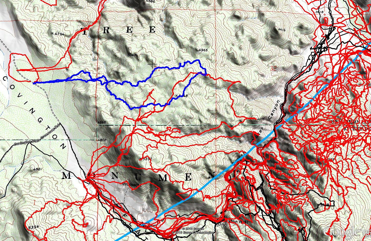
JT81 GPS tracks are shown in dark blue. Tracks from the original search are shown in black and searches since then are shown in red. The light blue line is the 10.6 mile radius from the Serin Drive cell tower.

Crude map showing route from Johnny Lang to Quail Wash cell reception area, and possible routes of travel out of Quail Wash into mostly unsearched areas.
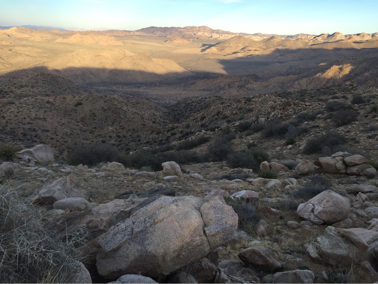
Looking southeast at the terrain towards the mouth of Smith Water Canyon (at the middle right, between the green and brown ridgelines).
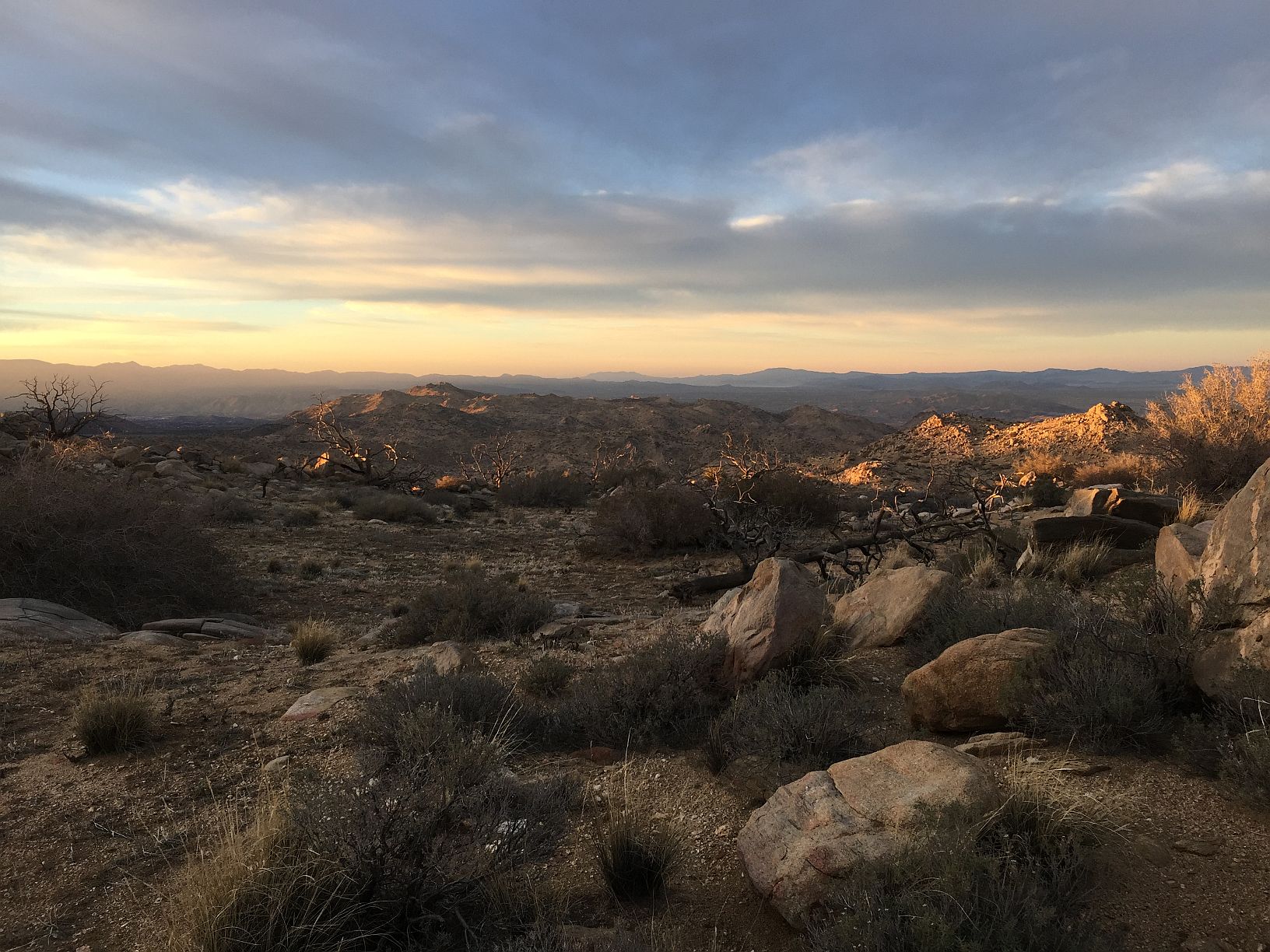
Gorgeous sunset lighting against the rocks in the highlands north of Smith Water Canyon.