Date: February 8, 2017
Participants: Tom Mahood
General Search Area:
The mouth of Smith Water Canyon along both the 10.5 and 10.6 mile Serin cell tower radius (Inbound on the 10.5 line and outbound on the 10.6 line).
Rationale for Search:
At this point in the game I’m flat out of ideas and have been so for some time. Given my belief that the 10.6 mile distance from the Serin Drive cell tower is likely accurate (explained below in the Comments section) I thought it could be worthwhile (and mindless) to simply walk along the 10.6 mile radius line and have a look around.
Impressions of Area and Findings:
While much of the area was flat and fully explored previously, the radii lines included some promising zones. It was very difficult and strenuous to hold a relatively straight path while traveling up and down over irregular terrain. I did come across several nooks that could have served as shelter but were not previously found on earlier searches.
Coverage level:
Very good along the two radii lines, however there are likely some areas at the 10.55 mile radius that were not visible. With the exception of these rather small, unlikely areas, the zone between the two radii has been cleared.
Comments:
I’ve explained this before, but maybe I can expand a bit more on why I think the 10.6 mile radius is an outer limit….
My understanding of the system Verizon uses at the Serin Drive tower is that the tower sends out a ping to a phone at 186,000 miles/sec (or thereabouts), the phone takes a very small amount of time to process it, then sends a response back to the tower, also at 186,000 miles/sec. Now the tower knows how long the phone should take to process and respond, then adds that time to the round trip pulse travel time and then calculates a distance, in this case 10.6 miles assuming everything works perfectly.
But what if it doesn’t work perfectly? Really the only way for this setup to “fail” would be for the returned pulse to take longer than it should (The speed of light is a maximum so the pulse can’t get back earlier than it should, only later). This could be due to the phone responding slower or perhaps the signal gets reflected off a rock face. In both cases because of the greater pulse travel time the tower will compute a distance to the phone that is GREATER than the phone’s real distance to the tower. So if the Serin tower measured a distance of 10.6 miles to Bill’s phone, the actual distance could possibly be as low as 10 miles, but really can’t be 11 miles. My gut feeling is the actual distance is going to be between 10.6 and 10.5 miles, but maybe as close in as 10.4 miles.
So, lacking any better ideas I thought it might be a simple and easy thing to just walk the radii paths, outbound on the 10.5 mile line and the return on the 10.6 mile line. I selected the most easterly portions, thinking if that worked I might have a stab at doing something similar in the middle Smith Water Canyon area, with its much more rugged terrain.
This approach turned out to be a lot more difficult than I anticipated. First, holding to a straight path over terrain with ravines running essentially at right angles to travel is a real pain in the ass. Secondly, and maybe more important, is that following the precise planned route and dealing with awkward terrain took so much attention that I wasn’t looking around as much as I should. When you’re planning where to put each foot it’s easy to miss things nearby.
I do have in mind perhaps repeating this effort in the next segment of Smith Water to the west but may wait until I’m in better condition for an adventure of that magnitude. This “easy” one kicked my butt. Also I can’t see any way a phone ping could have escaped from this central region of Smith Water and give a distance of 10.6 miles. But hey, I got no other ideas….
GPS Mileage for this trip: 8.1 miles
Cumulative GPS mileage to date: 920.1 miles
GPS tracks for this trip in Google Earth kml format
GPS tracks for this trip in Garmin gdb format
GPS tracks for this trip in gpx format
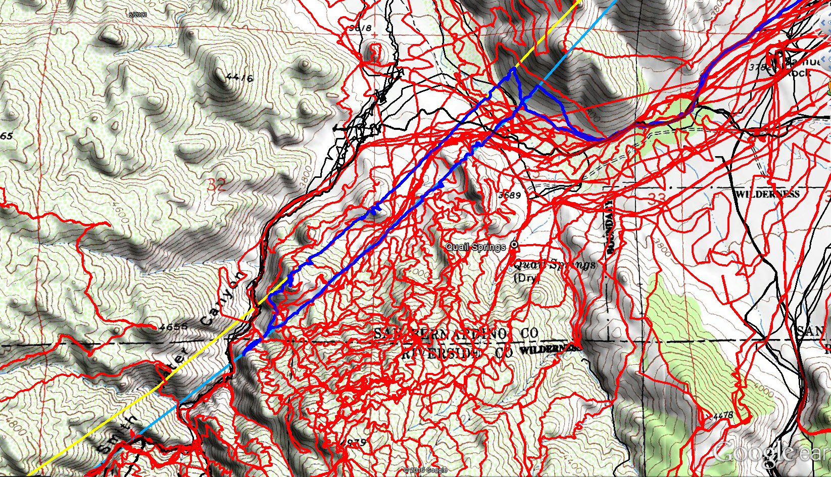
JT86 GPS tracks are shown in dark blue. Tracks from the original search are shown in black and searches since then are shown in red. The light blue line is the 10.6 mile radius from the Serin Drive cell tower and the yellow line is the 10.5 mile radius.
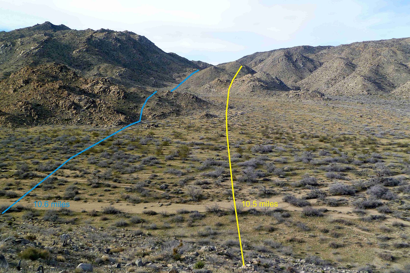
Looking westerly along the path of the two radii I investigated on JT86. I actually went beyond the far hills where the lines disappear.
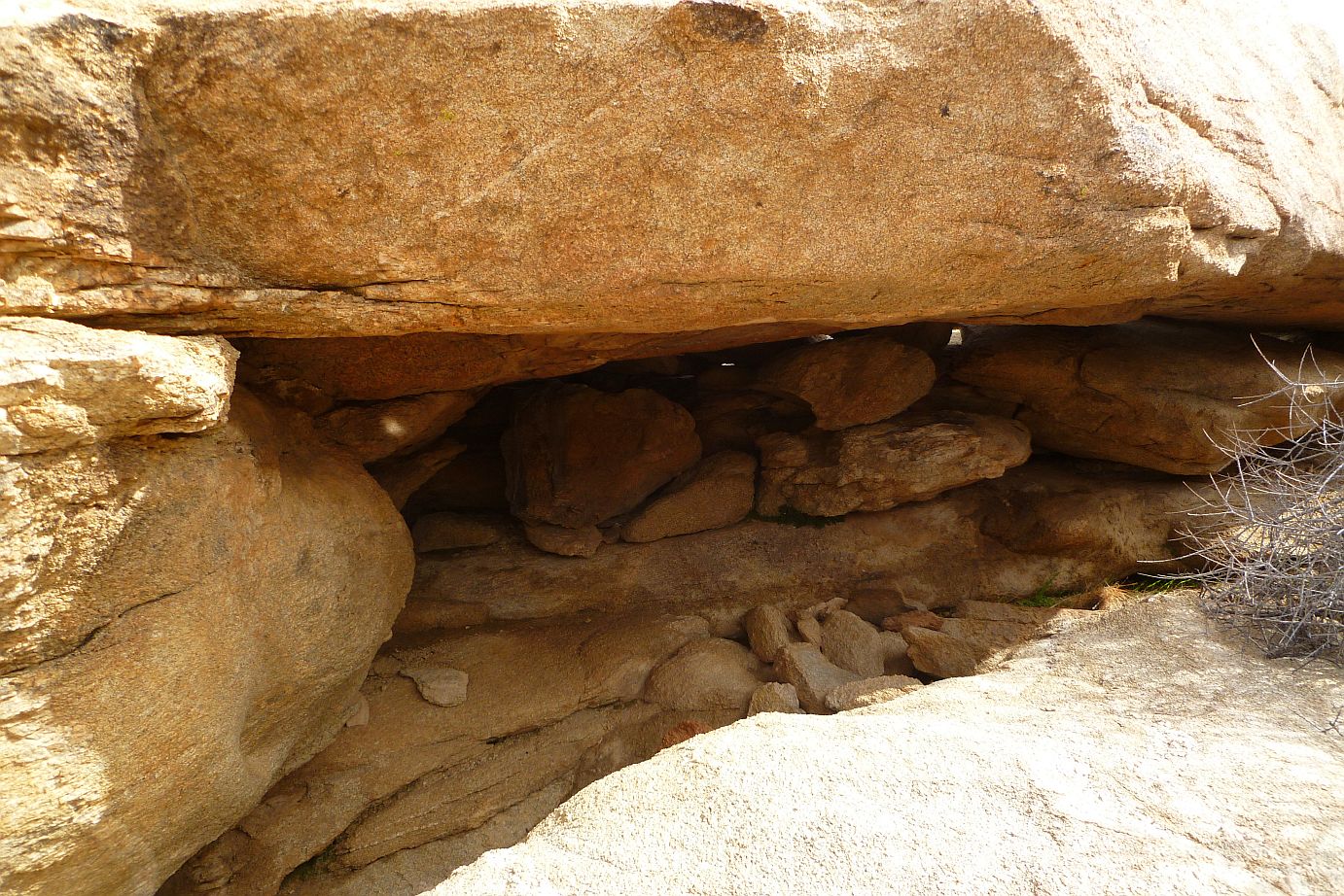
I came across several of these very inviting shelters that could hide an individual very well.
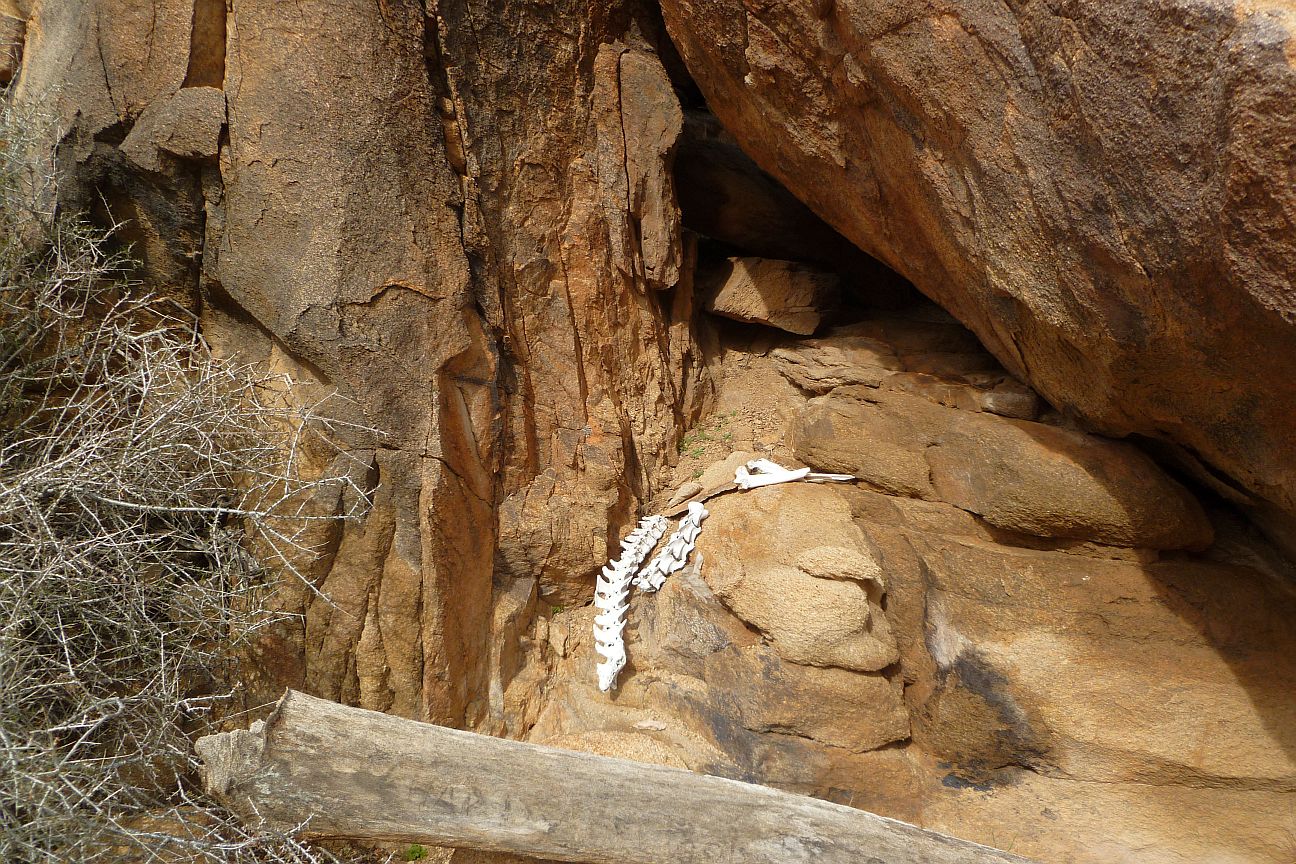
I spotted these bighorn or deer bones from quite some distance away so I am able to spot stuff.

Looking westerly in Smith Water Canyon toward the easterly grove of Acacias. I have previously speculated that Bill may have attempted to climb the canyon sides after reaching this point to attempt to acquire a cell signal.