Writeup and photos by Adam Marsland
Date: April 4, 2017
Participants: Adam Marsland, Geoff Manaugh
General Search Area: East Side of Quail Wash north of Smith Water Canyon, and some rocky hillsides on the north side of Smith Water Canyon
Rationale for Search: Looking for Places that Bill might have sheltered and then expired after pinged the tower from Quail Wash.
Impressions of Area and Findings: Well, it sure was a nice day. Nothin’ we ain’t all seen before otherwise.
Coverage level: Good.
Comments:
Well, when I was last out here roughly six months ago, I was following up a new idea that was reasonably plausible: that Bill had expired after pinging the tower in Quail Wash near the mouth of Smith Water, and then continued north up the wash towards Joshua Tree Village, at some point leaving to find shelter and then passing away there (the reasons we didn’t look at this area more closely earlier are summed up in prior reports). At that time, there remained one small area I hadn’t looked closely at, on the east side of the wash just north of a low pass that Tom came through on one of his early searches, and south of my last trip through the area.
I said I’d get around to taking a look at it one day, and I’m as good as my word, this time with a sturdy hiking enthusiast and journalist named Geoff Manaugh in tow. This is the best condition I’ve ever been in on any Joshua Tree excursion, and we gobbled up more than 11 miles of terrain without breaking much of a sweat. So that’s cool. Wish I could tell you something more relevant to the Bill mystery, but I sure can’t. My limited observations follow.
First, Bill wasn’t there. Big shock. While we might have missed him, I doubt it (small area and not much cover), and the most likely spots in the surrounding area have been looked at on previous searches. We gave a few of them one more look.

These are the kind of potential shelters we keep an eye out for (and there are a great many of them!)
Second, interestingly, a new trail has been routed through this area, just east of and parallel to Quail Wash. It’s called the Mary Trail and the trail signs are recent; they weren’t here my last visit. The new path obviated the need to look at some areas we were going to look at, since it passed right through. This I assume will bring more hikers into the area and perhaps one of them will solve this mystery, since I’m not having much luck at it.
Third, this is a big year for snakes. The internet reports that speckled rattlers live on rocky hillsides and have a nervous temperament, and rosy boas are extremely docile. I can now confirm both are true. I am glad of this, since did at least see the rattler before I bumped into it (it also saw me, and let me know it was unhappy). The boa not so much, but it didn’t care.
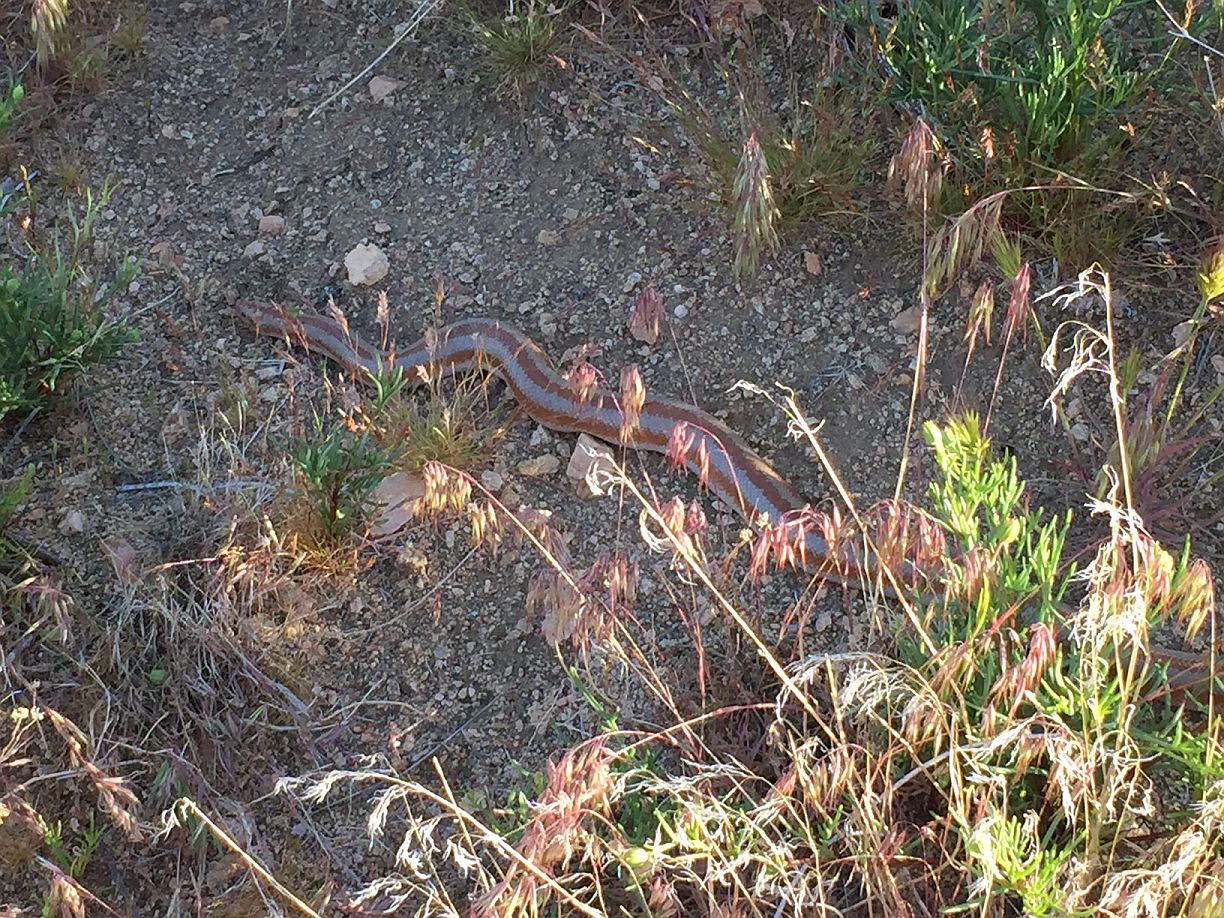
Ladies and gentlemen, the world’s most relaxed snake.
Fourth, after checking out Quail Wash we had a look at some of those ascents to the north side of Smith Water near the eastern mouth, which appear to be easier than the not-quite-vertical slopes that Tom’s been subtly trying to tempt me to explore near the acacia groves in the middle of the canyon. (Tom, like I said I’m really sorry about nearly getting you killed with that whole Upper Covington thing…) I can report that it is substantially easier to get up the north side over here, but past the first low hills it’s still fairly daunting. We didn’t try it because the sun was starting to fade (and because we really couldn’t convince ourselves that Bill would have gone any higher than where we were). We did, however, find a low area about two stories above the canyon that Bill could have conceivably reached and that would have made a nice place to hang out. We gave that a pretty close look. Nothing to see other than a nice view, reproduced below.
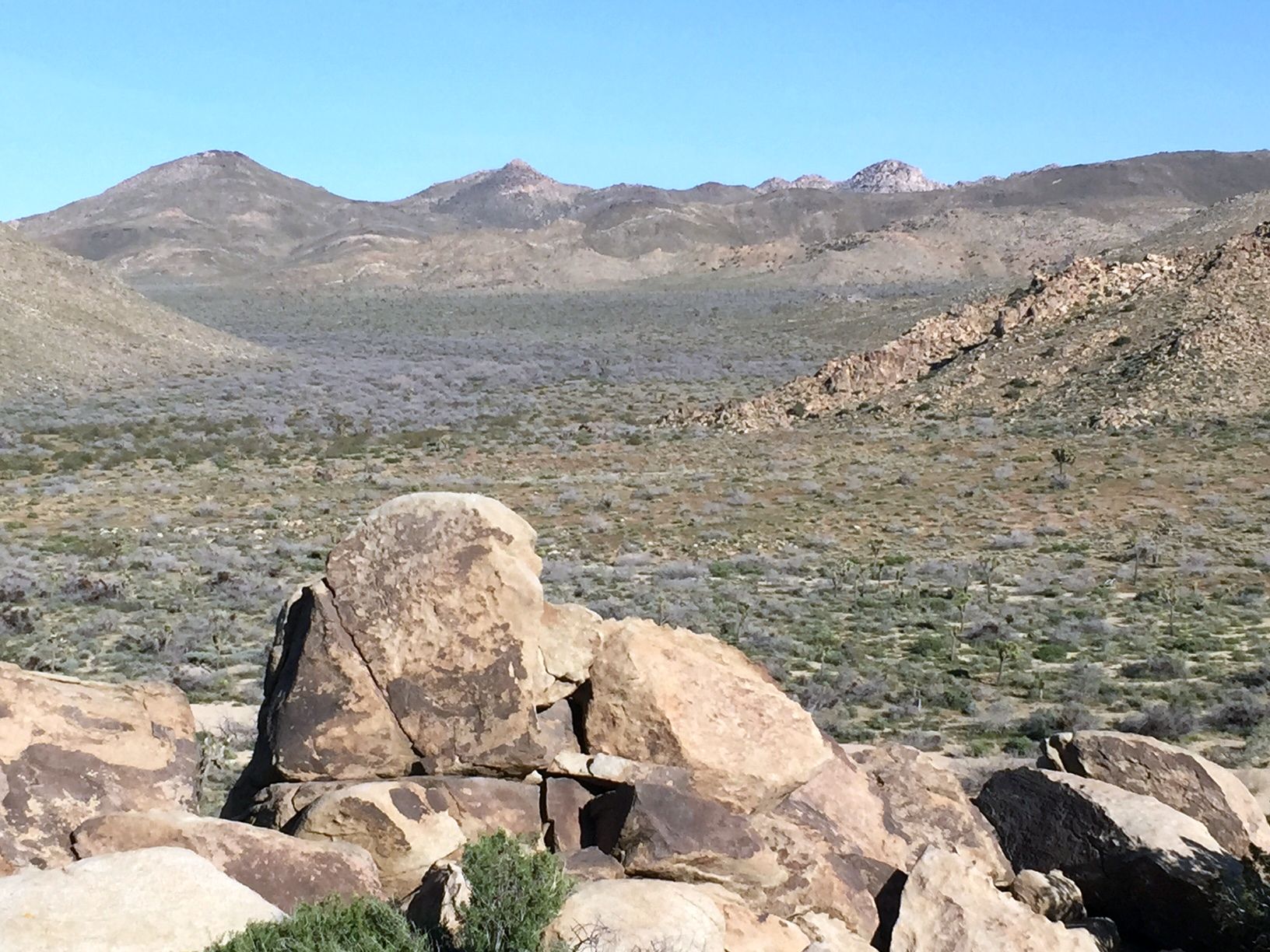
View of the Quail Wash area from the north side of the mouth of Smith Water Canyon looking northerly.
And that’s about it. I’m out of ideas. He might have pinged the phone near the mouth of the canyon, gone up the wash and once leaving it gone about anywhere north of there and not been found…except there’s no logical reason for him to have done so, and likewise going more than a little ways up the north side of Smith Water Canyon would seem beyond an impaired person’s capabilities.
At this point, I think Tom’s acacia grove theory is probably the best bet. I have no better ideas, and having exhausted this new theory I’m again leaning towards the idea that either Bill is not in JTNP at and the ping was a staged event to make us think otherwise, or that there’s some key fact that’s wrong or missing from our understanding of events. If he is indeed in the park, then your guess is as good as mine where he might be, because the whole dang thing don’t make no sense.
Thanks Geoff for a fun day, beautiful hiking weather and a good conversation.
GPS Mileage for this trip: 11.2 miles
Cumulative GPS mileage to date: 931.3 miles
GPS tracks for this trip in Google Earth kml format
GPS tracks for this trip in Garmin gdb format
GPS tracks for this trip in gpx format
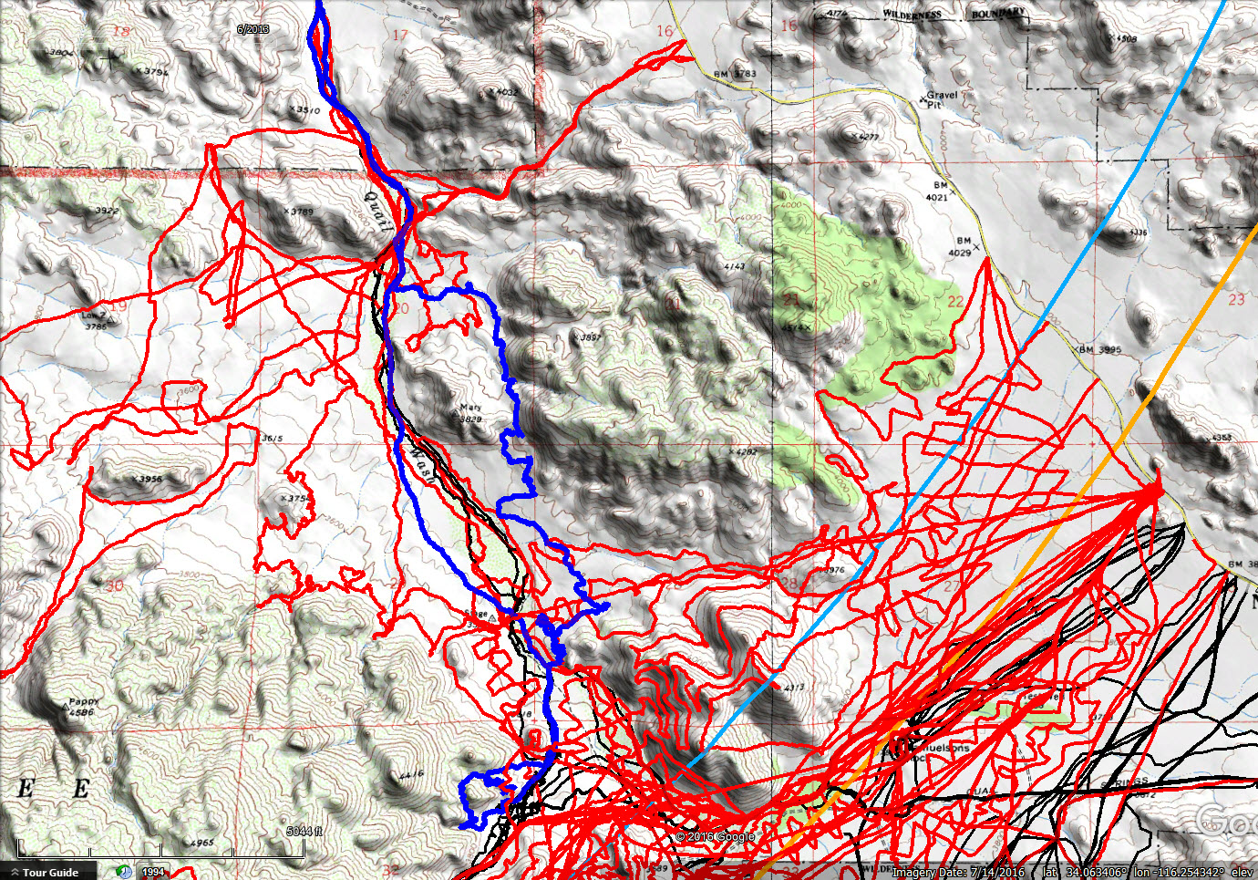
JT87 GPS tracks are shown in dark blue. Tracks from the original search are shown in black and searches since then are shown in red. The light blue line is the 10.6 mile radius from the Serin Drive cell tower.