Writeup and photos by Bret Lamb
Date: April 1, 2018
Participant: Bret Lamb
General Search Area: Major drainage southerly of Eureka Peak and westerly of Upper Covington Flats
Rationale for Search:
Trying to think outside of the box on this one. The geometry of this canyon is close to being a radial line on the 10.6 mile circle, with Serin Drive Tower being at the center. Perhaps this could have allowed for a cloud to have reflected a signal down into this area. Also this area is seldom, if ever, visited, not near a trail, and completely unexpected for Bill to be in. Check, check, and check. The only problem is there’s absolutely no reason for Bill to have ended up here. As Tom’s mentioned before, Bill would have to fight against the terrain to get here. That being said, this canyon has long been a pet theory of mine that I want to finally put to bed.
Impressions of Area and Findings:
My plan was to start into the canyon from the north so I could explore more terrain that was on the nearer side of the ping radius, and only go about a half mile past the ping radius since the margin of error for the ping’s distance is more generous on being nearer to Serin.
Hiking in this area you quickly understand why the topography is so extreme. The earth gives way under your feet on just about every step down these steep canyon walls. Driving my trekking poles into the ground to gain some purchase wasn’t very helpful either; the sand swallowing up about one foot of pole. Even the slabs of rock jutting out of the canyon walls that look like solid granite crumble into huge chunks with the slightest pressure. It was hard not to trigger multiple slides of water-like flows of sand and rock.
Steep and quite treacherous descent down into the canyon.
Once I got down to the bottom of the canyon the hiking got much easier, dare I say pleasant, and the scenery was actually quite beautiful. If it weren’t so difficult to get here I wouldn’t mind returning for a leisurely stroll. This area is also extremely isolated, which is quite nice, to my liking anyway. The only signs of humanity were an old prospectors food can and about 8 or 9 Mylar balloons strewn throughout the canyon.
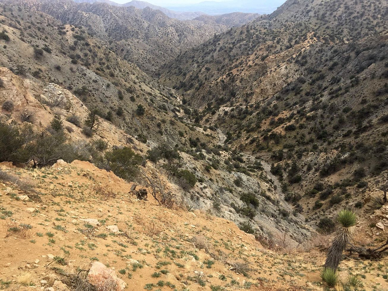
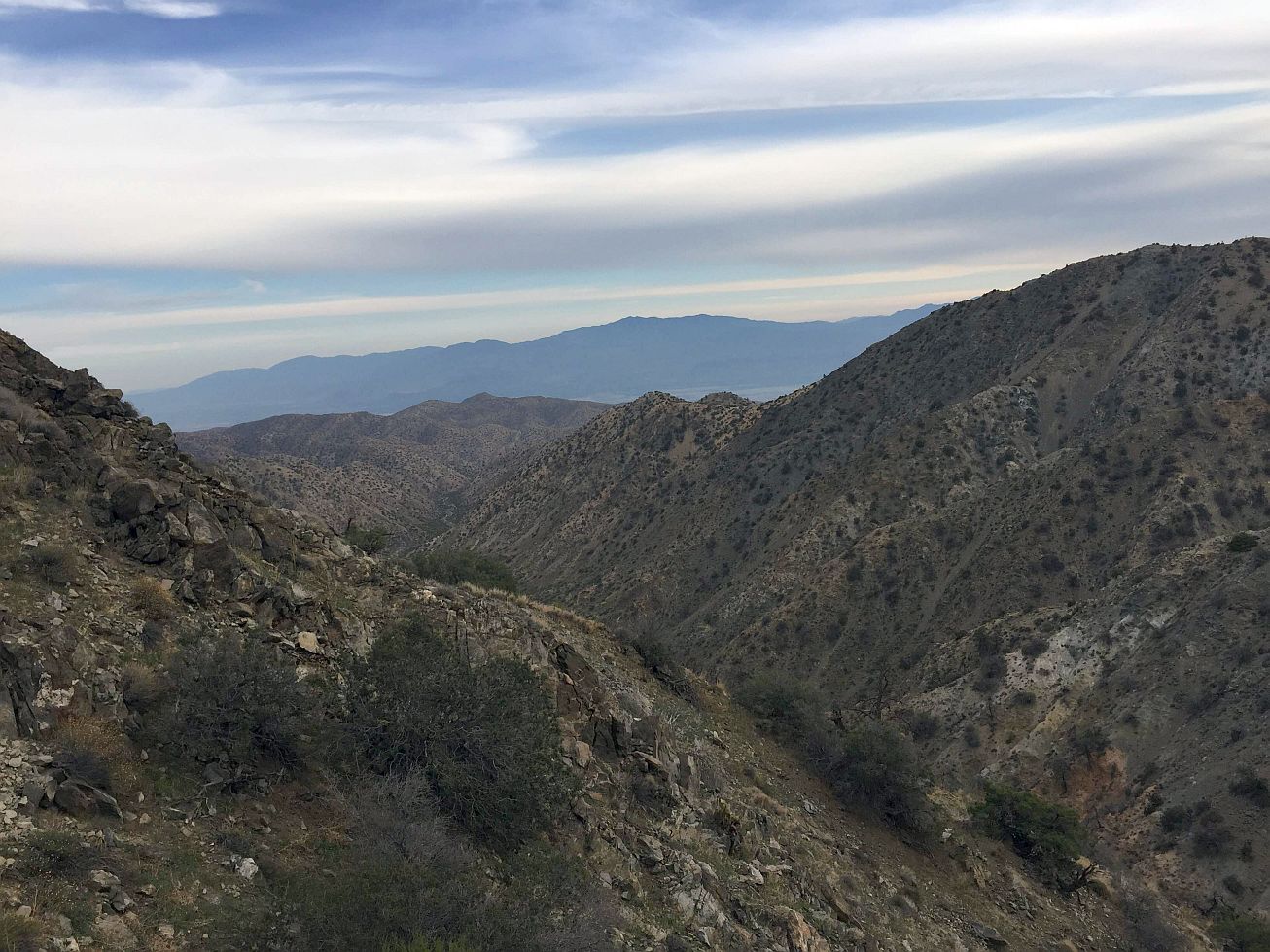
View from the main canyon bottom looking NNW. The saddle in the left third of the picture more or less lines up with Serin tower.
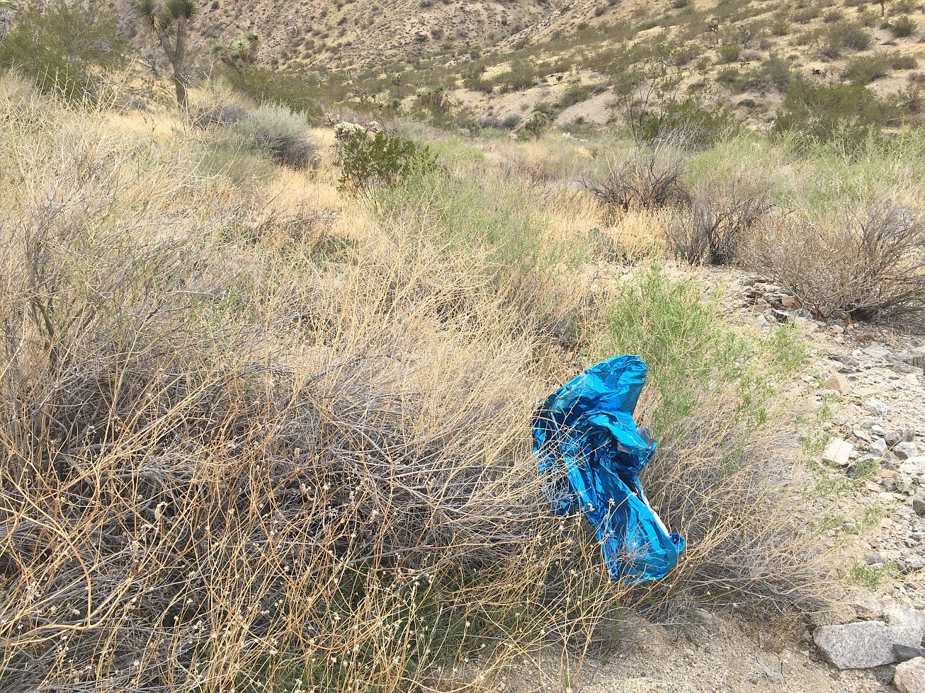
One of many mylar balloons collected on this hike.

Old food can.
I climbed up a small ridge that was just about on the 10.6 mile radius, and scoped out the area with some binoculars. I was able to scan the entire canyon floor from there. I spotted what looked like a bleached white bone propped up against a yucca. I trudged over to it, and found it was merely a dead leaf of the yucca that had turned white and was drooping.
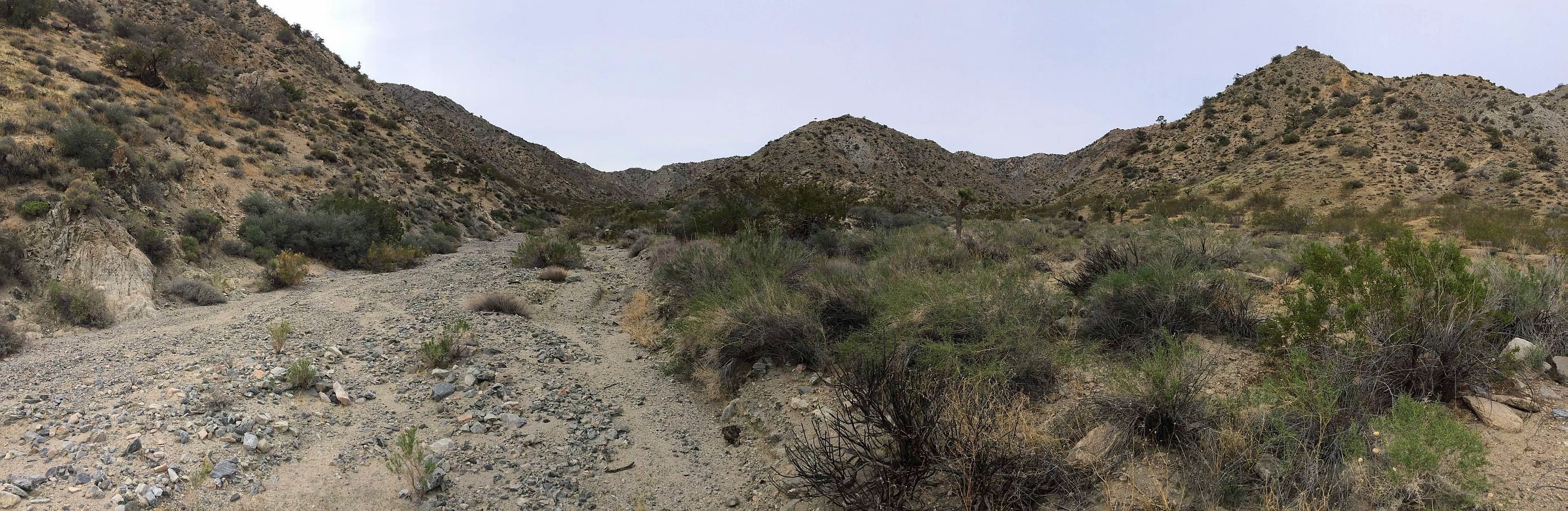
View from the top of a small hill on the Westerly side of the canyon around the 10.6 mile ping radius.
I continued up to and past the ping radius for half a mile, finding nothing. I turned around and on the way back decided to check out a couple of interesting looking side canyons.
My exit out of this area was much better than my entry. I gained a good amount of elevation via pretty gradual drainage that had one 10 foot dry fall thrown in to keep it interesting. Once the drainage dead ended I climbed up out of it onto a steep ridge, but being pretty well vegetated, the earth was much more stable to hike on.
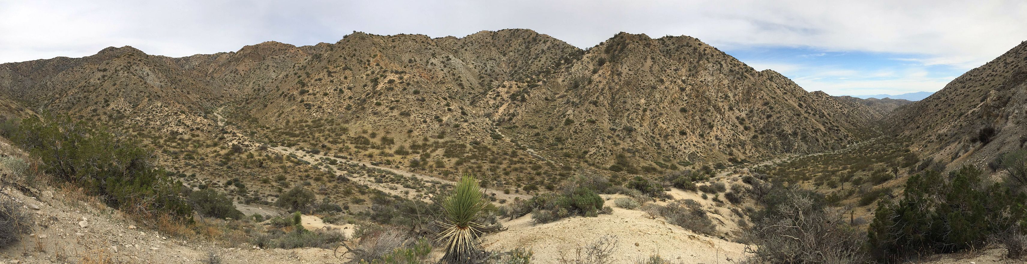
Found an easier way out. Still not easy, but easier. The main drainage continues off in the distance down to Desert Hot Springs.
Coverage level:
Very good. The canyon bottom is fairly narrow, so if there was something to be found down there, I would have seen it.
Comments:
This hike was very successful for me in that I can unequivocally put to bed my harebrained theory Bill could have ended up here. I think it’s safe to say that this is my first and last foray into this area of the park.
I’m currently leaning back to the idea that the Bill is somewhere between Smith Water Canyon and Quail Mountain and that maybe 10.6 miles should be taken with a grain of salt. There is still a lot of unsearched land (compared to SWC) in the hills NW of Quail Mountain, perhaps 11 to 13 miles from the Serin tower, that is also hard to get to, sees little traffic, is close to cell coverage areas, and a much more likely place for Bill to have ended up. Some of this unsearched area also includes some drainages where debris from Bill may have collected.
GPS Mileage for this trip: 7.2 miles
Cumulative GPS mileage to date: 987.9 miles
GPS tracks for this trip in Google Earth kml format
GPS tracks for this trip in Garmin gdb format
GPS tracks for this trip in gpx format

JT89 GPS tracks are shown in dark blue. Tracks from the original search are shown in black and searches since then are shown in red. The light blue line is the 10.6 mile radius from the Serin Drive cell tower, the yellow line the 10.0 mile radius and the orange line the 11.1 radius.