Date: November 7, 2018
Participants: Tom Mahood
General Search Area:
Areas of Serin tower cell phone coverage southeasterly of Quail Spring.
Rationale for Search:
This was a small area of Serin cell tower coverage that hadn’t been searched before. And I wanted to go on a hike.
Impressions of Area and Findings:
A fairly rocky area that likely gets little to no visitation. Unlikely to be on any sort of route Bill would have attempted as it provides no logical path in or out of the Quail Mountain topography.
Coverage Level:
In most cases, very good. I did a lot of traversing up and down slopes, and visibility downslope was excellent.
Comments:
Jeri had some business to attend to in SoCal and needed to fly out for a few days. I decided to tag along and maybe do a bit of wandering in Joshua Tree, as it’s been a while since I had been there. But flying meant I couldn’t bring my usual heavy boots or a hiking pole. That limited me to trail shoes and my wits for balance, usually not a good combo. With these constraints, I planned a route filling in a hole in the ground search coverage which also had an area of Serin cell tower coverage. I couldn’t come up with a plausible reason why Bill could have possibly ended up in this area, but no one had yet looked there and it was within my equipment-limited abilities. And I thought it’d be nice area to cruise through.
Driving into the park’s west entrance, I was surprised to see large areas of sand washed across the road, as well as the road inside the park. Turns out this was still remaining from a severe storm that hit the park on October 12, 2018 and hadn’t yet been fully cleared. There was also evidence of substantial water flows in all of the dry washes I crossed during the hike. Most surprising was the appearance of a carpet of new, green grass spread across the flat valley encompassing Samuelson’s Rocks. Didn’t the grass know it wasn’t Spring? In fact, this was a good thing for searching as the heavy water flows likely moved potential clues around and down washes.
As I traversed the valley towards Quail Spring, as I had done so many times before, I stumbled again upon one of the several old homesteads in the area. I had been past it before, but this time there was a carpet of new, green grass. A very pastoral look.

A homestead from the 1920s or 30s. My destination is the ridge directly behind it, and that’s the mouth of Smith Water Canyon just right of center.

This looks to be some sort of outdoor coking setup for the homestead. It’s too small to be any sort of smelter or reduction arrangement.
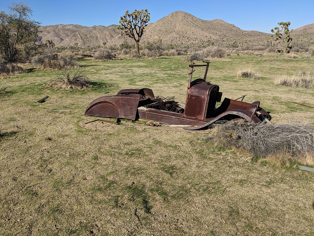
A car that’s been “parked” for quite some time at the homestead. The amount of new green grass growth is readily apparent. Looks strange for a desert in November.
Reaching the ridgeline, which was my initial target, climbing posed no serious difficulty for me, despite my equipment limitations. Still, I maintained a higher level of caution as one misstep could result in a pretty bad day.
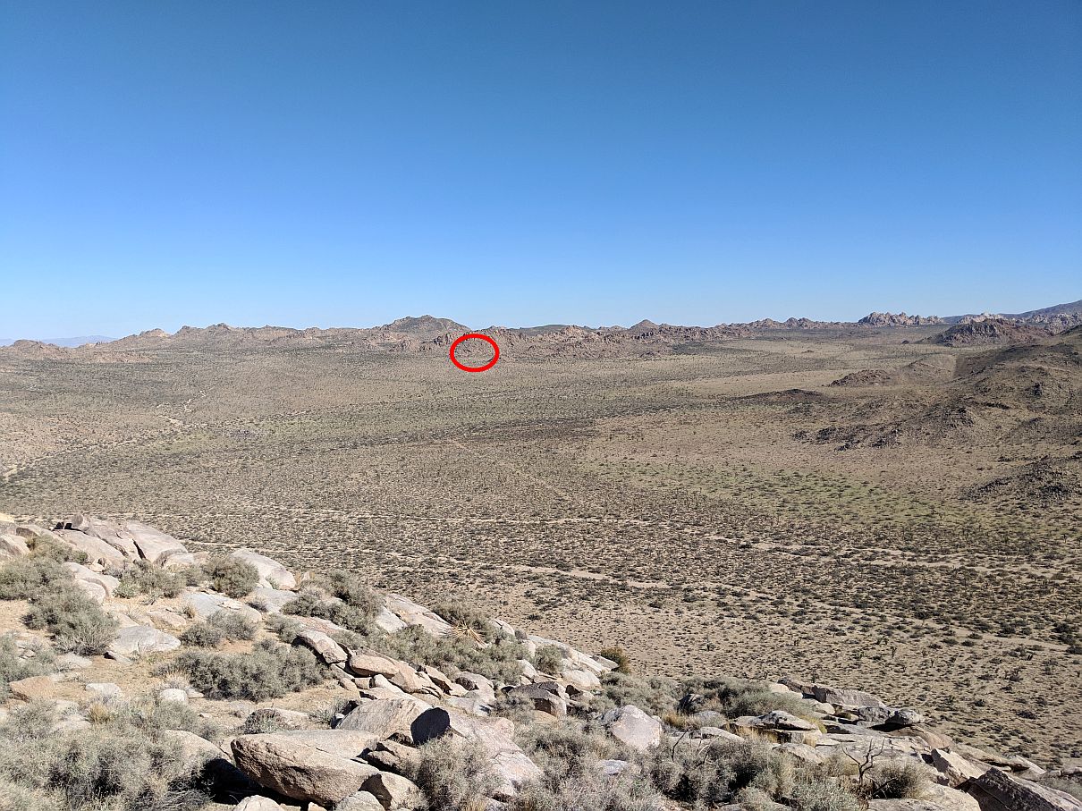
Having reached the top of the ridge, a look back at where I parked on Park Road, circled in red. That’s about 2.4 miles away, a nice stroll.
The terrain was interesting, and there were a number of potential hiding places to check. However the topography of the area made it unlikely Bill would have passed through the area. He would have had to descend into canyon I was about to drop into, then climb out of, for no obvious, good reason.
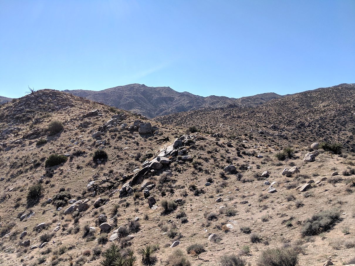
Also from the ridge crest, a look towards the southwest and Quail Mountain. This gives a sense of the ruggedness of that higher terrain.

Looking north up Quail Wash. Yucca Valley is visible in the distance, while a part of the Joshua Tree community may be seen closer, just right of center. The mouth of Smith Water Canyon is just left out of picture range, left of the small, rocky hill.
Having cleared the area of cell coverage, I dropped into the canyon and started up its westerly slopes. This unsearched area had more potential, since it could have been on a descent route from Quail Mountain, but no luck. I did come across an odd cairn that I examined a bit, but figured it was merely an old mineral claim marker. After that, I exited the canyon near Quail Spring and headed back to the vehicle.

An odd cairn I came across while descending into a ravine. Most mineral claim cairns I have seen consist of stacked rocks but not this. But it’s likely for a claim of some sort.
As a closing note I should point out that with this trip, the 91st one since I began keeping track years ago, the total recorded mileage of search tracks has now exceeded 1,000 miles. Damn, who woulda thought? In truth, there have been others searching who tracks I haven’t kept record of, so this sad milestone had already been met. As point of reference, the mileage of search tracks accumulated during the organized initial search for Bill was approximately 770 miles. So this is another 1,000 miles on top of those. One would think that this vast number of ground miles should have been more than sufficient to find somebody pretty much anywhere in the entire park. But to think that, one would have to have not visited the slopes of Smith Water Canyon with its astronomical number of nooks and crannies.
GPS Mileage: 7.3 miles
Cumulative GPS mileage to date: 1,001.7 miles (Pretty much nuts)
GPS tracks for this trip in Google Earth kml format
GPS tracks for this trip in Garmin gdb format
GPS tracks for this trip in gpx format
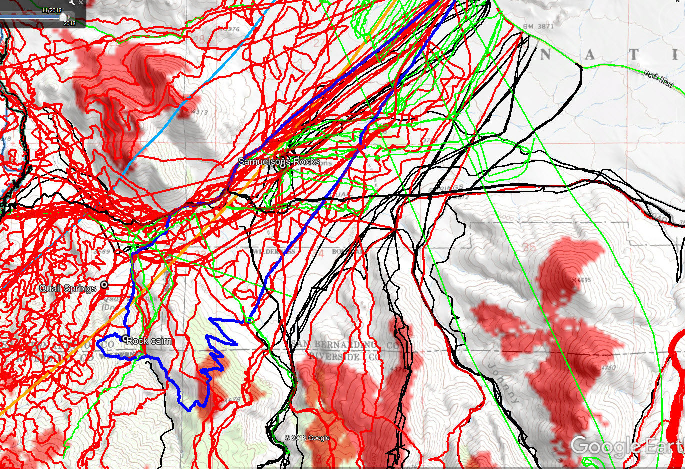
JT91 GPS tracks are shown in dark blue. Tracks from the original search are shown in black, searches since then are shown in red and tracks from the Orbeso/Nguyen search are in green. The light blue line is the 10.0 mile radius from the Serin Drive cell tower and the orange line is the 11.1 mile radius. Serin tower cell coverage is the red shading.