After some thought I decided the only way to actually closely examine the surface of this spine was via rappel. In previous site visits I knew I could get part way down the spine before the serious cliffage began and verticality ensued. I had a nice 200′ long static line rope from my vertical caving days that should be long enough to cover the areas I had been unable to reach (or so I thought). I also had a full set of descending and ascending gear, and as an added bonus, even knew how to use it all. Doesn’t mean I’m still not a danger to myself or others though.
So early one cold October morning I arrived at the top of the Kutz Canyon Overlook with a fair amount of determination, only a little sense and one damn heavy pack. The pack was heavy because it contained not only a very long (heavy!) rope and climbing gear, but I also had packed a number of 18″ lengths of half inch steel rebar and a rather heavy sledge hammer. I may have had a few rocks in it too for all I could tell.
Since I knew I was dealing with essentially dried mud, how to anchor a rope safely was of more than passing interest to me. Reaching back to my caving skills, I decided to set up a three point self-equalizing anchor with a backup safety. This involved hammering my sharpened pieces of rebar deep into the mud slopes, then using webbing to balance the load (i.e., my ass) roughly equally over the three primary anchors. I figured this would provide a decent safety margin. Not that I’ve ever been wrong.
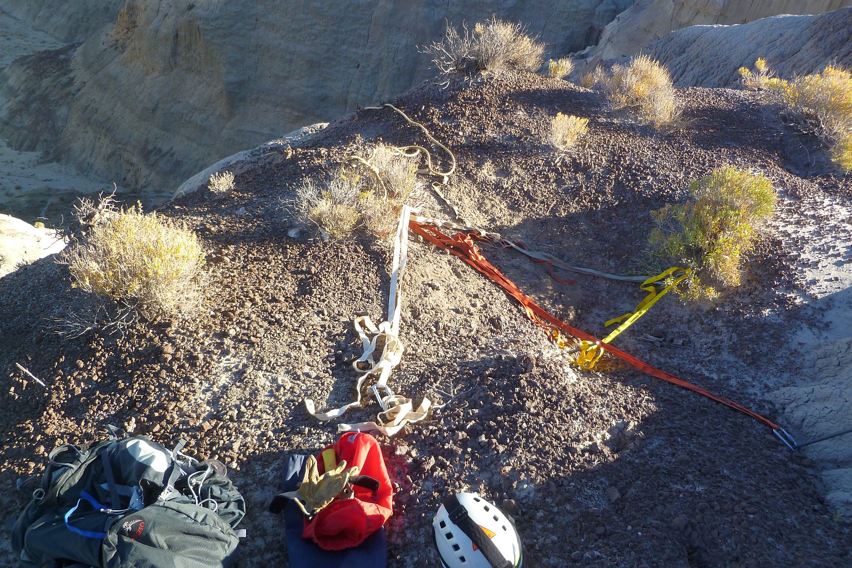
My three point rappel anchor, with a backup….just in case. It ended up being completely bombproof and was damned hard to eventually remove the rebar lengths.
With all that foreplay out of the way I had no choice but to start the rappel. I hadn’t been rappelling for quite some time so starting down was as knee-quivering as I had expected. But once over the edge it all came back and felt really comfortable. It was an odd feeling to think no one may have been on these slopes for many hundreds of years. Now some idiot on a rope was.
The slope was far too steep to just down climb, but not steep enough to keep the rope from constantly getting tangled on bushes. This slowed things a bit, but forced me to take it easy and be cautious.
Most of the initial descent was uninteresting. But then I reached a very eroded portion of the spine. As I went over and descended in a fully vertical chute, there at the bottom of the chute were a couple of pieces of very straight wood protruding from the vertical mud face. That was certainly unexpected! The wood lacked cut or shaping marks but didn’t look like anything growing naturally in the area. Given the inaccessibility of this particular spot, it was an exciting find. I am using this excuse as justification for getting jazzed about sticks in mud.

The two unusually straight pieces of wood sticking out of the vertical mud face with my boots as scale.
Continuing down on rappel, I could see I’d reach the end of my rope about 70′ or so above the highest point I had previously climbed. At that point I stopped and had a look around.
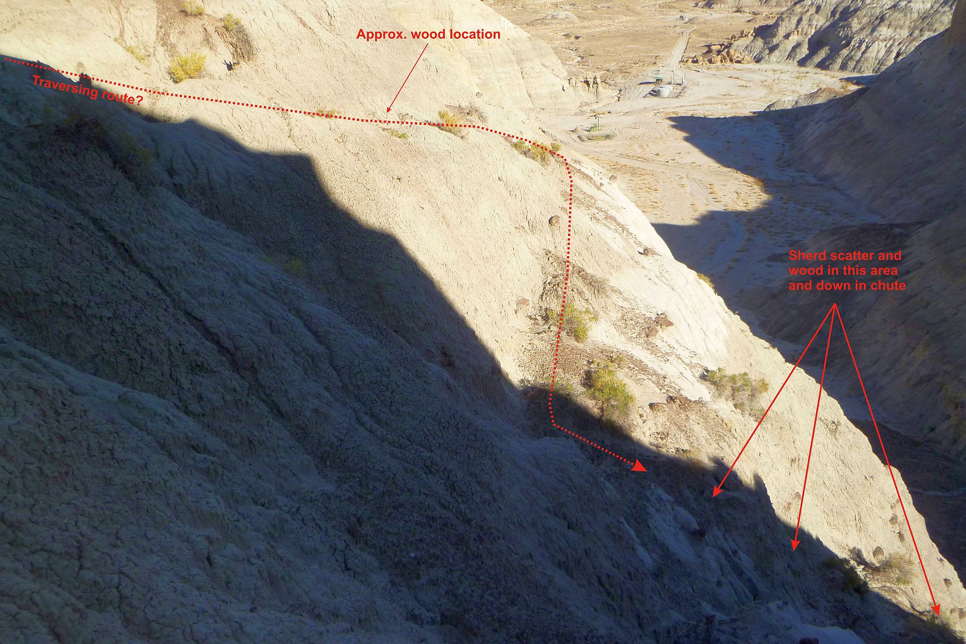
While the area was less vertical than what I had just come down, given the exposure I wasn’t comfortable unclipping from the rope. But I could side step laterally a bit and saw a few areas of lithic and sherd scatter which I explored to the extent I could.
To my untrained lay eye, there were what appeared to be eroded ledges on the side of the slope which I thought might be a traversing trail. There were also a few pieces of that good old anomalous wood on these ledges. I took some pics which I later showed to someone familiar with Chacoan travel. He thought it unlikely that these were any sort of trail, but rather natural differentials in erosion. I will defer to that assessment as I know how my eye likes to find patterns even when there aren’t any. But at that point in time I thought I might have been seeing something.
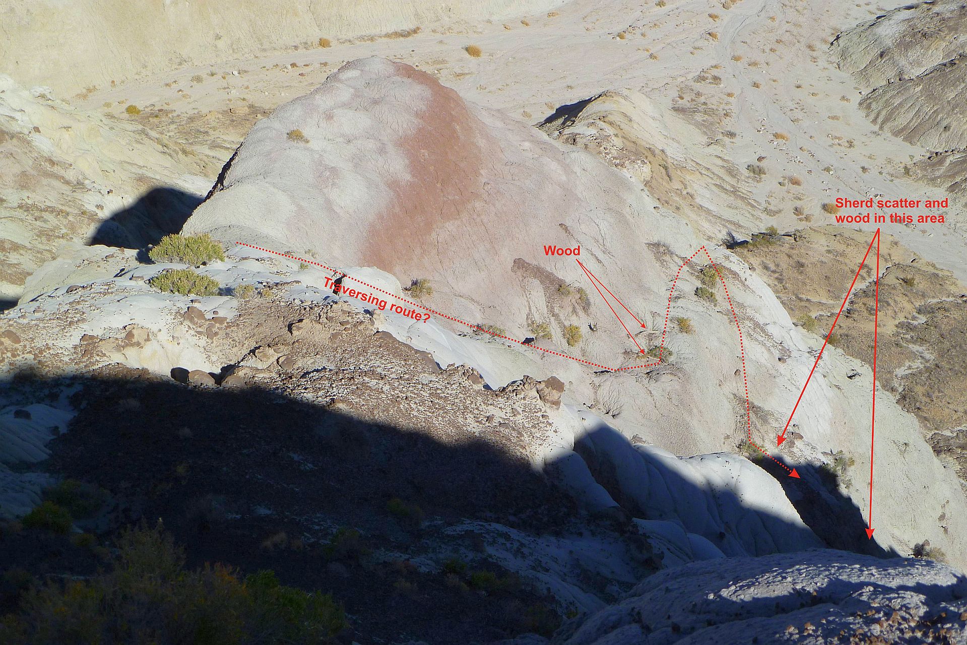
As I descended these features initially stuck me as possible trail remnants. I spotted some straight segments of wood laying on these ledges adding to that sense.
Another look at the terraced area from a bit further down.

A zoomed look at one of the terraces. While I would have liked a closer look at those wood pieces, I didn’t feel safe moving over there. It’s a looong drop.
Seeing as how I had cheated death to that point, and was literally at my rope’s end, it seemed a good time to switch to ascent gear and start the much more physically challenging climb up. Gravity sucks sometimes. When I reached the wood pieces sticking out of the mud face I stopped and broke off a very small sample for future analysis.
In addition to the still images I took while on rappel, I also had an HD video camera attached to my helmet (I figured it could explain what happened should things , um….go very badly wrong). I’ve edited the video a bit and sped some of it up by three times to keep it from being any longer than it already is at an excruciating 27-1/2 minutes. It may be viewed here if you have some spare time in your life that you’ll never want back. You may note from my verbal comments I seemed to have a weird fixation on wood. Actually I was keeping an eye out for was any sort of wood that didn’t look like it grew there:
Safely back home, I began searching for a firm to do carbon dating, because, well….Everything’s on the Internet!. After a little hunting and more than a few inquiries, I settled upon DirectAMS in Seattle. They use a technique called Accelerator Mass Spectrometry (hence the “AMS” in their name) which required only a fraction of a gram of material to get results. This worked with the small sample size of the wood I retrieved. So I sent the sample off and waited.
A number of weeks later I had my result. The wood sample was dated to have likely stopped growing between AD 810 and 887. I say “likely” because the way radiocarbon dating works is that it’s about it being more a probabilistic range rather than a specific date. Add to that some technicalities due to the radiocarbon calibration curve not being a straight line during that period and the best that can be done is two likely date ranges within the AD 800s. But in any case, this was clearly old wood, nudging 1,200 years old.

Age probabilities for the wood sample taken off one of the pieces sticking out of a vertical mud face at an inaccessible area of the spine.
This sounds intriguing and seems like it supports the existence of a stairway but there are problems. This date is a bit too early. This period would have been just before the Chaco Canyon community started its major growth boom around AD 900. Construction of Pueblo Bonito had begun in the AD 800s but it was at least another century before it went nuts. In that sense it’s not too far off, so maybe.
But there’s more. The development of the Salmon Ruins, the presumed destination of the Great North Road, didn’t begin in earnest until around AD 1290. This dating implies there was some sort of wood structure descending into Kutz Canyon for four hundred years prior to Salmon’s major construction. That requires a considerable leap of the imagination. Even the Twin Angels ruins, just a couple miles further north along Kutz Canyon, wasn’t constructed until AD 1050.
Around this time I had begun playing with drones. Crashing mostly, but every so often things would go right and I’d get some decent pictures from them. So I thought this might be a good way to get images of the more inaccessible portions of the spine, AND without risking my neck. I always like those sorts of ideas….
Next: First Kutz Canyon Drone Imaging Attempt, April 22, 2013
or, Back to the main Kutz Canyon Stairway page