It didn’t take long to turn back to a desert. It was August, after all, and the hot weather dried things out fast. And the storms ceased. All I had to do was figure out how to get to the bottom.
The area surrounding Kutz Canyon Wash is a maze of oil field roads. While they are open to public travel, there’s no map of them. But there is Google Earth. Using it I was able to work out a roundabout access into the wash bottom coming off Highway 550 a few miles further north. There may have been other routes but this one looked obviously good on the satellite photos. And seeing as how there were wash crossings involved, potentially wet, I wanted the best route I could find. So I loaded all the turn points into my GPS and headed off into the wilderness.
My Google Earth skills didn’t let me down as the Twin Angels Overlook came into view from the other direction. It was an easy drive up to the oil pump I had seen a week earlier in the canyon below.

The view of the spine and supposed stairway area from the approach road in Kutz Canyon Wash.

A closer view of the spine from below with the oil pumping operation in the foreground. The eroded trough-like area on the left (easterly) side of the spine turn out to be of most interest.
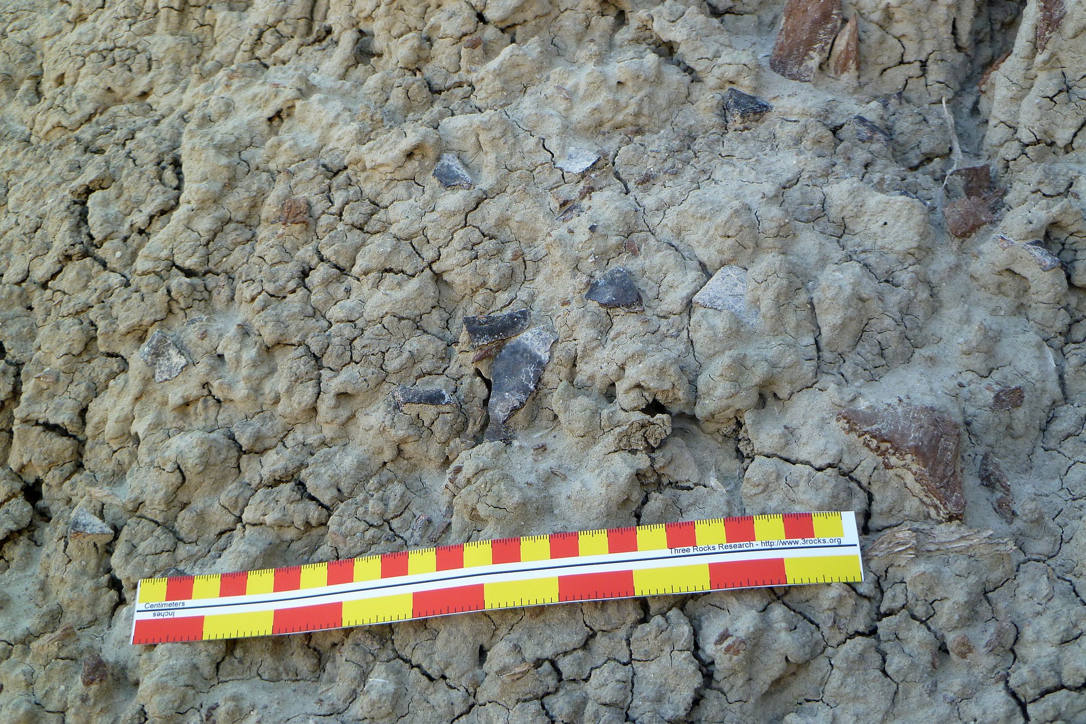
I first started poking around the easterly side of the spine. The ground, while now hardened, surprised me with a new sort of treachery. The surface was covered with various sized pebbles that had been partially eroded out of the base material. They generally adhered to the surface pretty well….until they suddenly didn’t. They then became rather nasty ball bearings!
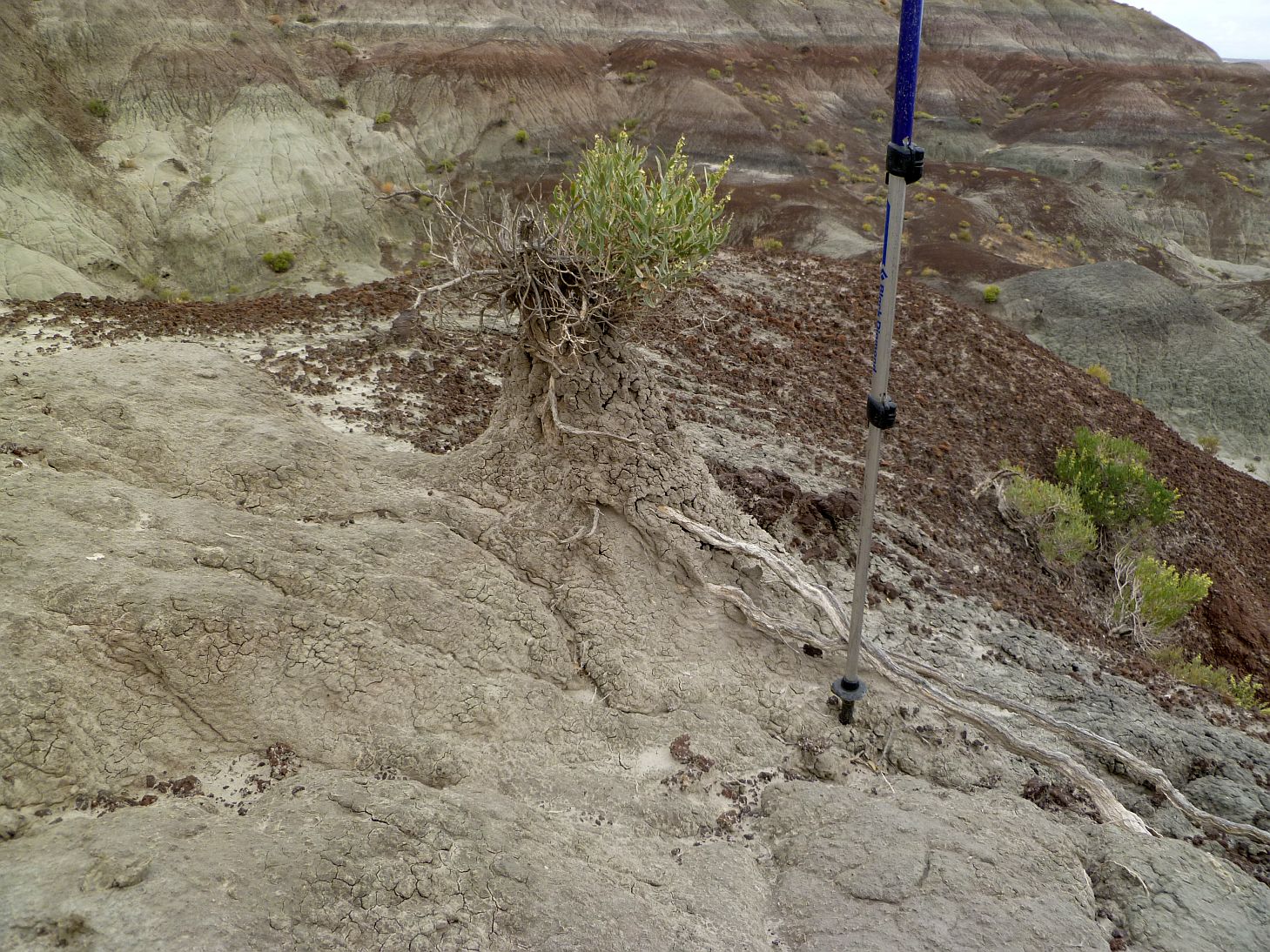
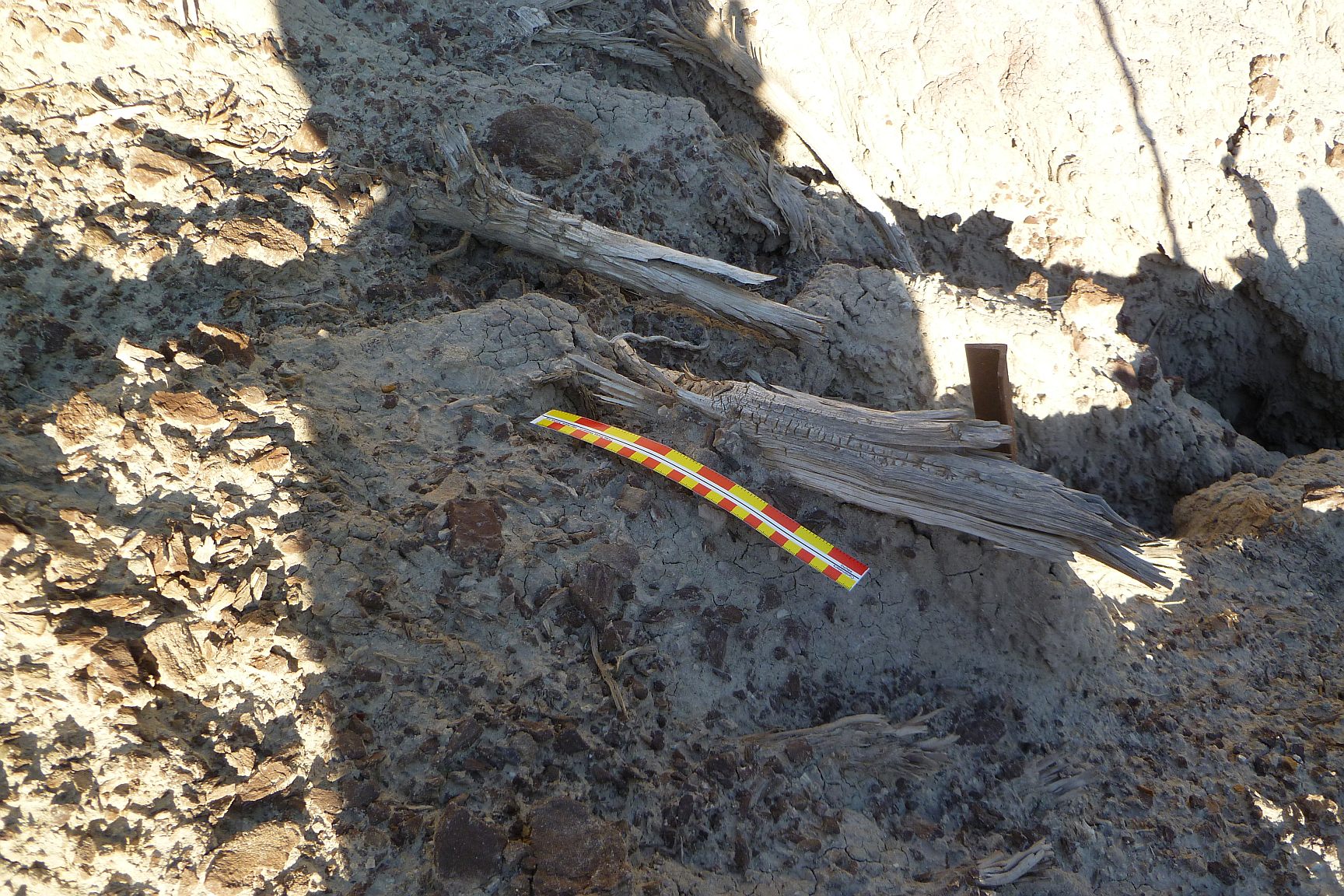
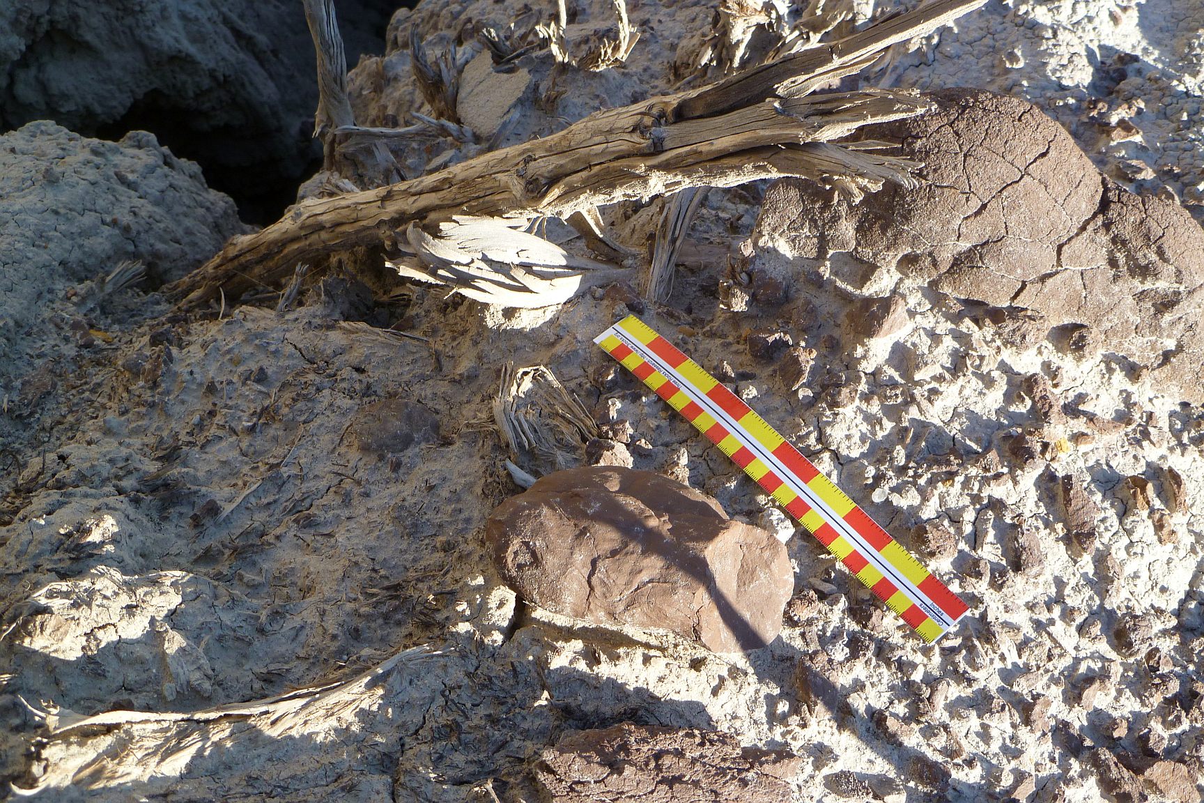
At one point on the easterly spine there was a large trough-like area that showed signs of serious erosion. In this trough I found a number of pieces of what I call “anomalous wood”. There is little vegetation in this vicinity and what there is consists of small, gnarled bushes (I have no idea just what they are exactly, as I’ve managed to avoid much of an education in botany). But the pieces of wood I found in the easterly side trough were clearly of some species that had long, fairly straight members. Stairway debris, possibly?

This location on the easterly side of the spine appeared to me to be the mostly like location for any stairway. While the picture makes it look easily climbable, it wasn’t.

A piece of anomalous wood at the base of the easterly spine slope.
In contrast, this is the typical variety of shrubbery growing in the area. Very twisted and gnarled.
This was a lower angle iron which blocked some wood from getting washed further down.
More anomalous wood on the easterly side of the spine.
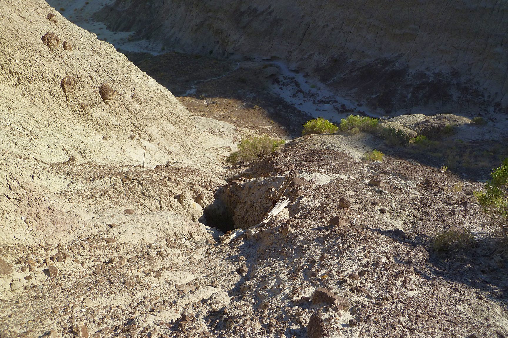
I was able to climb maybe 80′ or so up the trough before I reached my pucker limit. Without proper gear it was unsafe to climb higher. It was at this point I noticed a rusted piece of angle iron jutting out of the slope to my left, so I cautiously moved over to investigate.
WTF? This was unexpected. It appeared to have been out in the elements for some time, yet was still firmly imbedded into the hill. It had served to block a few pieces of the anomalous wood from falling further down the slope. Looking at its position, it seemed to me that it was likely a safety belay point remaining from the explorations of Sofaer et al. I looked higher up to see if I could spot another, but this was the highest. If so, then this was as high as they would have reached on this side of the spine.

Looking up the route from the point at which I could climb no further safely. The upper angle iron is in the lower right of the picture blocking some wood. It looked to me like a belay anchor and I saw none above it.
Looking back down my climb route from the highest point reached.
I downclimbed and headed over to the westerly side of the spine. If possible, this was even nastier than the easterly side. I thought there might have been a route up to the top in this area, but upon reaching it I quickly changed my mind. Given the erratic, ball bearing nature of the surface it would take a far stupider man than myself to try (and that’s saying something). Oddly, I did come across a sherd or two and some lithic scatter on the westerly slopes that appeared to have washed down from the spine above.
Lithic debitage on the westerly lower slopes of the spine. It’s location suggested it washed down from above on the spine.
Retreating back to the bliss of level ground I considered the spine in front of me. There were really only three possible routes down, the westerly side, right down its nose, and the easterly side.
I was able to quickly dismiss the idea of coming straight down the nose. As enamored as the Chacoans were of straight line travel, the drop was close to vertical and it would have been impossible (and stupid!) even for them.
The westerly spine slopes had some plausibility. However the ground was very broken up on that side and I had failed to come across any anomalous wood. There was just no evidence of anything on that side.
That left the easterly side. There was an eroded chute or trough-like feature I was able to climb for some distance. Further, there was a scatter of wood of a type that clearly seemed out of place. And putting on my engineer’s hat, that terrain seemed the simplest upon which to build some sort of stairway-like structure. Not that I would have wanted that job.
So I tentatively formed a thesis that if there was any sort of stairway, or reasonable facsimile thereof, it would have most likely used a final route down the easterly side of the spine. I realize I’m just a wanker archaeology enthusiast but now I had a working theory based upon a site investigation.
Following this little adventure, I happened to run into a professional archaeological acquaintance of mine and recounted what I had found. He had access to New Mexico’s registry of cultural and archaeological database and made a query of the area. He told me that he found no listing for any cultural site on the spine I had been exploring, stairway or otherwise. He said there were sites nearby, which I knew (like the “shrine” site), but nothing on the spine.
I found this rather odd considering the existence of Sofaer, Marshall and Sinclair’s 1989 survey of the site. It’s their report that seems to be the genesis of all future mentions of a Kutz Canyon Stairway. They wrote with such certainty of something there, so why wasn’t the site recorded?
It struck me that the most probable reason was the difficulty of actually examining the surface area of site closely. It’s not a location one can simply walk across and visually scan. It’s dangerous even by my standards and I’ve been known to have pulled off some stupid stuff. I found it unlikely that Sofaer et al ever got above the upper angle iron I found driven in the slope. If true, that meant no one had even really explored the spine to see if anything was there.
Clearly, I was going to have to do something about that.
Next: Rappelling Kutz Canyon, October 25, 2012
or, Back to the main Kutz Canyon Stairway page