The Bat Catches Papoose Lake
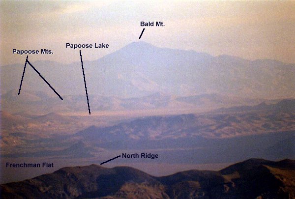
This image is a scanned (courtesy of the “Psychospy Scanning Service”) photo taken by the ever industrious (almost legendary!) Swiss Mountain Batfrom atop Mt. Stirling. Mt. Stirling is located about 45 miles due south of Papoose Lake. The photo was taken 10/11/95 at 7:15 AM, utilizing a 500mm lens. In spite of the apparent haziness of the image, the Bat reports it was a pretty good visibility day, with craters in the Test Site clearly apparent.
Although the image really doesn’t show anything significant, and I’m unaware of anyone who has ever seen anything of interest at Papoose from Mt. Stirling, I’ve placed it here to give an idea of what can be seen of Papoose Lake. Unless you’re skimming the airspace boundary in an airplane, this is about as good as it gets.
As a point of reference, Lazar’s alleged “saucer hangars” would be on the far side of the lakebed, just to the right of where the black label line touches the lakebed. In other words, you’re looking right at it. So it’s right there for all the world to see with a spotting scope……I wonder why no one’s ever seen anything??

Return to Papoose Primer page