Date: 4-15-2013
Participants: Tom Mahood
General Search Area: Southeasterly slopes of Smith Water Canyon mouth and slopes above Quail Spring.
Rationale for Searching This Area:
Explained in way too much detail here: Current Bill Ewasko thoughts, January 2013.
Impressions of Area And Findings:
The usual treacherous terrain, although I must be getting used to it as it’s no big deal anymore.
Coverage Level:
Very thorough. I moved rather slowly and did a lot of scanning with binoculars. I’d say my coverage level was 80%, out to about 100′ on each side of my travel path. I also spent considerable time doing binocular scanning of the northerly slopes of Smith Water Canyon, from its mouth to about the eastern grove of Acacias. There had been some thought that Bill might have been headed down Smith Water and possibly ascended the unsearched north slope in an attempt to get a cell signal.
Comments:
A lot of miles have been spent searching the area southeast of the mouth of Smith Water Canyon to no avail. On many levels it makes sense, that Bill may have been attempting a cross country trip to Smith Water Canyon in search of water, but it is just not working out.
As we’ve probed this area there have been a few issues in regards to cell phones that caught my attention. First is that there seems to be better cell phone coverage in the upper regions than the splash maps show, at least according to what we’ve seen in the field. Second, the idea that Bill’s cell phone suddenly goes dead just as he gets to a cell zone strikes me as a remarkably unfortunate coincidence. But maybe. And finally, the measurements by Mike Melson suggest that distances measured by the Verizon system out of the Serin Drive cell tower are fairly accurate path lengths.
So here’s what’s been troubling me. Anyone coming over the top runs into some pretty good areas of cell coverage, we’ll out from 10.6 miles. And some of it is even out further than 11.1 miles, the distance considered within reasonable error. So if Bill did come over higher up, the ping should have been very strong and occurred further out than it did.
Now that changes if the travel route is lower down, and more northerly. In playing with Google Earth, I found a possible path that slowly descended from the upper reaches of the Quail Mountain area into this area without passing directly through the cell coverage zone. It skirted it just to the north, essentially just above Quail Spring. Someone traveling this path would have a continuous downhill route (important if injury is involved) and would pass just below the cell coverage area and thus could generate a single transitory ping at the proper distance.
I usually work out a GPS search route in advance of heading to the field and somewhat slavishly follow it to ensure I get the coverage I wanted. It’s sort of a mechanical, brute force method that essentially ends up doing a line search over time. I wanted to try something different this time.
What I did was ascend the slopes southeasterly of Quail Spring until I intercepted the general path I had found. I then turned to Smith Water with the view of someone who needed to get into that canyon for water and followed the terrain to best do that. I just followed my gut. I knew where the cell coverage zone was above me, so I deliberately made an effort to stay below it. I did note that from the vantage point of my approach that bowl southerly of the mouth of Smith Water could possibly be mistaken for Smith Water itself by someone unfamiliar with the area. That led me to climb the ridge between the bowl and Smith Water proper, which is almost on the 10.6 mile radius. It was along here I scanned the north slopes of Smith Water Canyon up to the height of a reasonable climb up the side.
I eventually reached the saddle between the bowl and Smith Water Canyon, having covered all the obvious possibilities. I turned back easterly and traversed across the face while ascending the south slopes generally going over areas already partly searched. From there I descended back down toward Quail Spring and back out.
Frankly, I’m stumped. Perhaps I’ve succumbed to my own delusion (usually it’s others who are its victims) but I really felt Bill was in this area. I mean, my gut still tells me that but my head says, “Look at all the red lines on the stinkin’ map! We’ve filled it in very well. He’s not there!” (My head can be rather annoying at times). Now I will concede we haven’t covered ALL possible spots in that locale, but I’d guess it has to be close to 85% of it. So I just don’t know what to make of it. It’s like I’m working an arithmetic problem and keep getting 2 + 2 to equal 5. I know it’s clearly wrong, but just can’t see why. I suspect it will be a while before I head back out there for another search. Obviously I badly require new ideas and need to pout about this a while. I. Don’t. Like. Being. Wrong.
GPS mileage for this trip: 8.5 miles
Cumulative GPS mileage to date: 694.1 miles
GPS tracks for this trip in Google Earth kml format
GPS tracks for this trip in Garmin gdb format
GPS tracks for this trip in gpx format
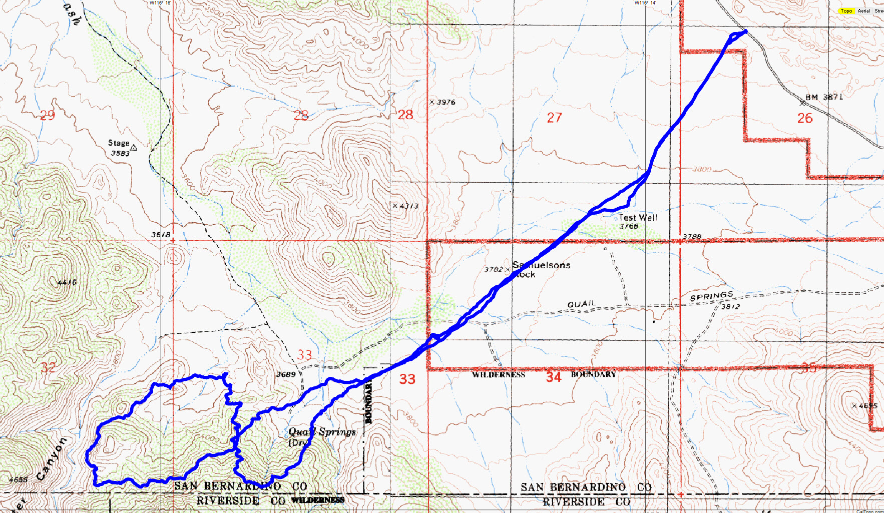
JT52 tracks

JT52 tracks shown in blue, in context with the others to date. Black is from the original search, red tracks since then and the green dashed line the 10.6 miles radius from the Serin cell tower.

A detailed view of the JT52 tracks in southeast portion of the mouth of Smith Water Canyon.

The general route is shown in red. The green shaded areas are the approximate areas of cell coverage from the Serin cell tower. The black lines show the approximate distances to the cell tower.
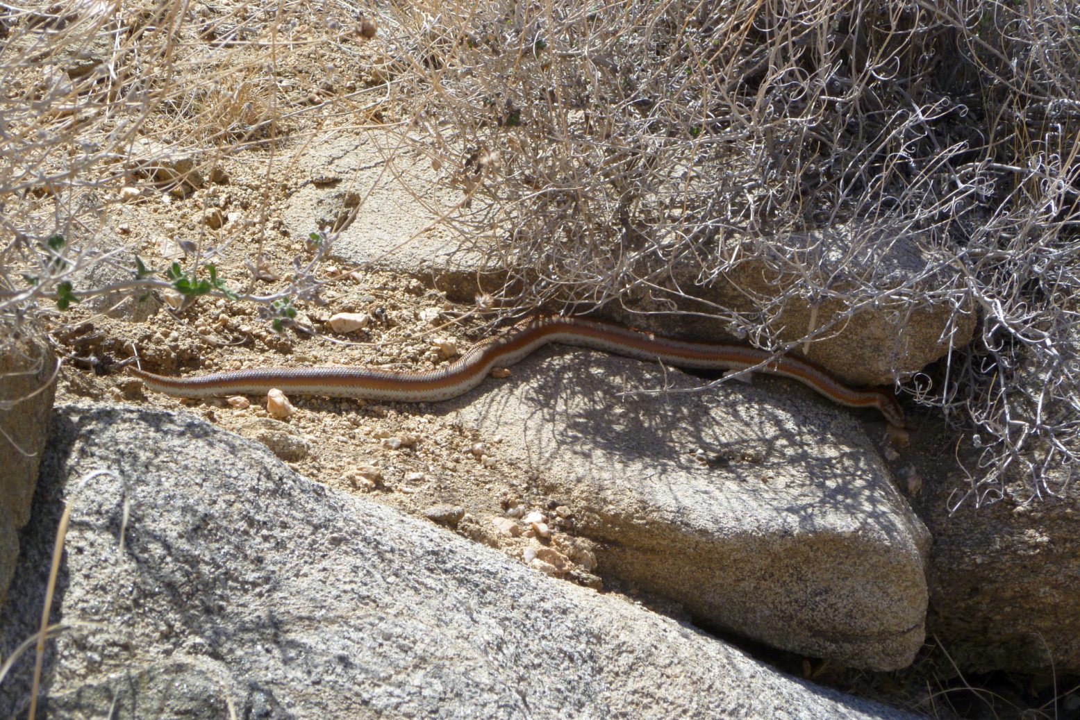
Yes, it’s snake season! But not to be concerned, only a nice, pretty Rosy Boa.