It is not well known that Santiago Peak in the Santa Ana Mountains was used as part of Michelson’s measuring efforts. I certainly had never heard of it. I first came across it in a brief two paragraph reference on page 319 in the book, “The Master of Light”, a biography by Dorothy Michelson Livingston, Michelson’s daughter. She writes:
“…Michelson now turned his attention to measuring the velocity of light over a far greater distance than had ever been used before. With the aid of his friends at the Coast and Geodetic Survey, the distance between stations on Mount Wilson and Mount San Jacinto, 82 miles away, was painstakingly measured, as was also the distance between Mount Wilson and Santiago Peak 50 miles away.
Neither of these tests gave much promise of success because of the hazy atmosphere and the smoke from constant forest fires…”
Later, going through the Pease and Adams papers at the Huntington Library, I was able to fill in a few, but not all of the details.
Driven by his dissatisfaction with the visibility along the Mount Wilson-San Jacinto line, in March of 1928 Michelson wrote to Adams asking if he had any preference between a station at “Mount Frazier” and “Mount Santiago” (Mount Frazier is today known as Frazier Mountain, elevation just over 8,000′, located in the Los Padres National Forest 60 miles northwest of Mount Wilson and about 7 miles westerly of Gorman. Mount Santiago is today known as Santiago Peak, elevation just over 5,600′, located 46 miles southeast of Mount Wilson). Adams quickly responded that he thought the seeing was good at both, but that Santiago might be better due to the intervening valley floors being lower. He said Frazier is accessible by road and Santiago was nothing but trail for the final miles to the summit. But Adams said he preferred Santiago if there was any chance of getting equipment to the top. Adams told Michelson he would be sending Jones to Santiago by the end of March to check out the location.
In June of 1928, the mirrors and other equipment originally used for the San Jacinto attempt were taken to the Santiago site and installed for testing by Michelson over the Summer. As usual, the press followed Michelson’s activities and reported them (articles below). Unfortunately, as with the San Jacinto installation, despite the larger 40″ mirrors seeing was too poor to perform reliable measurements. Shortly thereafter the equipment was removed from the peak. Today the 40″ mirrors, used for both the San Jacinto and Santiago Peak attempts, are on display in the small museum located in the base of the 100″ telescope dome on Mount Wilson.

Los Angeles Times of Aug 1, 1928 announcing Michelson’s arrival in Pasadena to begin tests of a beam path between Mt. Wilson and Santiago Peak in Orange County.

Los Angeles Times of Sept 20, 1928 announcing Michelson’s failure to establish a satisfactory beam path between Mt. Wilson and Santiago Peak.
The site today
Huh? Santiago Peak? As I said, that was news to me. I had been on Santiago Peak many times but never noticed anything Michelson-like. I knew it was a veritable antenna farm, providing communications for much of Orange County and the Inland Empire. It was time for a road trip…Actually, several, it turned out, over a period of years.
Getting to the top of Santiago Peak in a vehicle is always an iffy proposition what with fire or storm damage closures. Finding an open route is sort of like winning the lottery. Finally, on a nice early December day in 2008, there was an open route and I headed off to the peak for a first look around.
Since I had never seen anything like what I had come to expect from Michelson’s equipment mounts on earlier trips to Santiago Peak, I stopped first at Modjeska Peak. It’s adjacent to Santiago Peak, almost as high, and with it forms the “saddle” by which Santiago Peak is also known: Old Saddleback.” My thought was that if Lookout Mountain came to be incorrectly called “Mount San Antonio” in most documentation of Michelson’s efforts, then perhaps a Santiago Peak installation could actually be on Modjeska Peak.
In the case of Modjeska Peak, there’s no current road all the way to the top, so a short hike was involved. There was an antenna or two on a lower flank, but nothing obvious at the top. So it was on to Santiago Peak.
If anything, there was even more massive antennas and foundations than I had seen before. I found it unlikely any evidence of Michelson’s installation might remain. Then off in the bushes in a northeasterly portion of the peak’s summit, I saw an old slab of concrete lying on its side.

Possible Michelson fixed mirror support pier, Santiago Peak (T. Mahood)

Possible Michelson fixed mirror support pier, Santiago Peak (T. Mahood)

Closeup of pier showing three attach points for something. (T. Mahood)
The age of the concrete appeared quite old, in line with what would have been used in the 1930s. There were also three holes in the top of the pier that looked like they could have been attach points for something, possibly a mirror mount? The pier looked as if it had just been bulldozed out of the way a number of years ago to make way for new construction. Given the remoteness of the site, it made sense that it would just be abandoned in place and no effort made to haul this “debris” down the mountain. So my impression, as of 2008, was that this was the remains of Michelson’s installation.

Possible fixed mirror pier location, in context (T. Mahood)

Looking toward Mount Wilson from possible fixed mirror pier on Santiago Peak (T. Mahood)
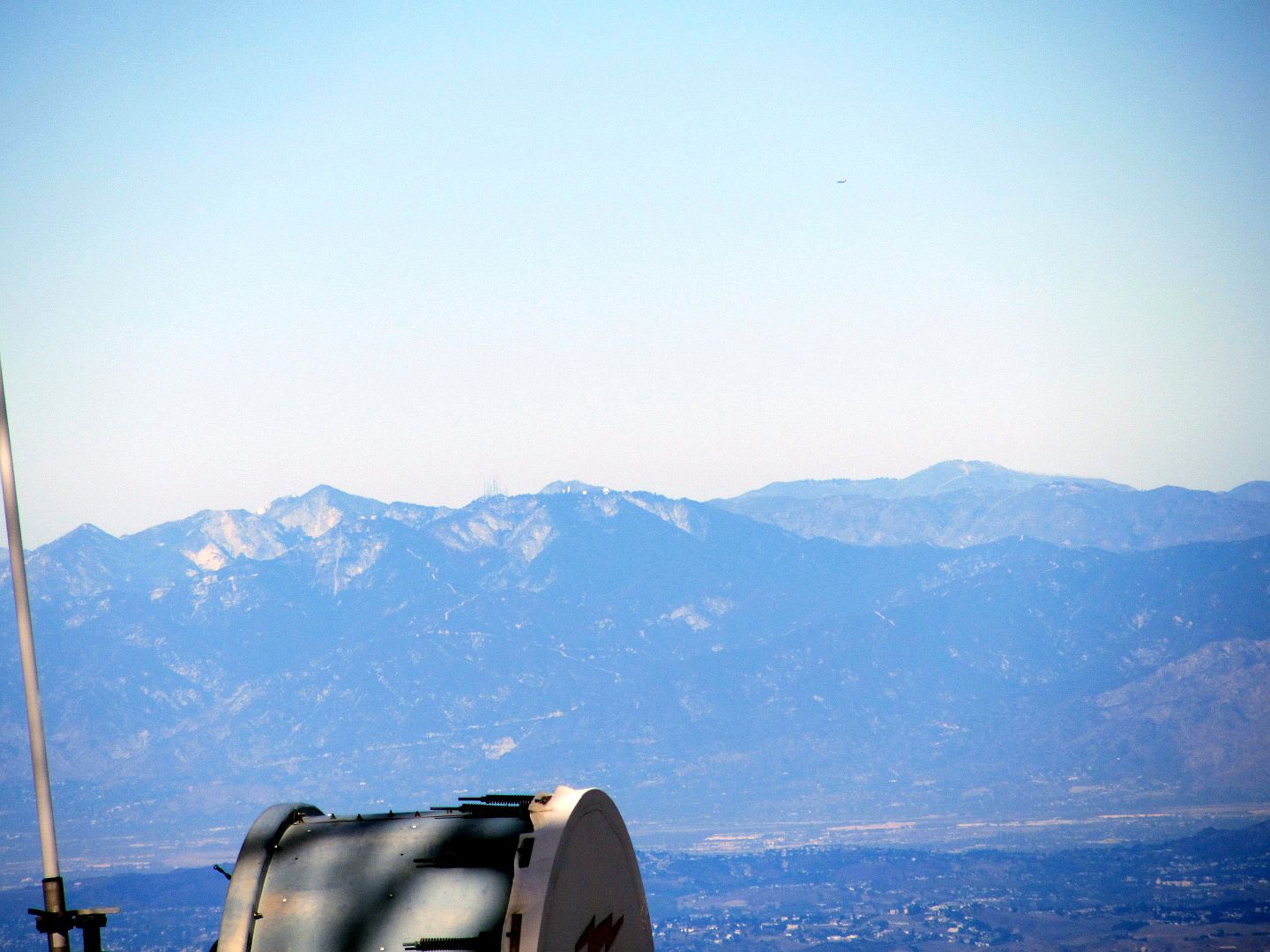
A zoomed view of the Mount Wilson domes from Santiago Peak. (T. Mahood)

Oblique aerial view of Santiago Peak site showing possible pier location (Bing Maps)
In late 2017 I made another visit to Santiago Peak to take measurements of the pier and further investigate its potential as a Michelson relic. I also wanted to spend some time looking around for a second pier (which I failed to find any trace of). Below is a drawing I did showing the pier’s dimensions and the bolt pattern.

It didn’t take long for my ideas to get dashed. Only a month later I was allowed access to the Mount Wilson files and was able to view Michelson’s construction plans for the Pine Cove installation, and it turned out the pier I had found on Santiago Peak looked like nothing in Michelson’s plans.
Michelson’s installation at Pine Cove used two piers, a front and a rear pier. The rear pier was 4 feet square and relatively squat. The front pier measured 1 foot by 2 feet at its top and had battered (sloping) side faces. Neither design matched what I had found on Santiago Peak. Since Michelson would have simply relocated the mirrors from the Pine Cove location, he would have used the same pier design.
Most importantly, the top surfaces of both Michelson’s designs had smooth finished concrete surfaces. There were no bolts or attach points. The mirror stands were designed to rest on a smooth mortar surface and had their own adjusters built in. So, clearly, the old pier I had found on Santiago Peak wasn’t from Michelson’s project there. But if that wasn’t it, where on Santiago Peak had it been?
In an attempt to answer that question I was able to acquire some old aerial photographs of Santiago Peak. The oldest I could find, from 1936, lacked the resolution to see anything as small as the concrete piers, and it’s likely that the huts would have been reused for other things in the intervening 8 years. But it was possible to see the fire lookout tower that was in place at the time, the lookout staffer’s residence and the general current “developed” area of Santiago Peak.
Below is a sequence of dated aerials showing Santiago Peak over time. Michelson would have likely placed his huts for easy access, which meant they had to be near the fire lookout. The area in which I had found the old pier showed no disturbance at all in 1936. To help in interpreting the images, I’ve highlighted a reference structure which is visible in all images, although it only exists as a foundation today.
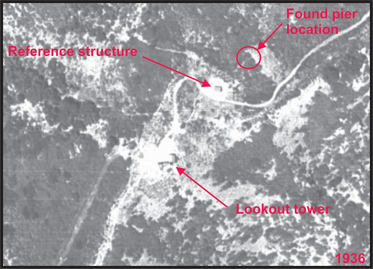
Santiago Peak in 1936, eight years after Michelson’s tests. Note lack of disturbance where old pier was found in 2008.

Santiago Peak in 1952.

Santiago Peak in 2015. Area in yellow is Michelson’s likely pier location, which has been disturbed greatly by communications tower construction.

Zoom of communications tower area. Fill slopes to the south and east have not been search for remnants of Michelson’s piers.
I know from personal visits to Santiago Peak in my wayward youth that the fire lookout tower was removed sometime in the 1970s and replaced with a massive communications relay tower atop a concrete building. I suspect Michelson’s piers were used as part of the fill material for this structure. There may be traces of the piers visible in the exposed fill slopes but I didn’t think to search that area since there wasn’t a line of sight to Mount Wilson on that side of the mountain. It’s likely the pier I found was associated with whatever facilities were visible in the 1952 image, possibly the base of an antenna mast or a guy wire foundation.
Back to Historic Speed of Light measurements in Southern California