Participant: Tom Mahood
General search area: The hellish, deep canyon area westerly of Upper Covington Flat.
Rationale for searching this area:
I blame Adam Marsland for this. He has argued for this area and searched it several times, but I dismissed it since there wasn’t any Serin Drive cell coverage in the area and I could think of no plausible scenario putting Bill in the vicinity. But then I do need to remember I have a distinguished record of being wrong.
I had been keeping this area in the back of my mind for a closer look when Smith Water is fully covered, which is imminent. Given the heat of Summer had arrived, curtailing ambitious Smith Water searching, I thought I’d start thinking about this area.
Looking at the splash map of the Serin Drive cell tower it was still obvious there wasn’t any coverage down into this unnamed canyon area. But I took a closer look at something I had seen before. The topography of the area is such that there’s a long, straight valley that runs from the edge of the canyon rim straight towards the Serin tower. It’s along the bottom of this valley the California Riding and Hiking Trail runs to the Black Rock area. This finger of Serin cell coverage runs right to the very edge of this canyon. The coverage doesn’t continue further south because the terrain in the canyon is beneath the sight line of the tower. But….what if there was a refraction or bounce of the signal at the canyon rim? Could that get a little ways lower into the canyon? Possibly, just possibly.
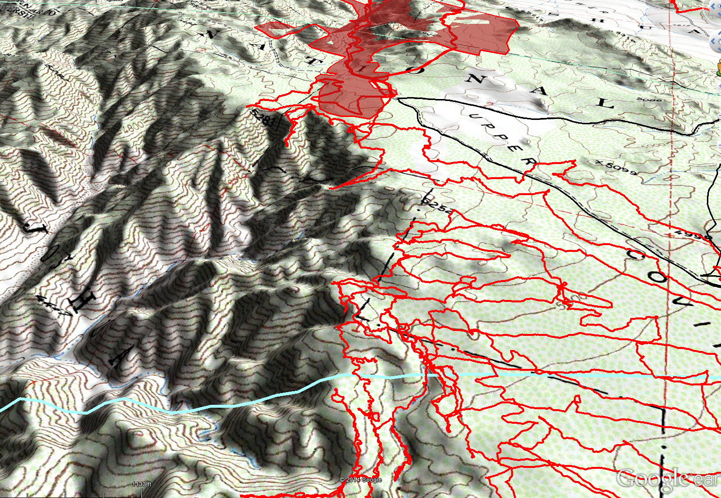
A finger of cell coverage (shaded red) from the Serin Drive tower is shown in this oblique view. Note how it reaches the very edge of the canyon then stops due to the ground falling away. The light blue line is the 10.6 mile radius.
Could I come up with a plausible scenario for Bill to be in this canyon? No, I still couldn’t. It seems like a crazy place to end up and quite impossible.
So I started approaching it as a problem of where could a cell ping POSSIBLY have been generated, that hasn’t yet been searched. Missing people are always found in the place searched very last. This area sorta fit that parameter, and then some. Nobody goes into this area, there’s no reason to. So no visitation, no searching and maybe, just maybe, the possibility of a weak Serin connection.
And there was a way to further exclude much of the canyon. Early on I had prepared a number of splash maps from some cell towers down in the Desert Hot Springs area that could provide coverage to the upper parts of Quail Mountain. I noted that some of them also illuminated parts of the upper reaches of this canyon. So I turned on all the splash maps in Google Earth and noted the areas that were covered. I figured if Bill were in any of these locations he would have pinged one of the cell towers down below in the Desert Hot Springs/Coachella Valley area. Since no pings were recorded, I felt confident excluding those areas. I ended up with an area in the canyon devoid of any obvious cell coverage. That’s shown in the exhibit below. Based upon that, I planned an initial pass through of the area along a set of ridge spines to get a better feel for the area, as I had only viewed it a few times from the canyon rim.
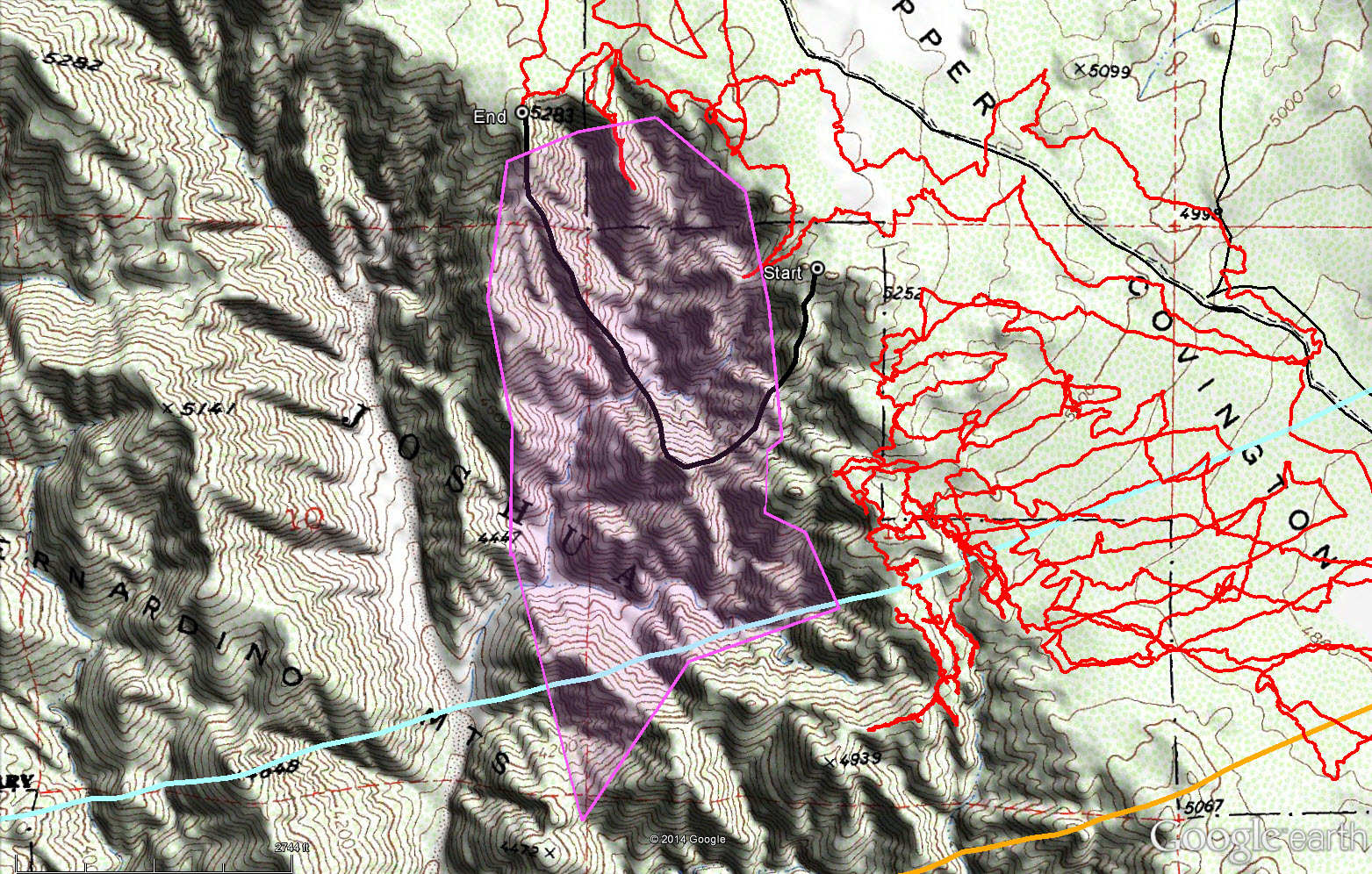
The planned route for JT67 was the black line through the overall area of interest, shaded in magenta. Previous search tracks are shown in red. The light blue line is the 10.6 miles radius from the Serin Drive cell tower.
Impressions of Area and Findings:
Holy shit! To quote Robert Falcon Scott, speaking of another desert, “Great God, this is an awful place….”. It is, by far, the worst and most treacherous terrain I have yet encountered in Joshua Tree. It makes Smith Water seem like a pleasant stroll. Yes, there were times I was dearly wishing I was in Smith Water.
The terrain is highly eroded and crumbling. I had planned my route along ridge spines, which is usually much smarter than canyon bottoms with their dry waterfalls. Now that’s true….unless the ridge spine comes to a knife edge with crumbly, loose edges and significant drop offs on each side. Yeah, fun times.
To make bad matters a bit worse I managed to start my descent down into the canyon via the wrong spine. No excuse, I wasn’t watching the GPS close enough and missed the start of the correct spine by just a couple hundred feet. I didn’t catch my error until after descending down areas I really didn’t relish climbing back up and happened to check my GPS. I salvaged it by finding a path to the bottom of the canyon but it wasn’t as planned and I prefer not to make dumb mistakes in unforgiving landscapes.
I was surprised at the severity of the terrain and feeling a rising level of anxiousness as to my being there seeing how easy it could be to get seriously hurt. I had a big advantage in that I had worked out what I thought was a (fairly) safe route in and out. Someone randomly entering this area looking for a way out would have no such advantage. The tendency would be to continue southerly up the main wash, hoping it would climb to the rim. However the main wash quickly splits into a network of smaller ones. And I knew from my observations at the rim that most of these small ravines end up going almost unclimbably vertical by the time they approach the rim.
Frankly, this place is a death trap. And maybe that’s what I’m looking for. Unfortunately.
Coverage Level:
Best described as crappy. The internal canyons are so incised I wasn’t able to see the bottoms from the spine, not that I was looking around a lot. Once at the bottom I explored some tributaries looking for anything that didn’t belong there. Aside from a Mylar balloon, there was nothing. But generally my sight lines were closer in to me than in other areas I’ve searched. While I would have liked to have explored further, the temperature was rising and I really wanted to get the hell out of there.
Comments:
Once at the canyon bottom it was a reasonably nice place. It’s getting there that’s the problem.
I also noted how convoluted the area is. I had maps and from previous visits to the rim had a general idea of the area. But once down in that canyon I got all turned around.
As mentioned, I can’t think of any plausible way Bill could have got himself into this area. To get lost in the Stubbe Spring vicinty and traverse cross country into this area seems nonsensical. It would be a fight against the terrain. But clearly he ended up in someplace no one has yet searched and this more than checks off that box. And it’s a trap. A cautious, well prepared hiker can make it through with moderate difficulty. A casual hiker would be lucky to make it though uninjured. But a hiker injured or otherwise under some sort of distress? I don’t think they would make it out of this canyon.
GPS mileage for this trip: 3.1 miles (Yeah, but they were dog miles!)
Cumulative GPS mileage to date: 792.4 miles
GPS tracks for this trip in Google Earth kml format
GPS tracks for this trip in Garmin gdb format
GPS tracks for this trip in gpx format
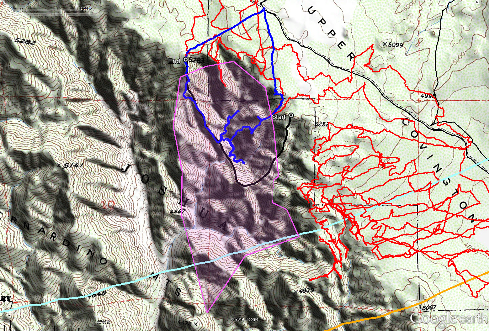
The tracks for JT67 are shown in blue. Compare them to the planned route in black. Oops, that was stupid.
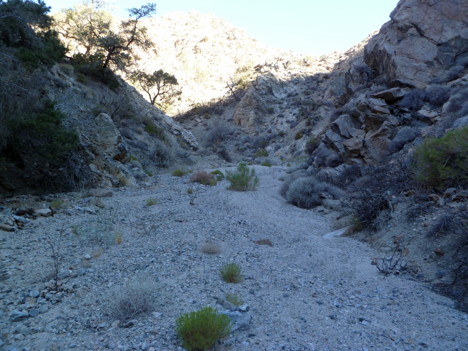
Typical view of the bottom of the main canyon. No problem here, very nice!
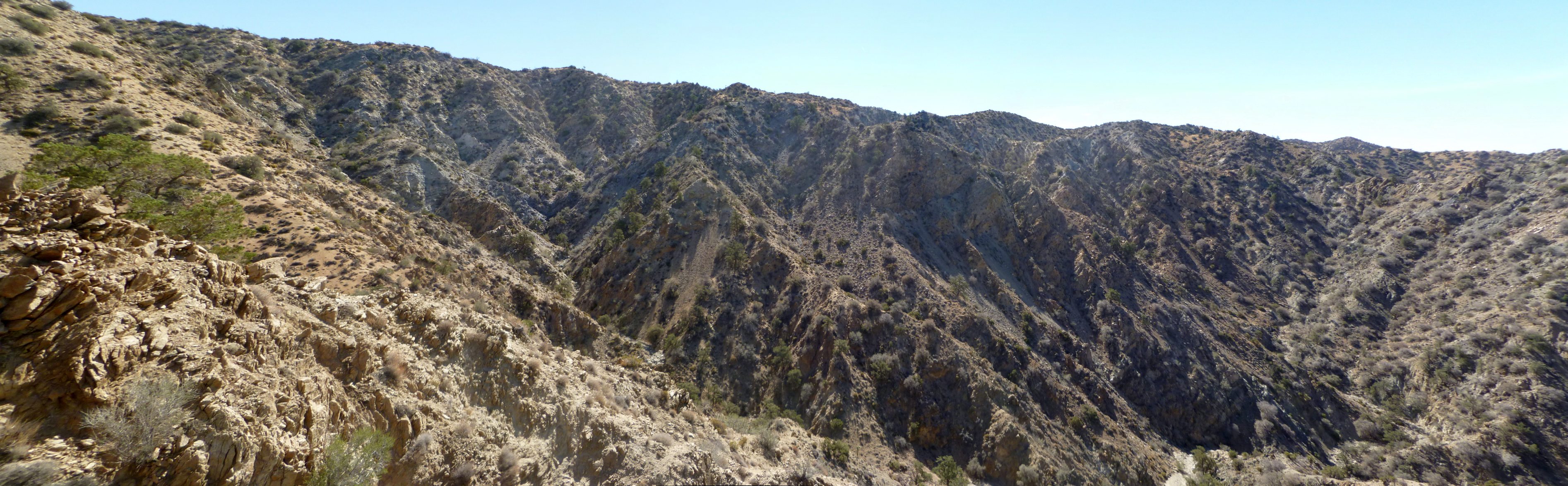
A panorama of the easterly slopes of the main canyon taken from part of the way up the exit spine. I was thinking I just might get out of this at this point. Those slopes directly facing the camera are most likely to experience a possible Serin cell ping.
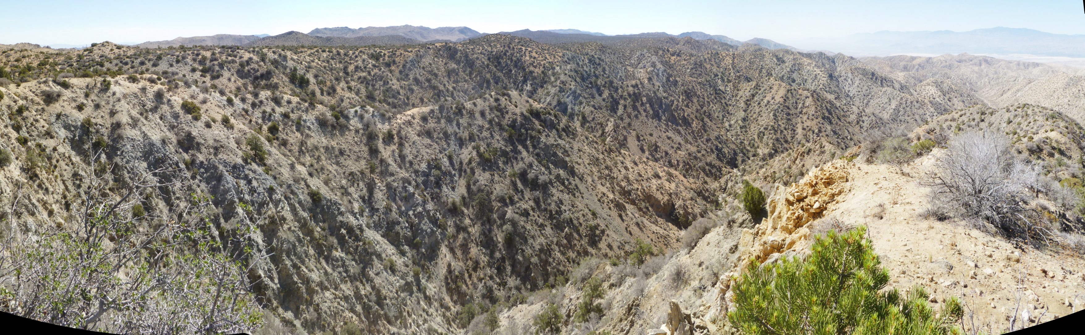
A panorama upon reaching the top of the canyon at its northerly most end. Note the desert valley off in the distance. Numerous cell towers would be reachable from this vantage point.