Date: 1/07/2014
Participants: Tom Mahood
General search area: The middle and lower portions of the central bowl area of Smith Water Canyon.
Rationale for searching this area:
This was intended to fill in blank areas in the search coverage to date in the central Smith Water Canyon bowl area. The majority of effort was spent observing the bowl area from high points on the opposing (northerly) canyon slopes.
Impressions of area and findings:
Rather than being an “on the ground” effort, the majority of time for this trip was spent observing the bowl area from a point approximately 200′ above the canyon bottom on the northerly slopes. This location provided an excellent vantage point for studying the lower 2/3rds of the bowl with various optics. The very upper parts of the bowl were not quite as visible, due to the upward looking angle. But the viewscape did cover a great many acres.
I was especially interested in examining the “last hundred feet” concept I discussed in the writeup for JT59. I am reasonably satisfied I visually cleared those areas between the (not-so) dry waterfall and Acacia grove on the west to approximately the start of the easterly Acacia grove. Areas easterly of there were somewhat out of my view so remain a possibility.
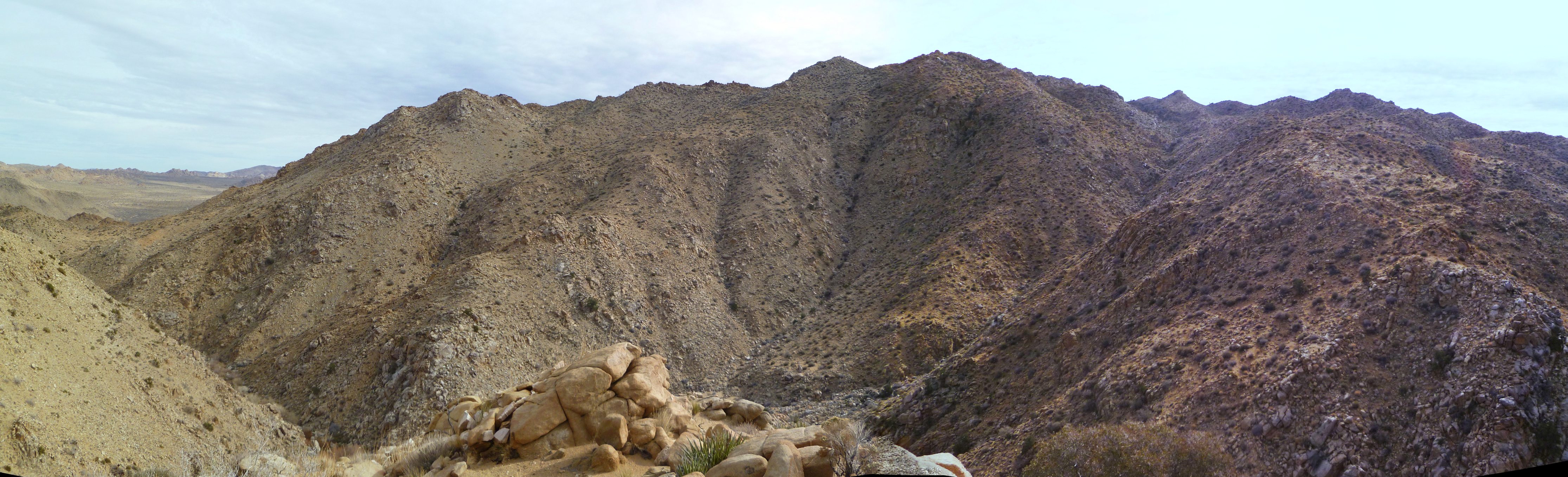
Looking southerly into the entire central Smith Water Canyon bowl. This viewpoint is about 200′ above the canyon floor, on the northerly canyon slopes, just easterly of the dry waterfall.
Coverage level:
Combined with previous efforts into the bowl, I’d estimate the total search coverage of the lower 2/3rds of the bowl area to be well in excess of 90%. There may be a few remaining hidden places but very few.
Comments:
Um….well….. If you’ve poked around this website you’ll know I’ve been fooling around quite a bit with small drone-type aircraft. A small, camera equipped multicopter that could be transported into the field would be ideal for searching these sort of areas. And I just happen to have a couple of those critters. One of them is a tricopter that would be perfect for searching the bowl area.
Now land controlled by a Federal agency, especially the National Park Service, is bound to have rules. Lots of rules. The sort of rules that would prevent operation of radio controlled aircraft over their property. So doing due diligence I scoured the JTNP website as well as the National Park Service’s overall rules. Would you be surprised if I told you there were a lot of them? But, interestingly, there’s no prohibition I could find regarding use of radio controlled aircraft. Knowing what wet blankets the Park Service can be, it just didn’t seem right that they would allow something as fun as RC aircraft in their parks. So I called the JTNP headquarters.
I explained to the nice man I had a small, electric helicopter that I was interested in using to take pictures of rock formations within the park (all quite true), and wondered if that was OK. He responded that was a new one for him (and here I thought this was the 21st century) but he’d check. I could hear him having a conversation with someone else and when he got back on the phone he said, “No, it’s not allowed”. I then nicely asked him if he could point me to where I might find such a prohibition as I had looked on their website and couldn’t see anything. He responded he had no idea as he had just asked a Ranger and that’s what the Ranger told him.
OK then!
So, use of RC “drone-type” aircraft within JTNP is at best a gray area, and quite possibly prohibited. And I usually don’t go out of my way to violate laws, even if they may be nonsensical.
If such a thing were permitted I would have loved to have brought my very quiet tricopter along, with four batteries. The vantage point I climbed to on the northerly canyon slopes would have made for an excellent launching point. The four batteries would have allowed me do three still imaging flights and one video flight. I would have been able to image a great number of acres, probably most of the bowl and the canyon walls. Hazarding a guess, I might have been able to acquire over 500 still images that would have been very useful for study. Unfortunately, I wasn’t allowed to do such a thing. Pity. But….Rules are there to be followed. So it never happened.
Hey, an update!! It was brought to my attention that there ARE rules against fun flying stuff in JTNP. There was a compendium of regulations (i.e., fun things you can’t do) adopted by the park on February 25, 2013, which is probably why I missed it. Here’s a link to the entire cheery list. But the pertinent part is as follows:
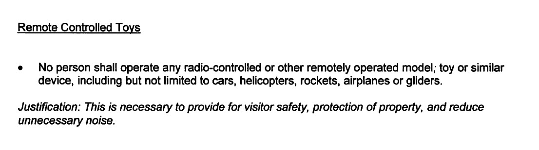
From the Superintendent’s 2013 Compendium of Designations, Closures, Permit Requirements and other restrictions imposed under discretionary authority.
So it’s a good thing I didn’t do that. I wouldn’t want to put any visitors (other than myself) in jeopardy, imperil property make any noise….
Frankly, at this point I’m almost dead out of ideas worth venturing out there to check. This trip brings the count to 60, a very high number and larger than I ever anticipated getting to. There are one or two spots left I think I’d like to look at, but basically at this point I’m flummoxed. I’m thinking at this point I may take a bit of a hiatus from the effort to think about it all. It should be a solvable problem and really should have resolved by now. And that bothers me. So I think I may let it rest a bit and do a bit of poking casual around out there that won’t end up getting written up as trip reports, because, you know, there are rules.
But it’s not over.
GPS mileage for this trip: 4.3 miles
Cumulative GPS mileage to date: 752.5 miles
GPS tracks for this trip in Google Earth kml format
GPS tracks for this trip in Garmin gdb format
GPS tracks for this trip in gpx format
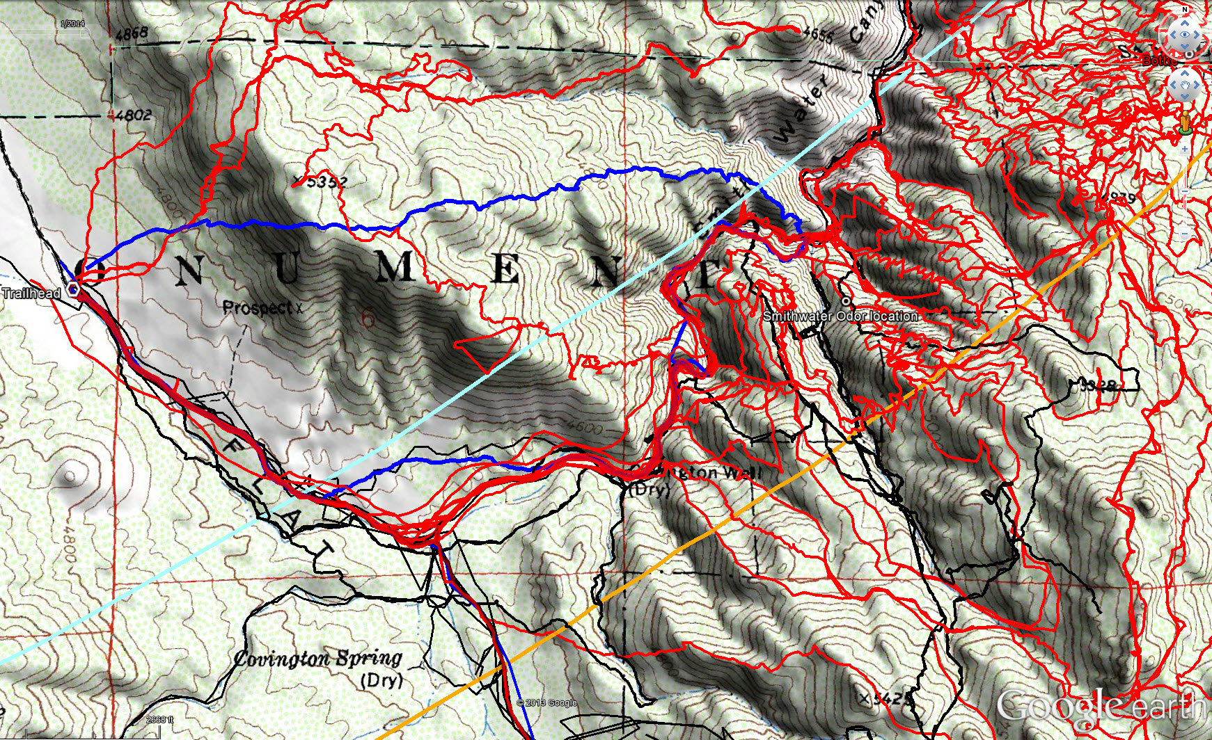
Overall tracks to date in the central Smith Water Canyon area. The black tracks are from the original search, red tracks those made since since, and JT60 shown in blue. The light blue line is the 10.6 mile radius from the Serin Drive cell tower and the orange line the 11.1 mile radius.
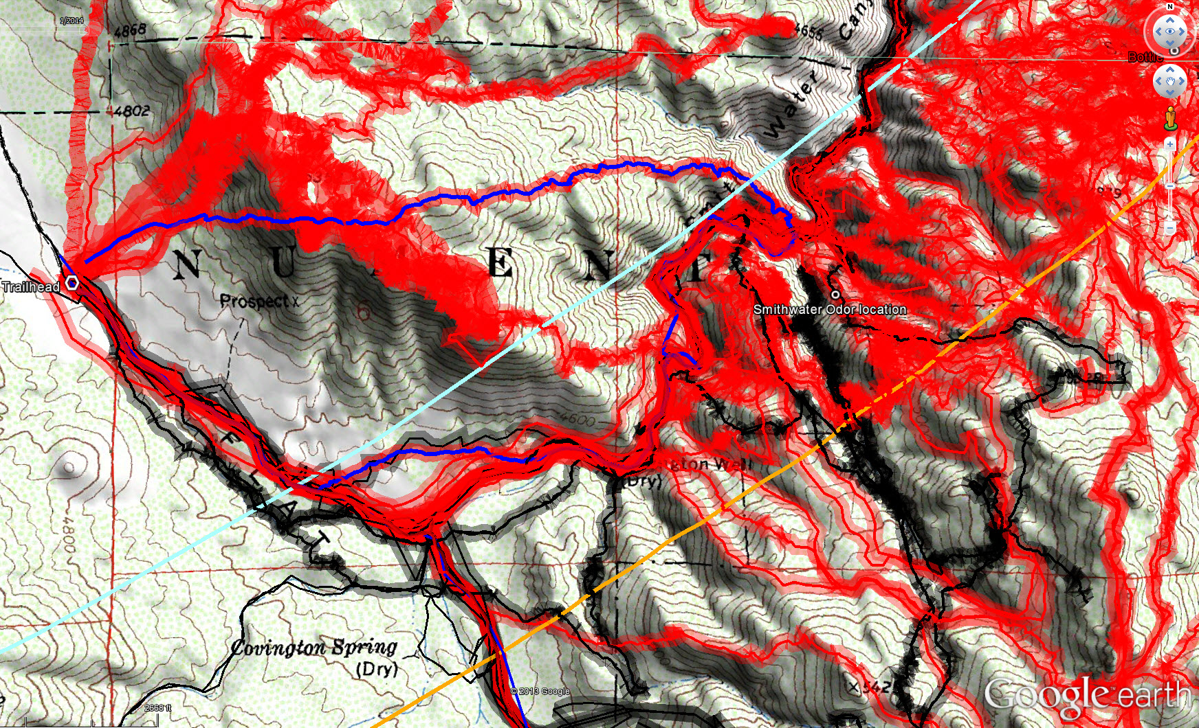
Overall tracks to date in the central Smith Water Canyon area showing a 50 meter swath of visual coverage. The darker the color the better visual coverage that area has received.